
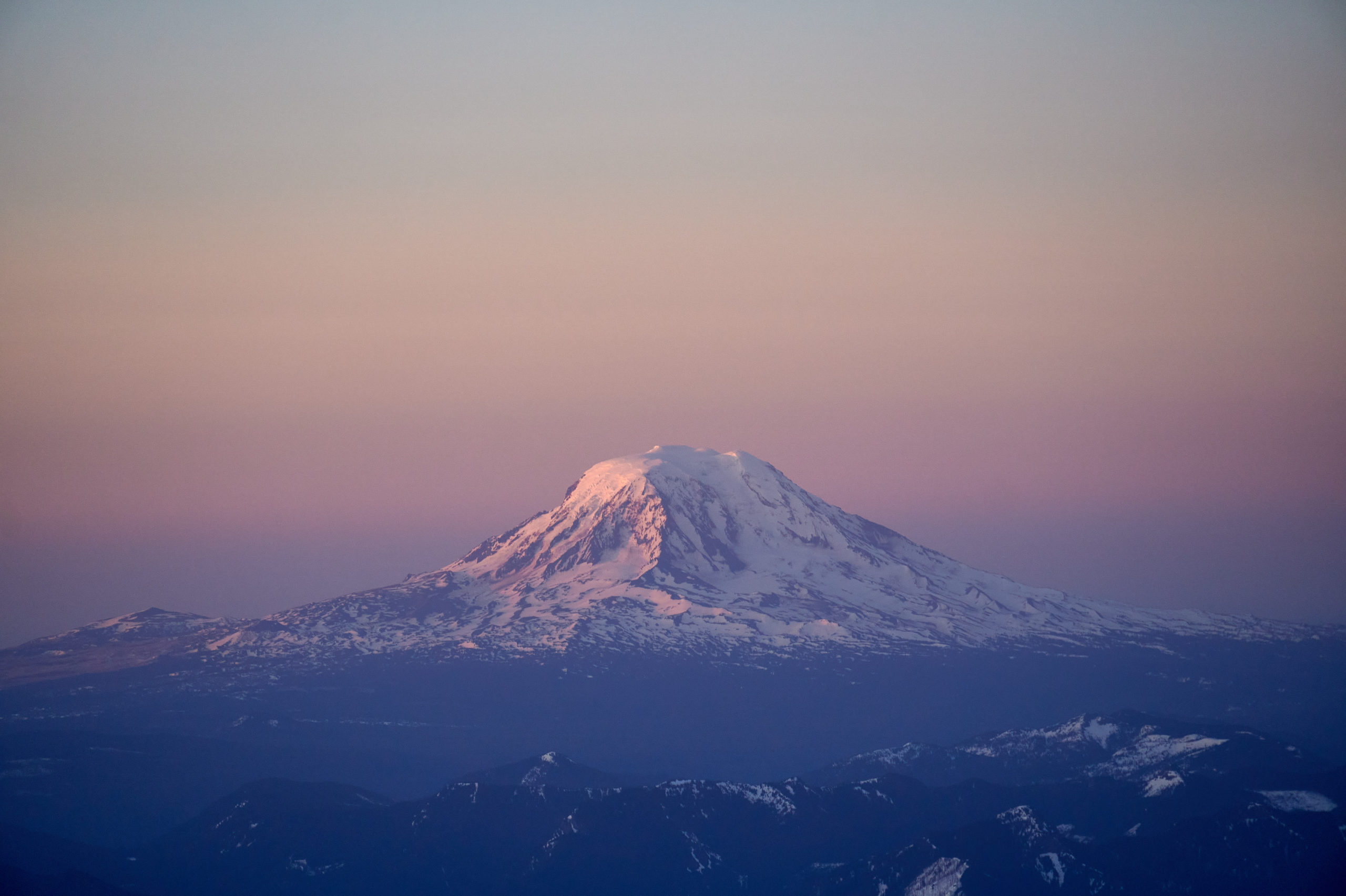
It’s impossible to see Mount Rainier from Seattle and not have your mind blown; it looks fake, it’s simply so big on the horizon. I’m sure Washington residents eventually get used to it, but every time I’ve visited Seattle the mountain captivates me. Taryn makes fun of how obsessed I am with the “scale” of things in the mountains, how intrigued I am when some feature or cliff appears enlarged compared to its surroundings. Rainier is the ultimate example of that and it just seemed so incredible to be driving down I-5 knowing you had been on top of it.
With Rainier in the back of my mind, I planned to spend a week in Seattle seeing friends, and do some spring skiing in the PNW. I drove from SLC to Seattle the weekend prior and Taryn met me from a week in Bend. With having to work during the week and needing to allow Sunday to drive back to SLC, I really only had Saturday to do a big adventure. I knew the chances of that day lining up with good weather was slim, but still let myself dream about skiing Rainier.
I’ve had exceptionally good luck with weather in the northwest and this trip was no different. The weather during the week was perfect and as Saturday drew nearer I began to check the weekend forecast obsessively. By Thursday the weather still looked amazing, sunny with 10mph winds on the summit, and Taryn and I decided to commit to attempting Rainier.
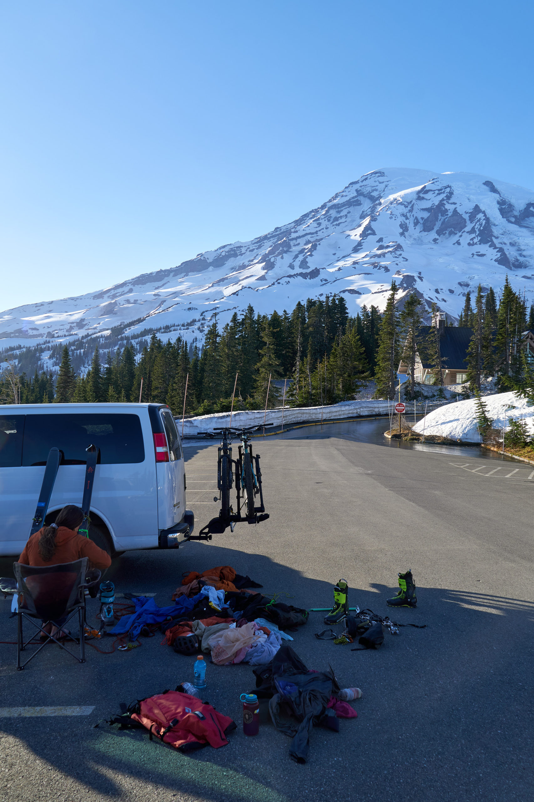
Climbing on Rainier requires a wilderness permit even if you are not planning on camping. Being before June 1st, the permits were only available in-person at the Paradise Ranger Station so we left Seattle midday on Friday to ensure we made it to Rainier before 4pm when the ranger station closed. Permit secured, we drove to the overnight parking and settled in for the evening. We sorted gear, did some much needed crevasse rescue refreshers, and marveled at the complexity of the mountain above us.
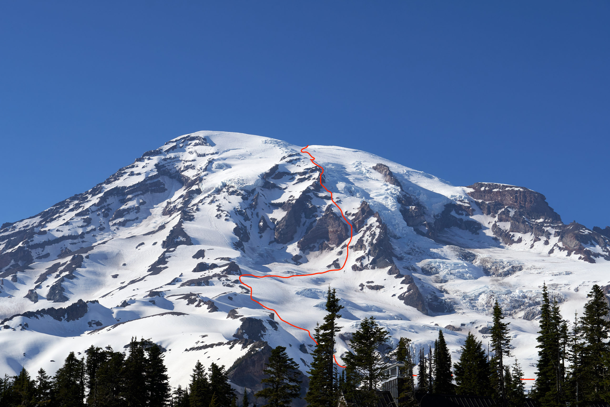
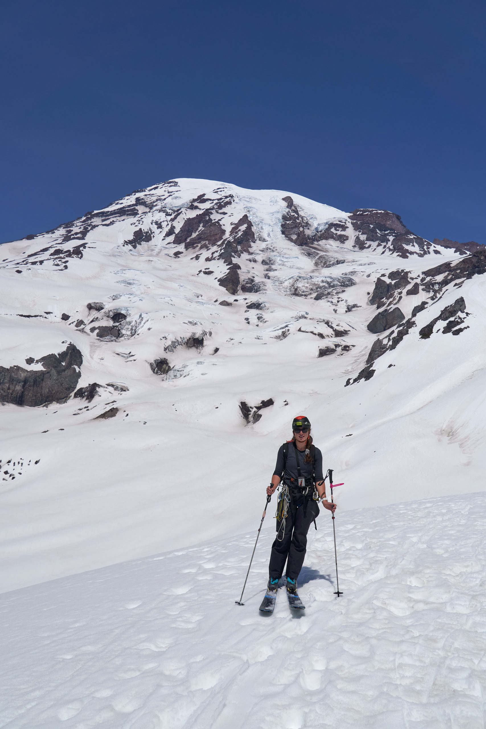
Before I launch into Saturday’s adventure, a brief overview of the route. We chose to climb and ski the Fuhrer Finger route, one of the more popular and reasonable ski routes off the summit. The route takes you from Paradise up to Glacier Vista, across the Lower Nisqually and Wilson Glacier, up a break in the rocks to the left of the Nisqually Glacier (the Fuhrer Finger), and through the Upper Nisqually to the summit. The route from Wilson Glacier up is shown in red below.
The main objective hazard of the route is rockfall, especially in the Finger, so an early start is critical. Taryn and I decided to be moving by 12:30 am and so we set our alarms for midnight and crawled into the back of the van while the sun was still high in the sky. Always the excellent sleeper, Taryn quickly fell asleep, but I found myself tossing and turning until 10pm when the summer sun finally set.
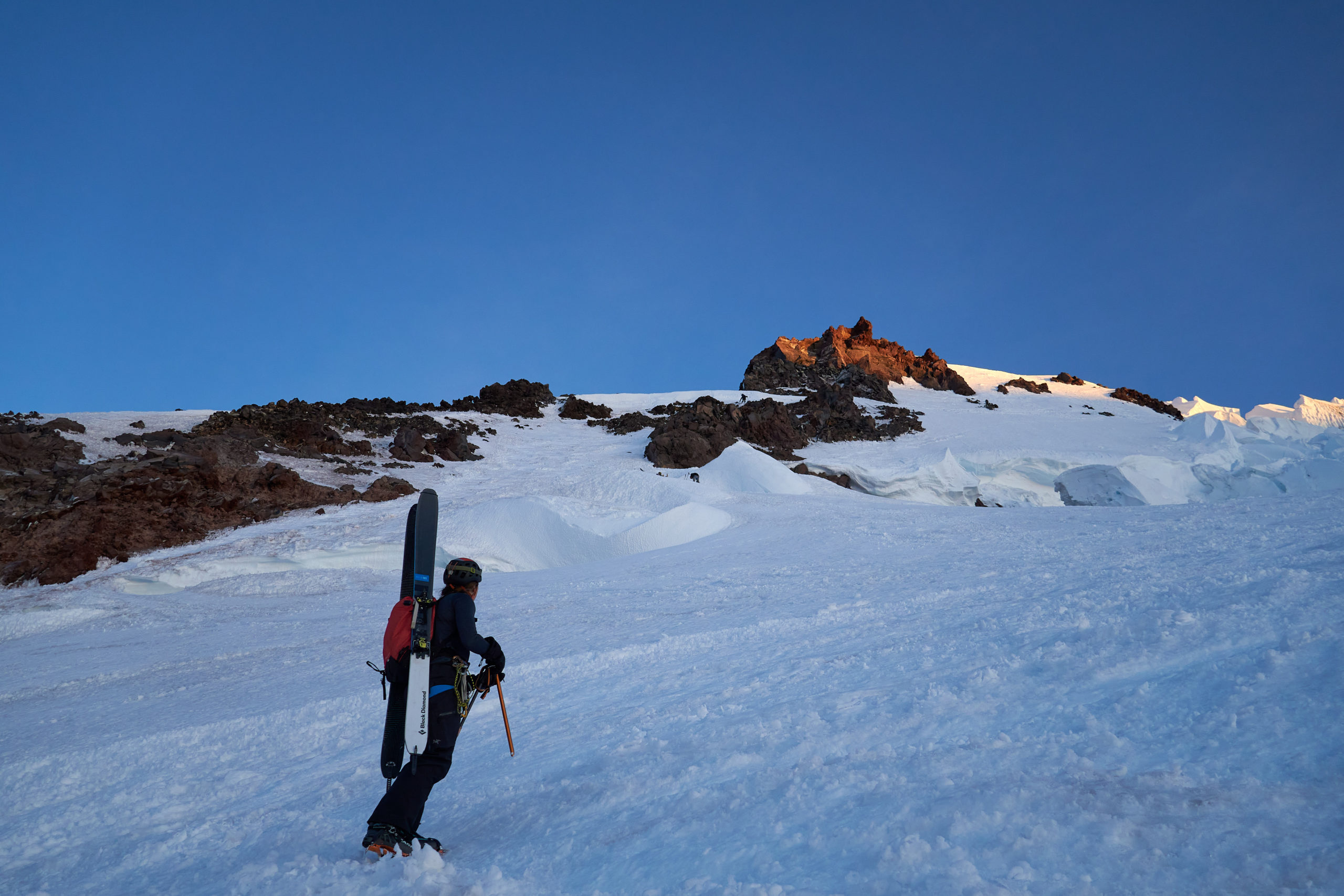
All too soon our alarms went off and we drove up to the main lot and put on our gear. We were on the snow and moving at exactly 12:30, right on schedule! The first couple of hours were a blur of sleepiness and darkness. Thankfully we had tracked down a gps track and we made heavy use of it as it was a new moon and our unfamiliarity with the terrain left us flying totally blind.
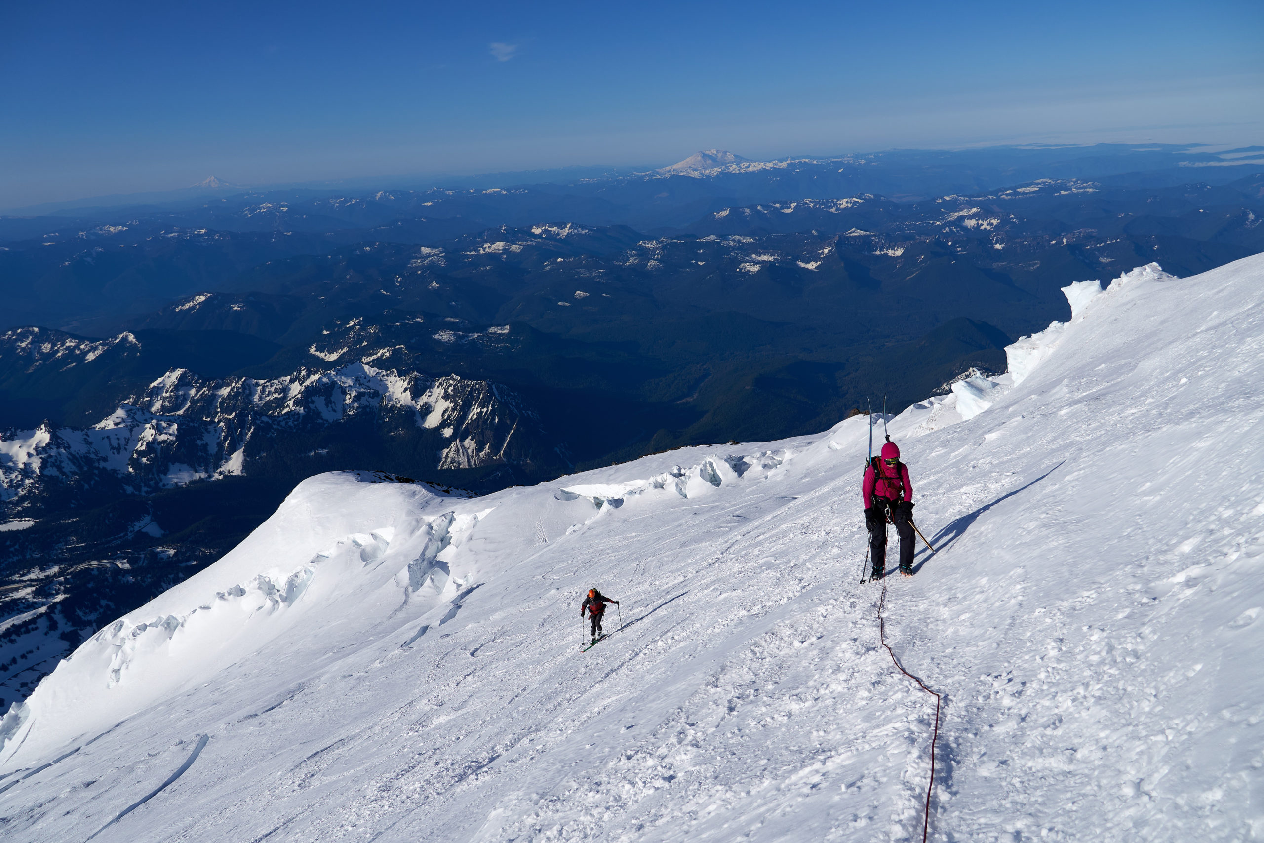
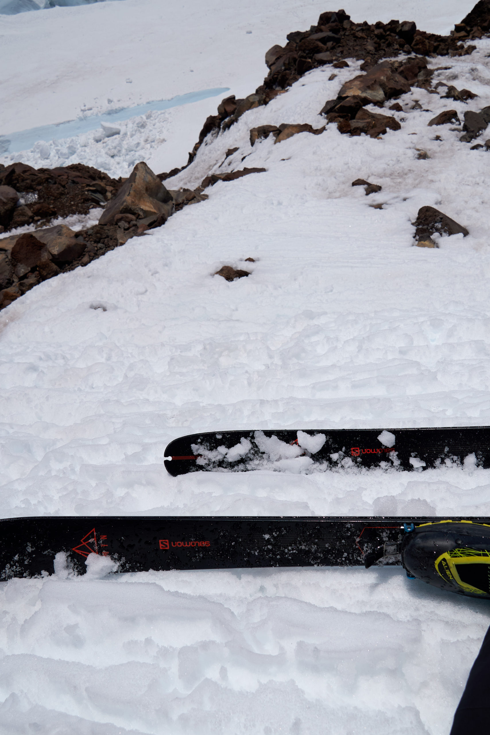
We made it to Glacier Vista in about 40 minutes and, after some sketchy down-skinning, found our way into Wilson Gully. A well formed skin-track appeared and we followed it up, stopping to rope up when we reached the glacier. The glacier was in extremely good shape and we saw almost no signs of crevasses as we made our way up. Taryn had one spooky little fall when her ski edge lost grip while skinning up a steeper slope, but she managed to quickly self-arrest. She used this as an excuse to switch to booting, and I switched soon after as well. We would boot the remainder of the route. A note on gear, both of us forgot our ski crampons in SLC, but neither of us felt like we really missed them. We might have been able to skin a few more sections if we had had them, but the snow was firm enough that booting made for easy travel.
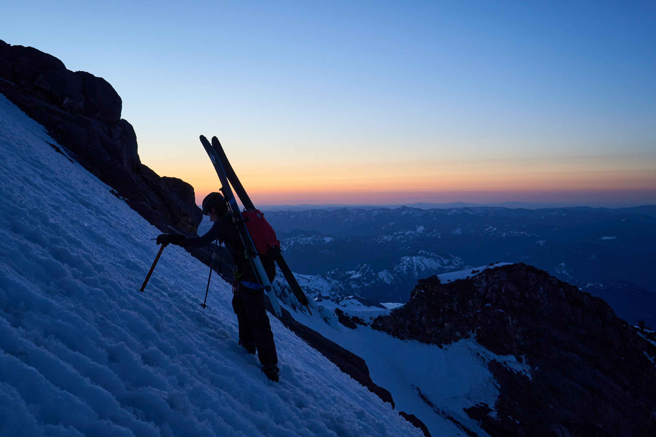
We reached the base of the Finger a bit before 4am and paused for a quick breather before setting off. The bottom third of the Finger was heavily sun cupped, forming stair-like indents that made for easy travel. As we got higher in the Finger, the pitch steepened and the sun cups disappeared. Taryn and I each had an ice-ax and I had brought a whippet which I loaned to Taryn when she began to feel the exposure. The upper flanks of the Finger were about at the edge of what I felt comfortable doing with just a ski pole and single tool, and I think having something sharp in each hand would have allowed me to move with more confidence.
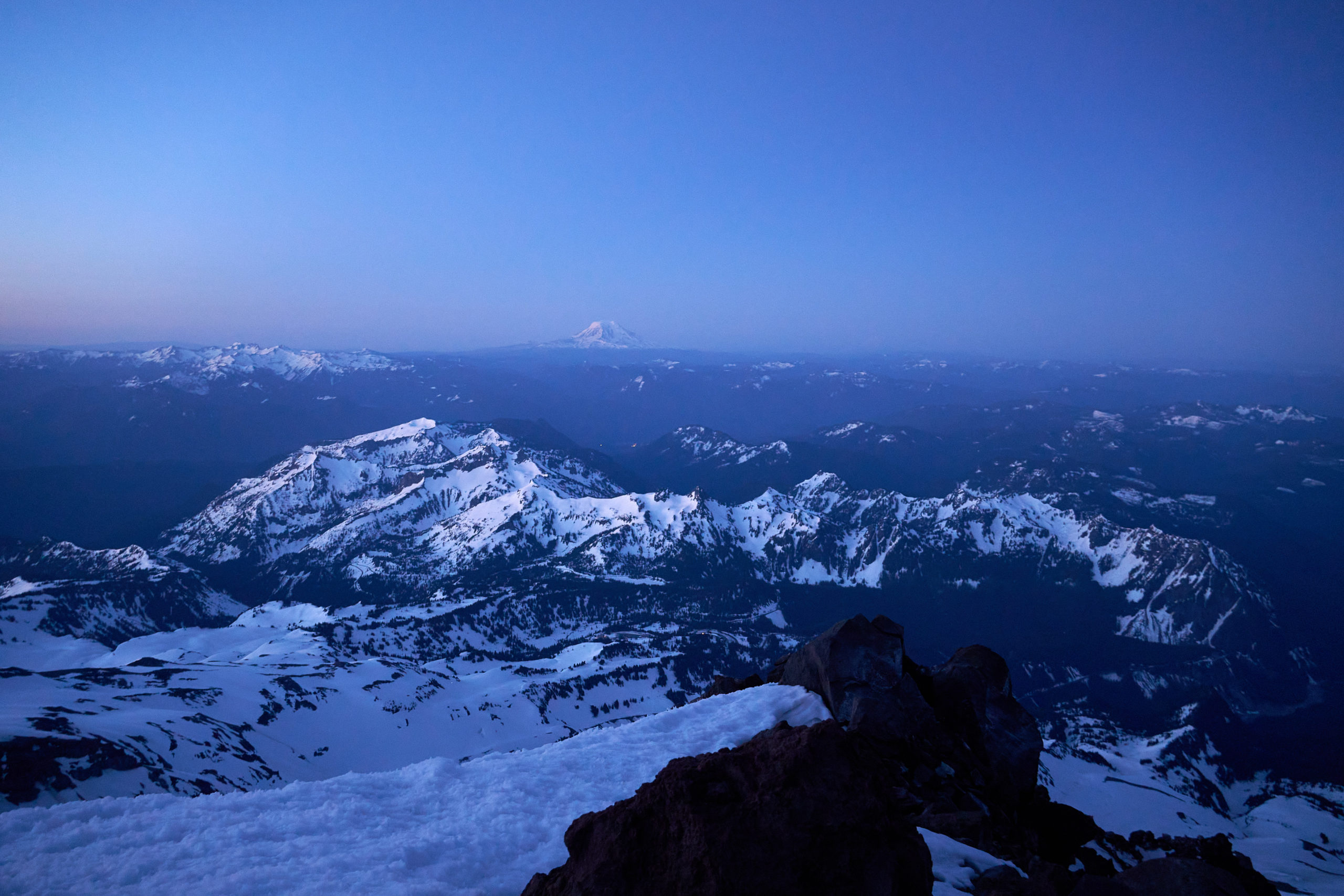
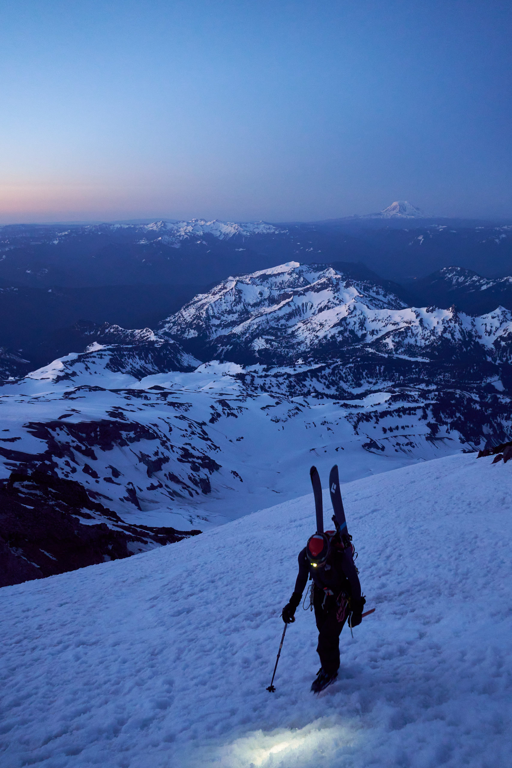
After about 50 minutes of booting, we made it to a safe zone on the ridge above the Finger. The first hints of sunrise were just beginning, and we stopped for a break to soak up the views. Despite still being 3500 feet below the summit, it already felt like we were on top of the world.
A quick note on rock fall in the Finger. Many of the trip reports I’ve read describe terrifying amounts of rock fall in the Finger. That was definitely my greatest concern going into the day and I was mentally prepared to turn around if things felt too sketchy. But, despite a low forecasted freeze line (I think it was ~10,500ft), we saw no rock fall. My thoughts:
- It’s always hard to separate luck from skill/planning/execution/etc in the mountains. We might have just been lucky.
- Taryn and I spent a long time debating what time to start. In the end, we settled on an earlier departure than we believed we needed. While this led to some stops on the way down, it allowed us to get through the Finger in the coldest part of the day, before there were a large number of parties ahead of us. Also watching the sunrise from so high on the mountain was a pretty special experience. Definitely worth leaving earlier than you think.
- We made pretty good time up the Finger which definitely minimized our time in the firing line. The bottom half of the chute is definitely more exposed than the top half so it’s worth pushing hard up the start of the chute, even if it means slowing down higher up.
I don’t think I have a super high tolerance for objective risk and, with the above qualifications, I didn’t feel uncomfortable going up the Finger. Just another data point, back to the trip report!
After a brief rest, we continued upwards, enjoying the more relaxed terrain and watching as the sky slowly shifted from purple to vibrant orange and pink.
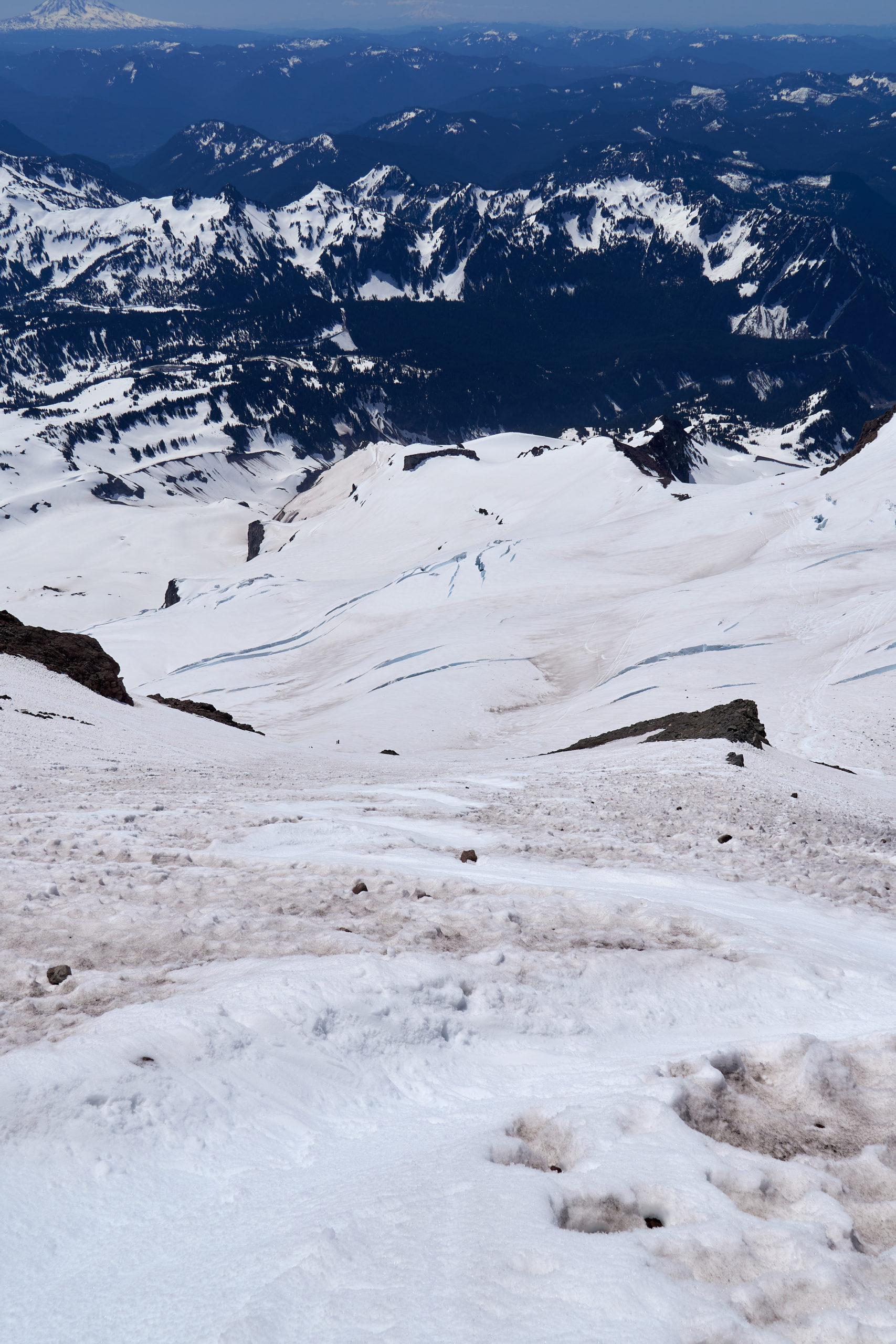
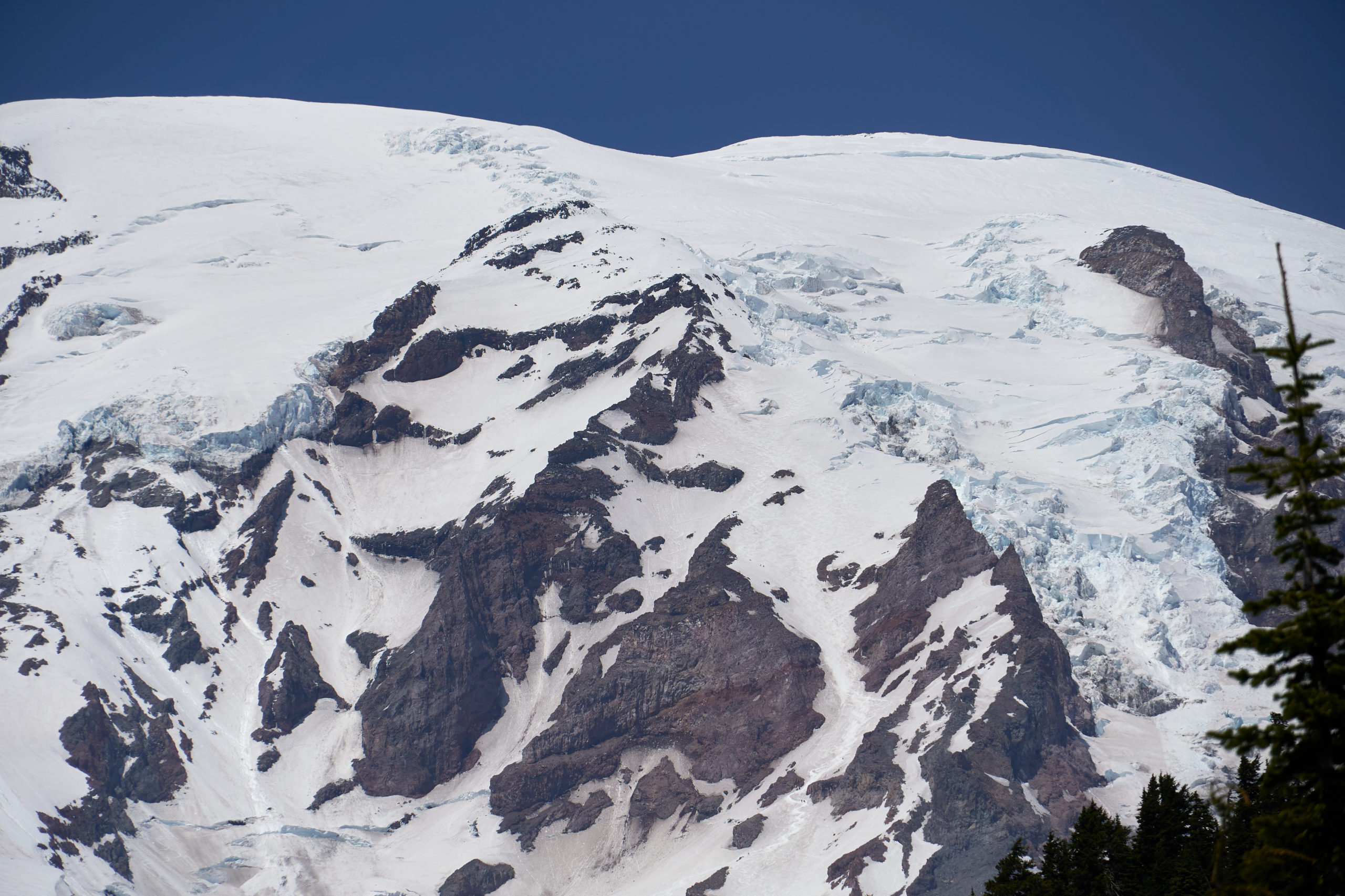
We worked up and right, towards the ridge-line that separates the Finger from the Upper Nisqually. The big remaining uncertainty we had about the route was how to navigate the Upper Nisqually. Older route descriptions seem to favor traversing through the Nisqually. All the most recent reports we had read stated that the Nisqually was far too broken for easy travel, and instead parties opt to ascend left of the Nisqually, climbing steep snow to gain a ridge I have seen called the Wapowety Cleaver.
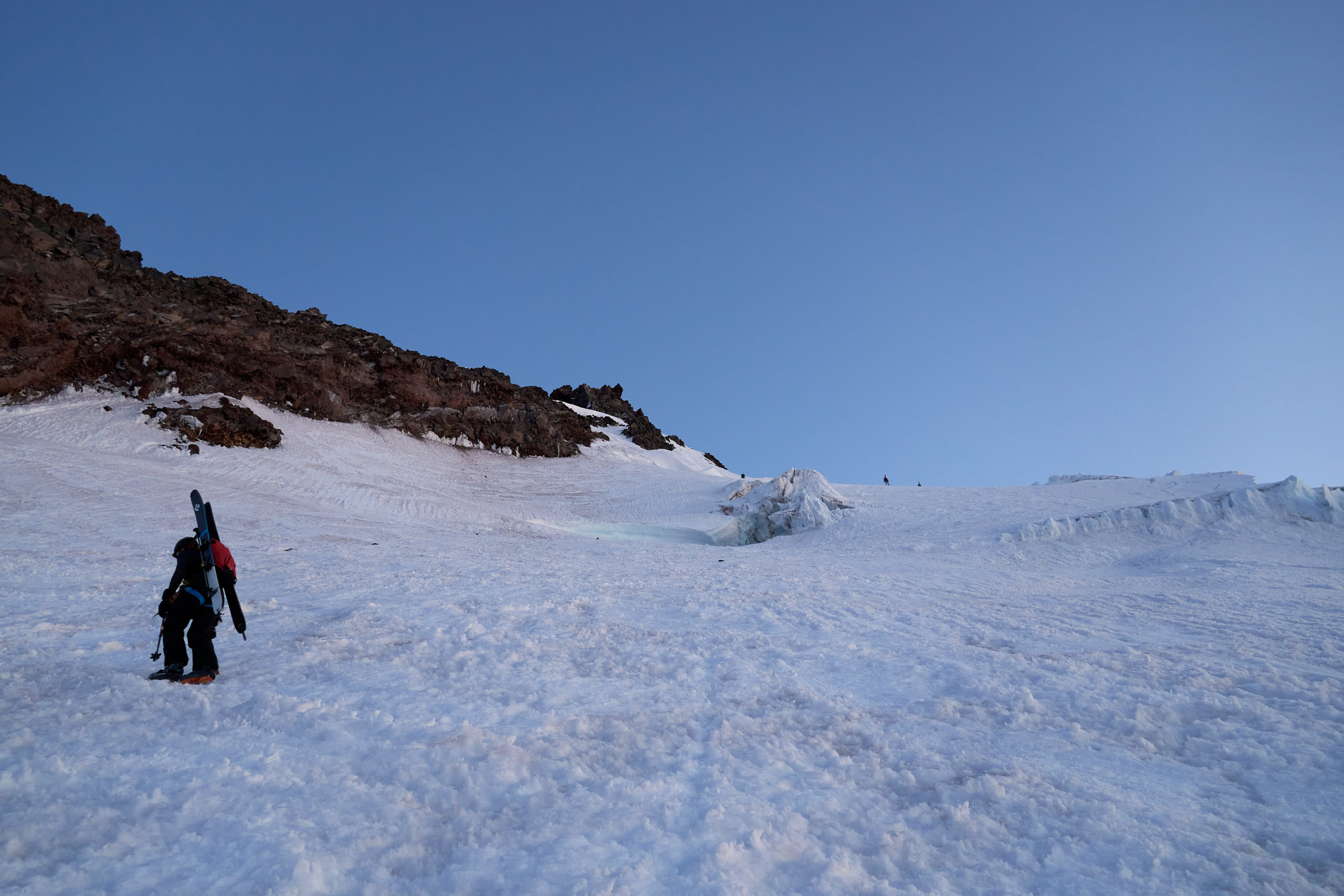
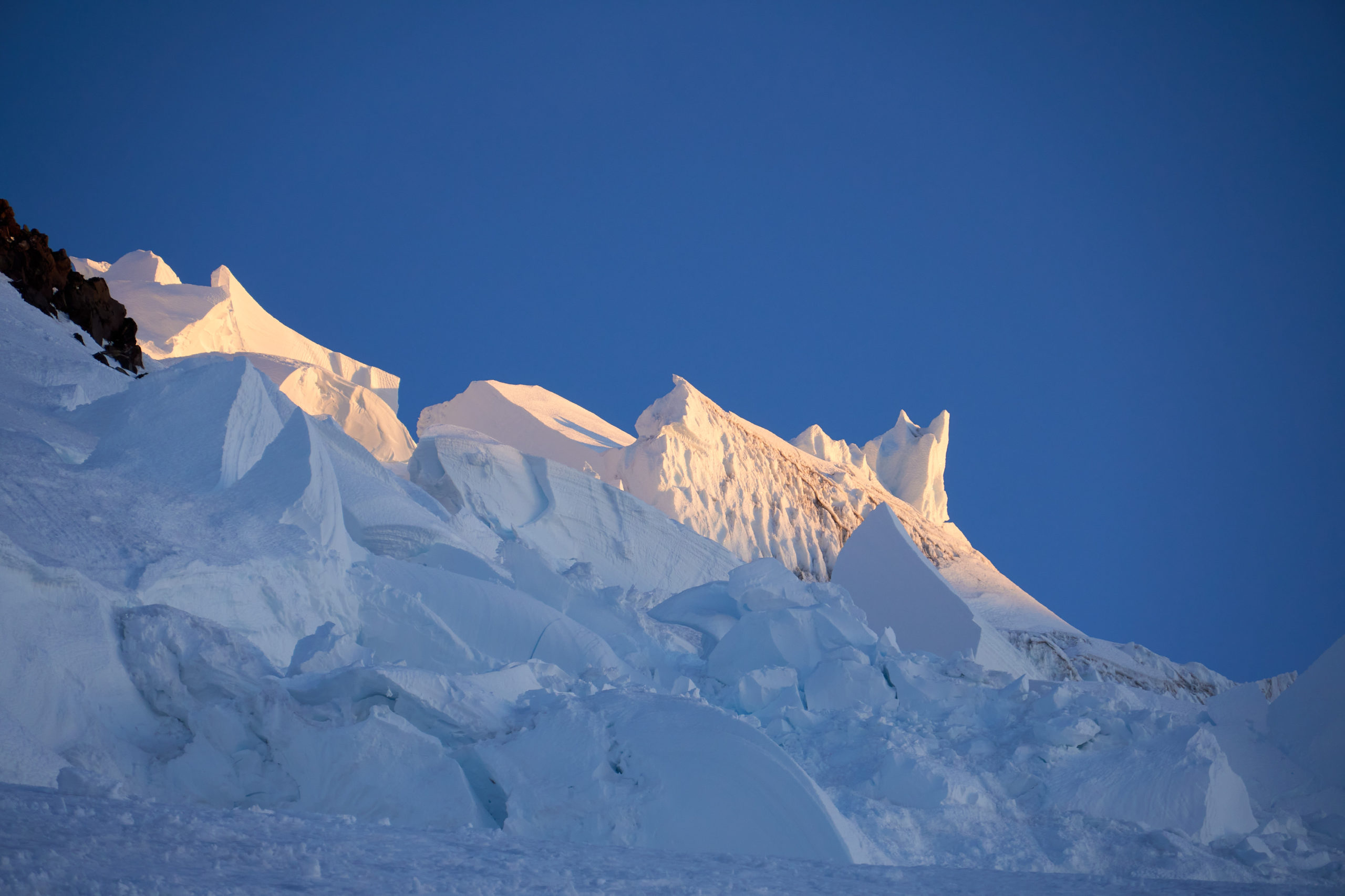
When we crested the dividing ridge-line, we saw that the Nisqually was just as broken and complex as reports had said. I’m curious how many years it has been like this and if glacial recession or just normal glacier movement is to blame. Either way, I can’t even imagine how long it would take to “safely” navigate through it.
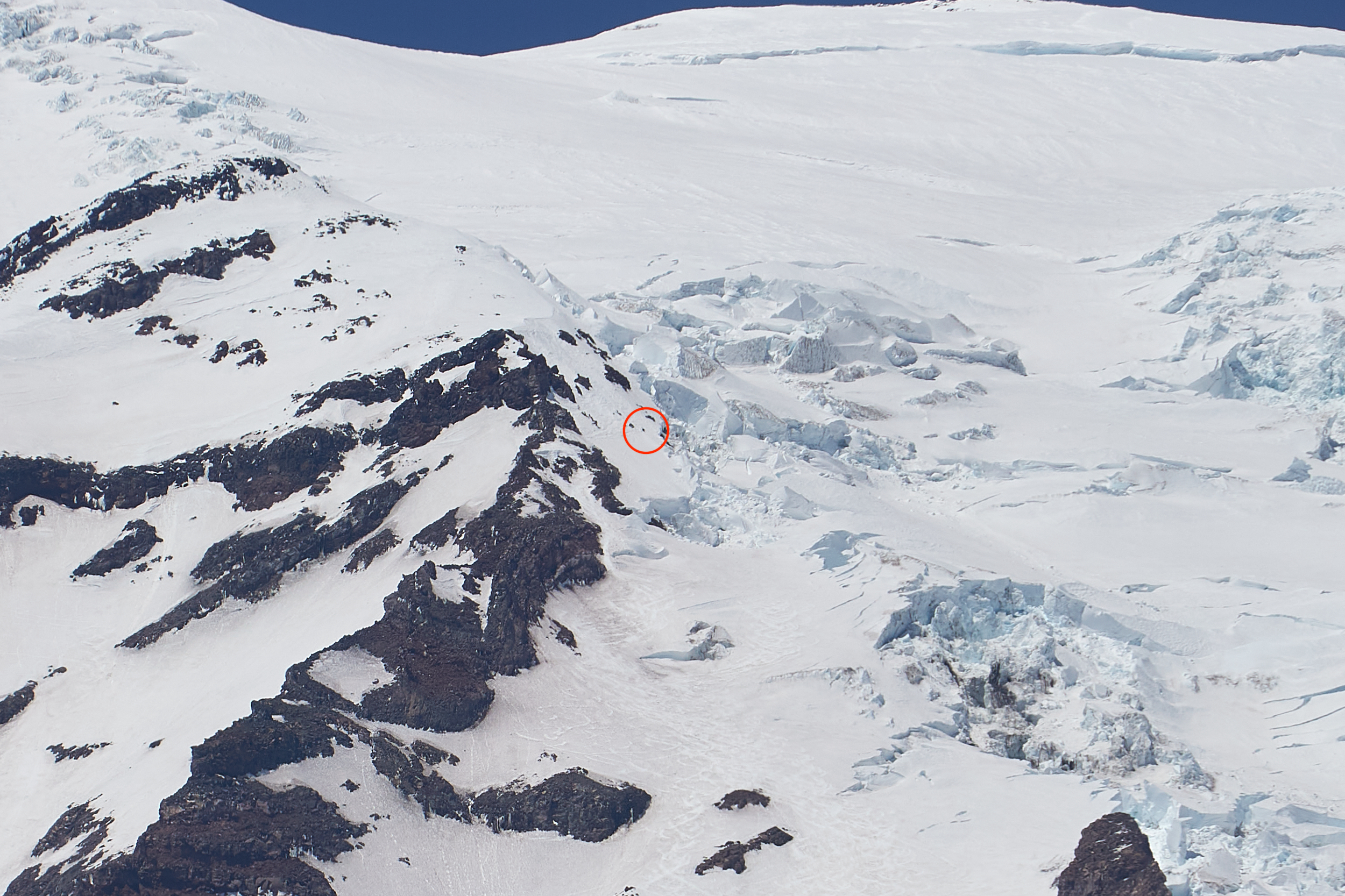
There was a fairly large bergschrund separating the Nisqually from the slope leading up to Wapowety Cleaver, but luckily there was a solid, well-defined snow bridge spanning the gap. In the photo below, a party of three can be seen taking a break right before crossing the snow bridge.
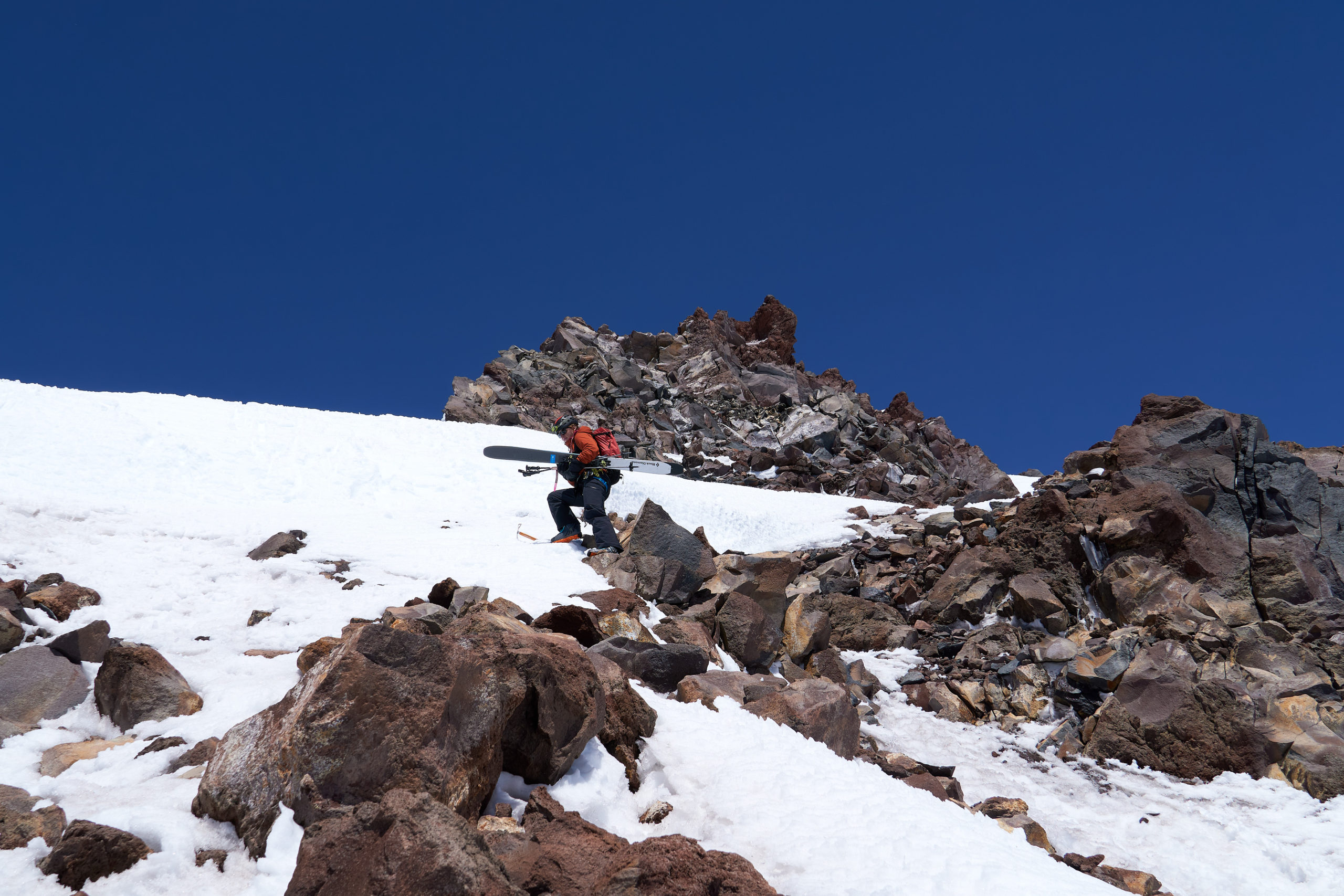
Safely over the snow bridge, Taryn and I booted up the snow chute and carefully picked our way through the rocks. The slope here was mellow enough that navigating the rocks didn’t feel too extreme, but care was definitely needed to avoid dislodging and boulders on parties below. Once through the rocks, we traversed right and booted straight up. This section had the steepest pitch of the day, and with a gaping bergschrund beneath us, we could definitely feel the exposure.
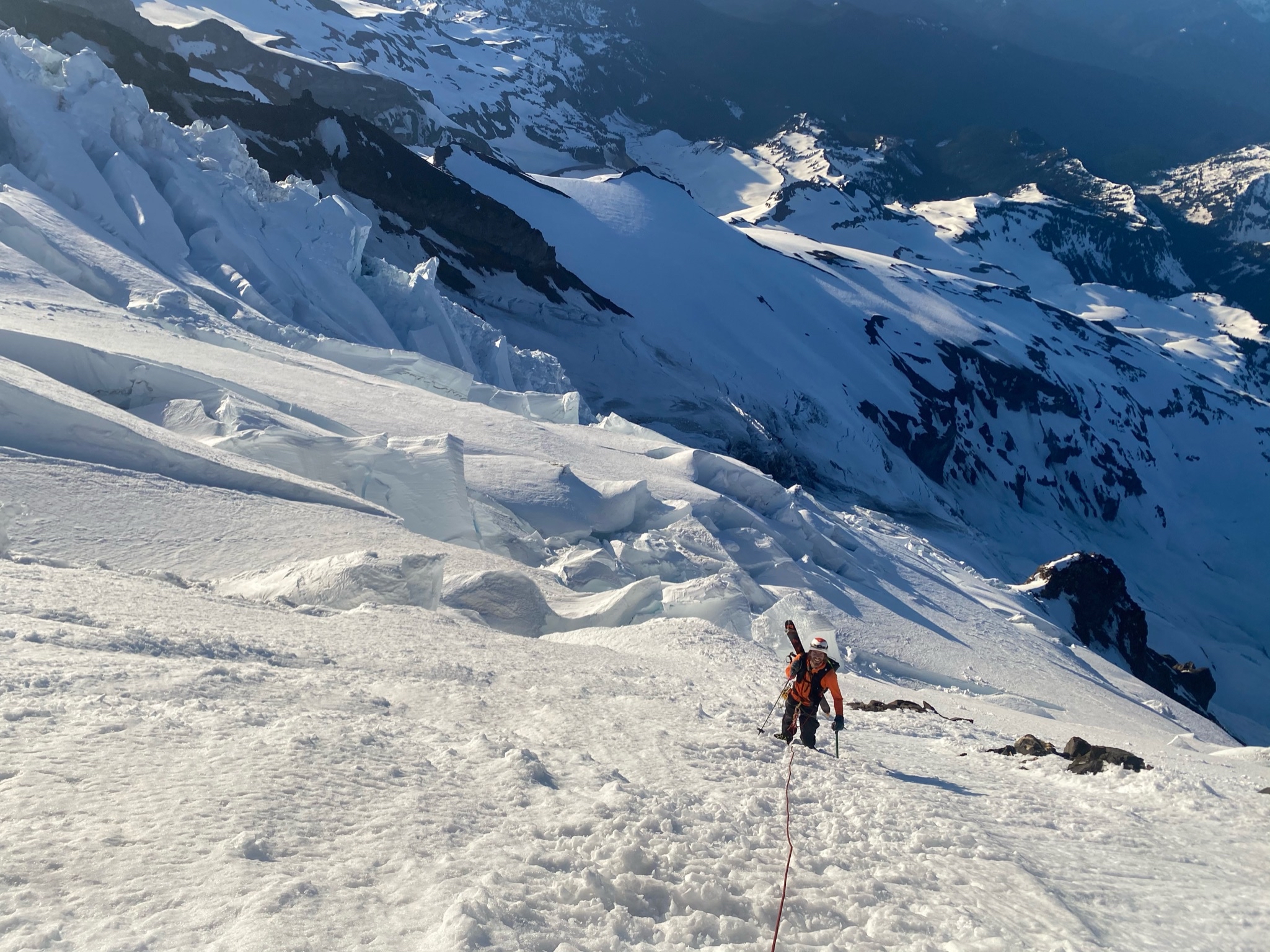
We had one scary moment near the top of the slope where one of Taryn’s crampons became dislodged on her boot. Luckily Taryn was able to reset it while balancing on her other foot. We both breathed a sigh of relief when we crested the ridge and found ourselves on mellower ground. We took a break so Taryn could fix her crampon and so I could catch my breath; at this point we had been on the go for almost six and a half hours and we were feeling every foot of the 12,800 feet we found ourselves at. Luckily, the route above us looked reasonable: some easy travel up the ridge, a small traverse back onto the Nisqually, and from there just a 1,300 foot slog to the summit. The glacier travel demanded we keep alert, but up here the Nisqually looked to be in great shape, and we knew if our bodies could handle the altitude the summit was within reach
The crossover back onto the Nisqually proved wonderfully simple, and we set about plodding up the slope. We could both really feel the altitude at this point, but luckily we found that even 30 second pauses rejuvenated us, allowing us to make slow but steady progress towards the summit.
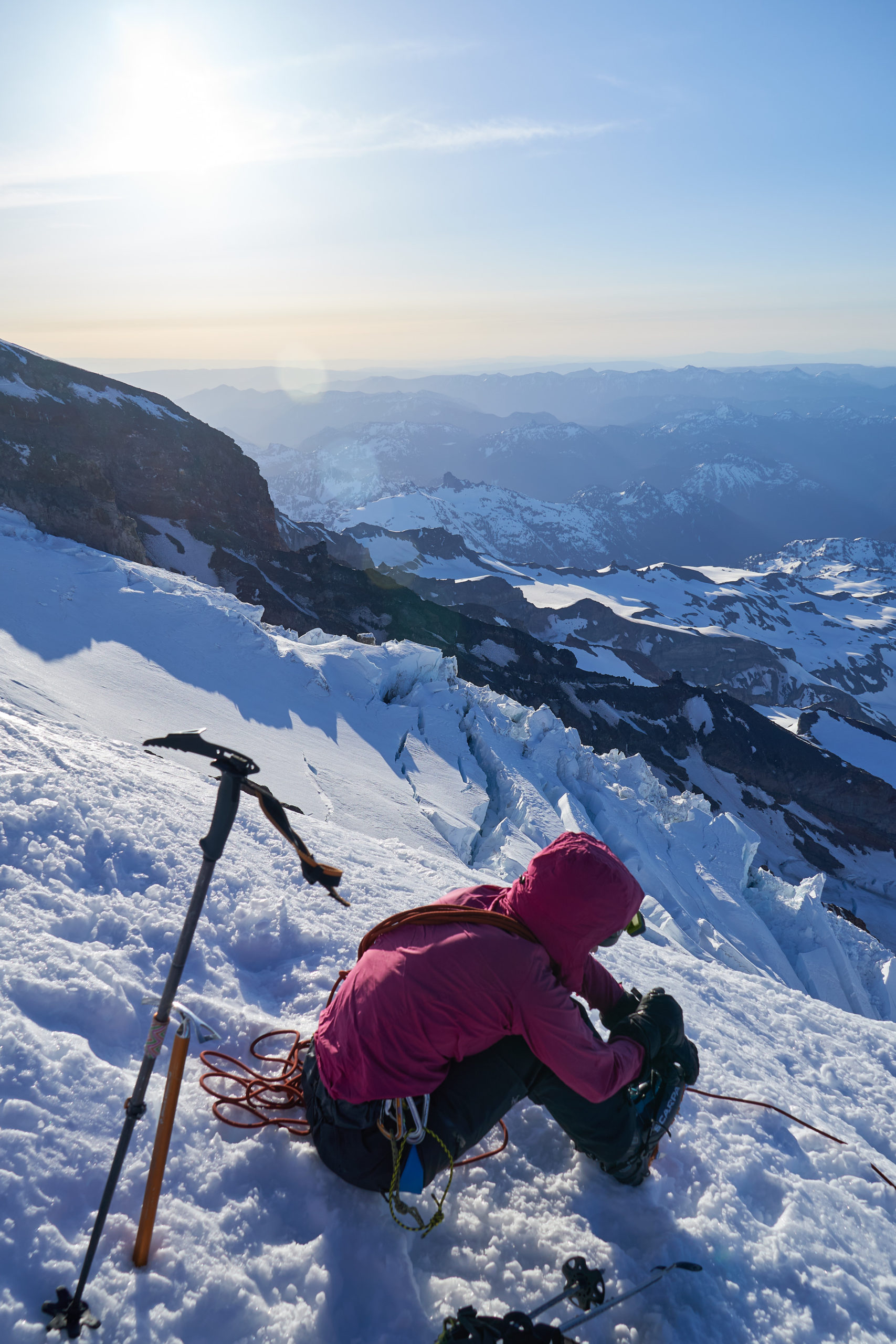
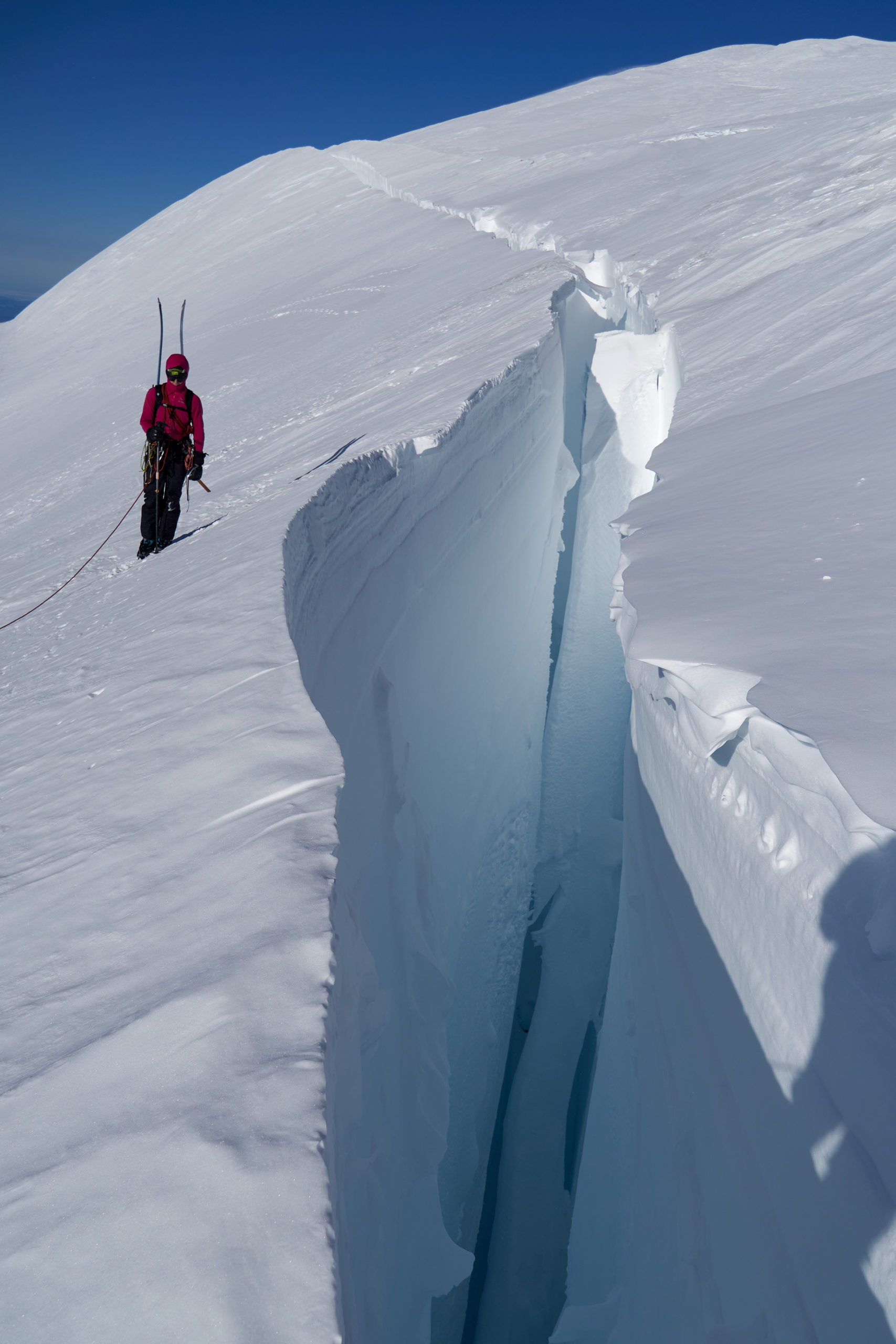
The Nisqually was easy to navigate and seemed to be composed of mostly solid snow, with only a few obvious, massive crevasses. We were able to traverse around most of them, but near the top we came to a large crevasse that spanned most of the slope. Luckily there was a narrow (but solid) snow bridge that allowed us to cross without any running leaps. It was my first time looking straight into a crevasse of this size and I was amazed at just how intimidating they are; there is a dark, cold energy they give off that you don’t get from a normal cliff-edge.
The slope beyond the crevasse flattened and from there it was just another couple hundred vertical feet to the summit cone. We crested the rim of the summit cone and dropped our stuff in exhaustion. Looking around, we realized a point further along the the rim looked a bit more summit-like so we picked our stuff back up and walked over to what turned out to be the summit.
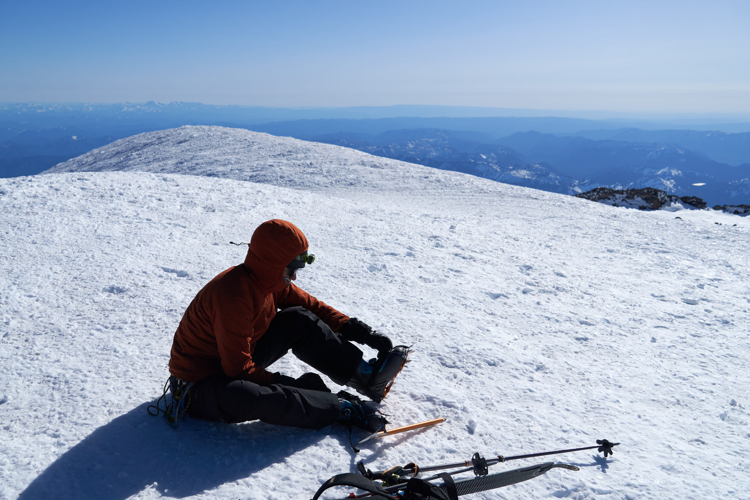
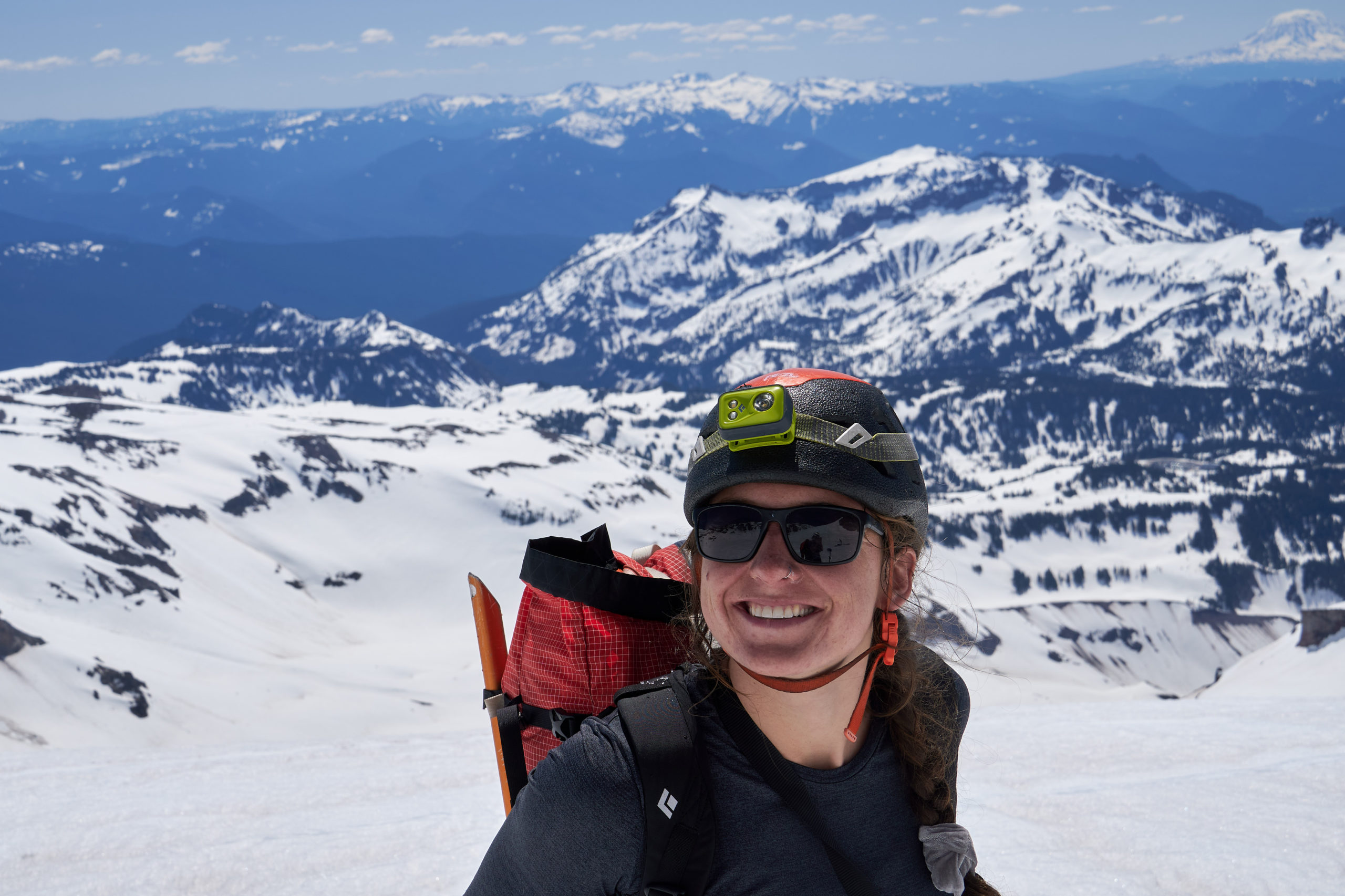
We reached the summit just under 8 hours after leaving the parking lot. The wind was quite strong up here and Taryn and I were both definitely feeling the altitude. Taryn felt nauseous and I was feeling pretty hypoxic; Taryn’s crampon strap had somehow gotten twisted in the buckle and I was comically slow as I tried to help her untangle it. In between the biting wind and brain fog, we failed to take any victorious group summit pictures, but it it felt great to sit there for a second, knowing we were done with the up for the day.
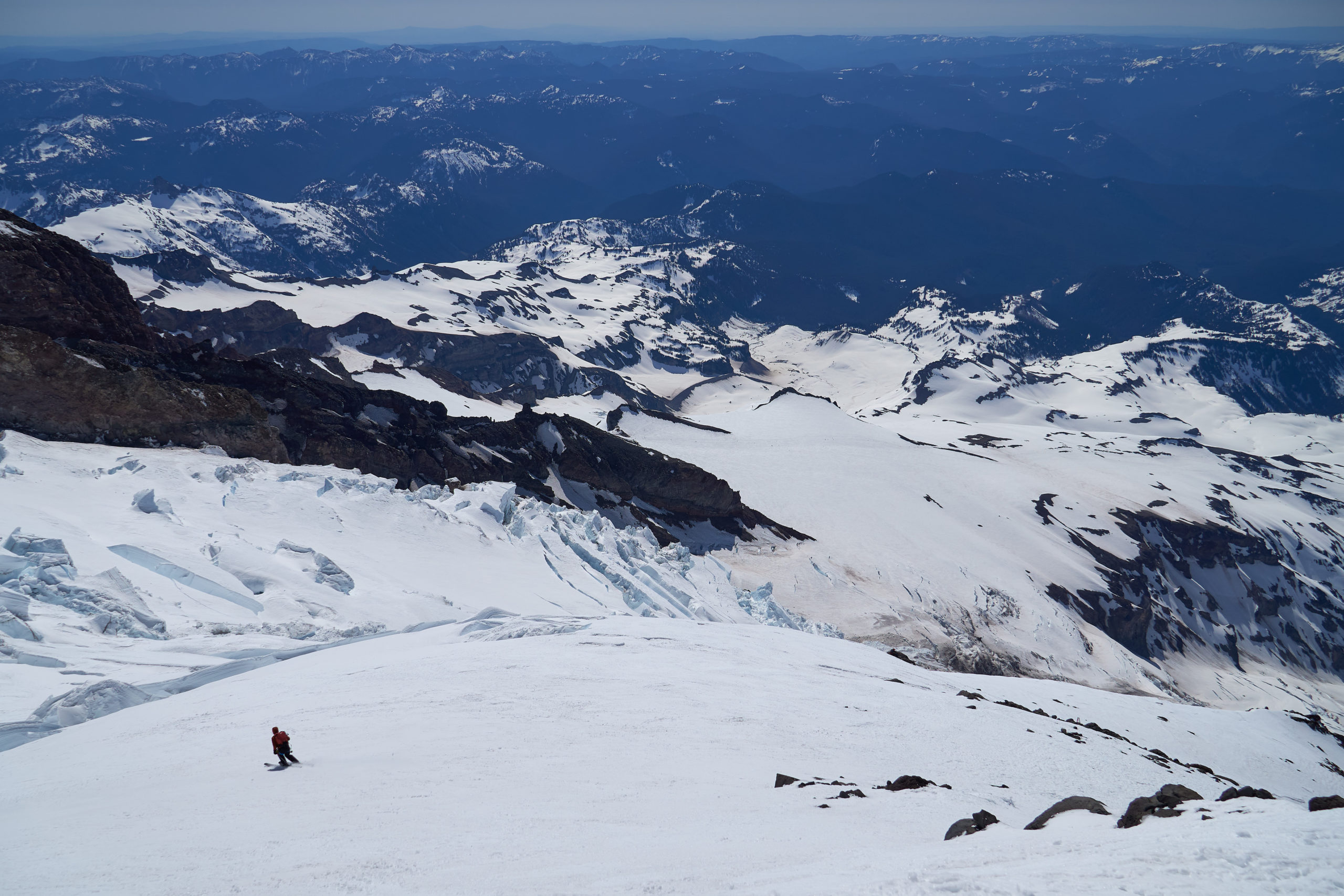
And then it was time to descend! Clicking into the skis and looking at the base far, far below us is a feeling I wont soon forget. Pretty much all of the ski descents I’d done up to this point were a single couloir or chute; it definitely felt different beginning the descent knowing we had multiple glaciers, chutes, and steep pitches to navigate. Luckily the turns off the terrain is mellow and offers the perfect warmup for the skiing below.
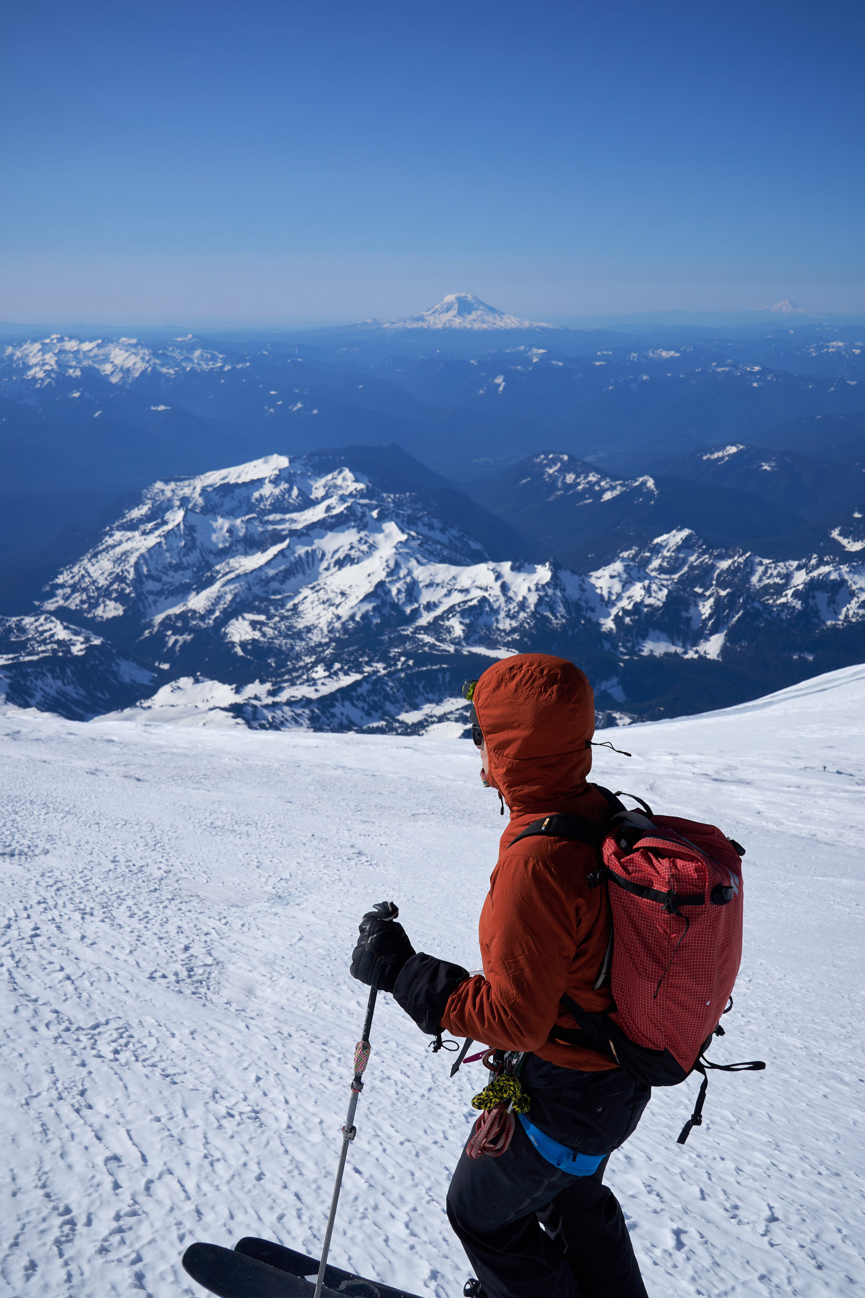
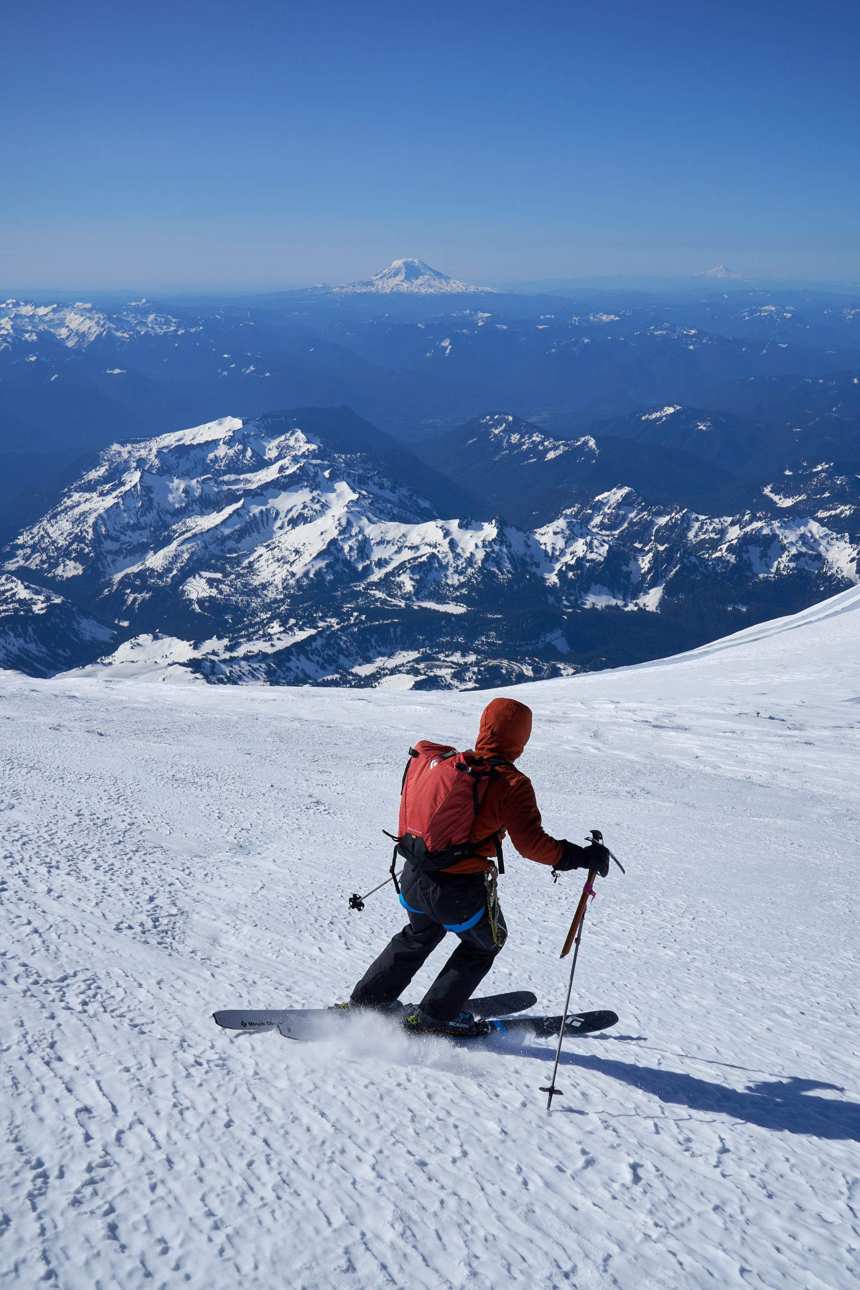
The first couple hundred feet was icy strastugi, firm enough to cause my feet to begin to go numb as my skis chattered across the frozen surface. Once we got below the summit cone, however, the snow became far more pleasant. It was far too windy and cold to form corn, but the snow was at least consistent and edge-able.
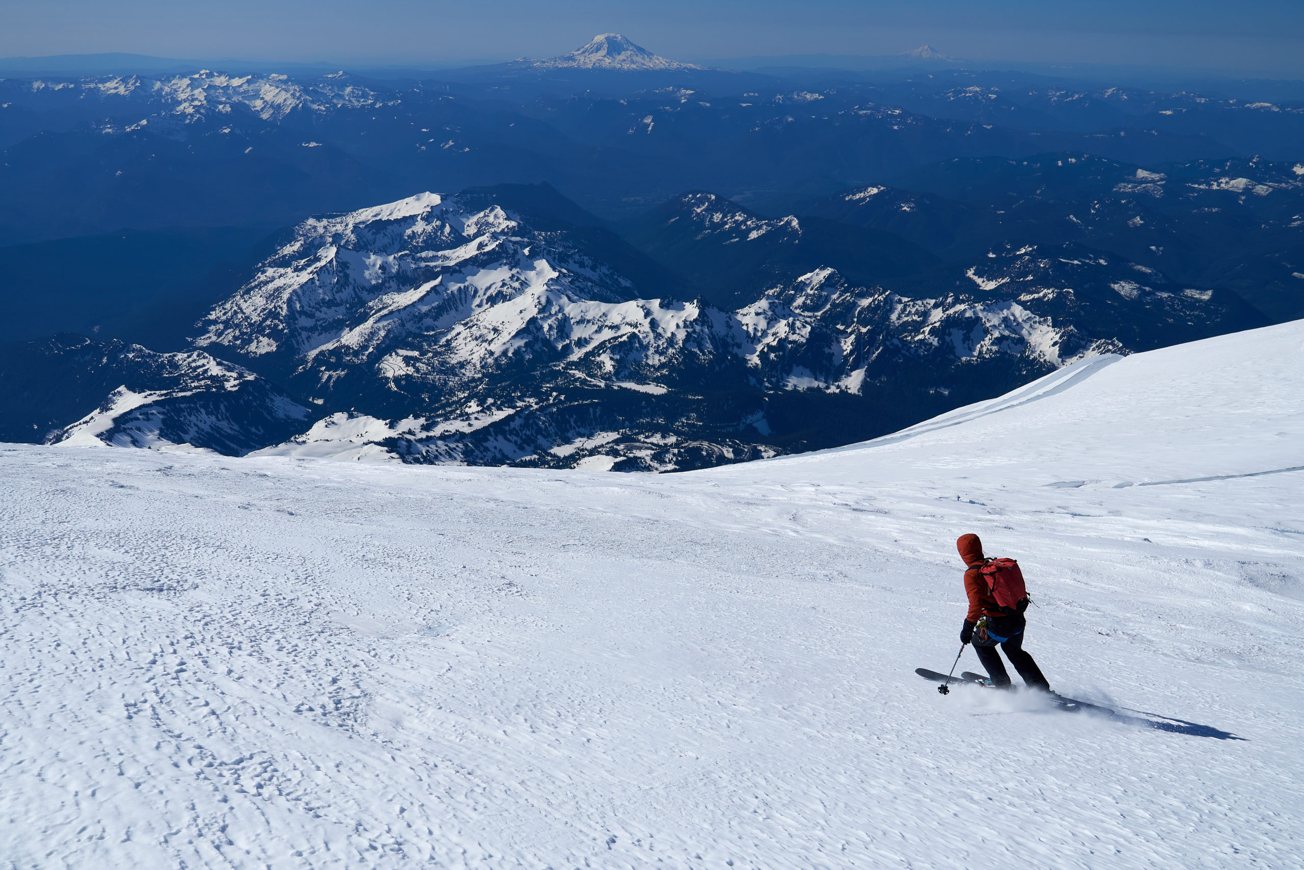
We picked our way carefully down the Upper Nisqually, cognizant of the fact that lurking crevasses would be a day ruiner. I managed to ski back across the snow bridge we had crossed on the way up, but Taryn opted (probably wisely) to tiptoe across on foot. Many of the parties we had passed on the way up were now working their way up the Upper Nisqually and they provided a wonderful sense of scale for the outrageous landscape we were descending.
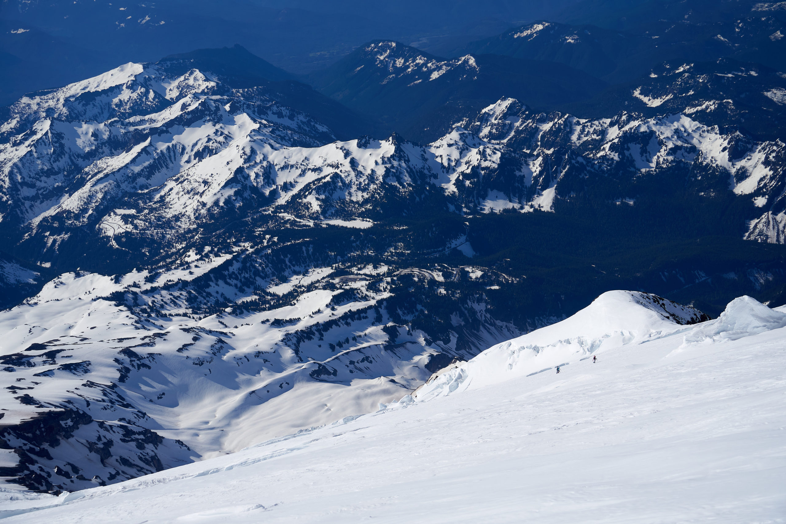
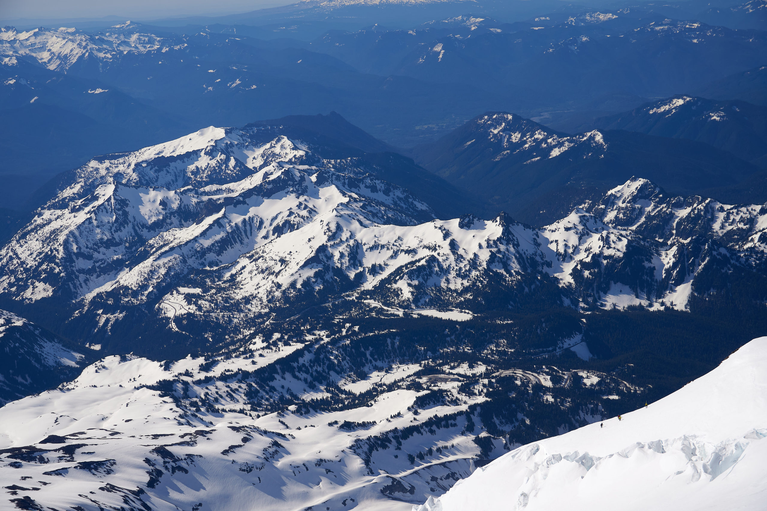
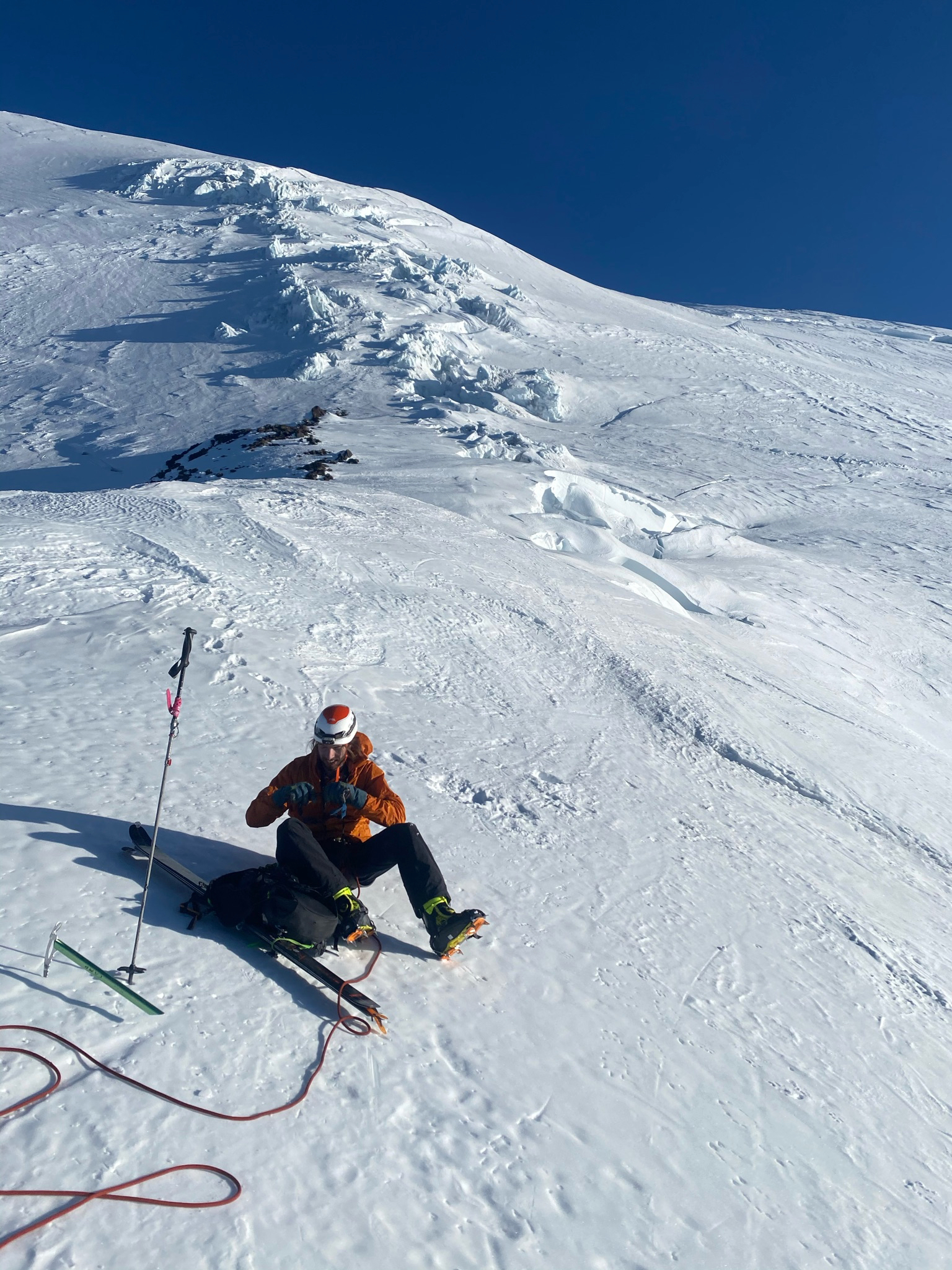
We crossed back onto the ridge from the Upper Nisqually and decided to take a break. The snow was still quite firm (it was only 9am after all) and the steep sections below us had us a bit nervous. It felt good to be back below 13,000 feet, and Taryn and I hungrily wolfed down some calories. I think my body was a unhappy with everything I had been subjecting it to because I found myself shaking uncontrollably, despite the fact that I didn’t feel that cold. I’m going to go ahead and blame the two hours of sleep.
After ~30 minutes we grew tired of waiting and decided to continue downwards. The exposure definitely started to ramp up as we approached the steep snow pitch we had used to gain the ridge on the way up. We stopped for another ~20 minutes above the crux to let the snow soften further.
Peering down the steep pitch was definitely nerve-wracking. On the way up I had scoffed at the side-step tracks we had booted through, but as I started down the face I quickly decided there was no way I was going to bother with any jump turns. The slope angle felt like it was in the upper 40’s, and the bergschrund formed the equivilant of a massive cliff directly underneath. Luckily the snow had warmed quite a bit and was plenty soft for side-stepping. As I drew even with the traverse over to the rocks, I realized that I was facing the wrong way. Unwilling to commit to a jump turn, I pulled out my ice-ax and plunged it into the snow. I clipped myself to it with a sling and did my best to stomp in a little ledge with my skis. Taking a deep breath I stepped 180° with my outside ski, forcing my body to face straight out, looking down at the bergschrund. Despite being anchored, the exposure was intense, and I quickly brought my other ski around so I was pointed in the direction of the rocks. Seeing my experience, Taryn took the time to carve out a little platform and take off her skis. Soon enough we were both safely above the rock band.
Navigating the rocks proved to be much more time consuming on the way down than on the way up. The rocks were too dense to ski through, but dispersed enough that there were multiple small snow-patches we had to navigate through. This involved a stressful amount of clicking in and out of skis, and we were both relieved when we made it out onto the snow slops below.
After all of these shenanigans it felt great to be back above the Finger. The snow was a little slushier than we had hoped for, given the delays above, but it still skied phenomenally; smooth, consistent hot powder. We opened it up in the upper half of the Finger, smiling and laughing as we swooped down the chute. I had expected the sun-cupped lower half to be a nightmare to ski, but luckily the route’s popularity had caused a track to be worn in, similar to the wiggles that you see at ski resorts in the spring.
It was an absolute blast skiing down this in the perfect midday weather, and the lack of hazards or exposure made for some wonderfully carefree turns. Through the Finger and clear from any rockfall we knew it was just some mellow skiing back to the car and we were all smiles as we savored the amazing weather and scenery.
From the base of the Finger we ripped down towards Wilson Gully, reaping the benefit from all of the early-morning’s hard work.
We did pay the price for our blind following of the gps early that morning when we found ourselves too far skiers right trying to drop back into Wilson Gully. We had been blindly following a couple ski tracks and they suddenly came to a halt. We realized that we were above a 200 foot cliff, completely cliffed out. Groaning, we took off our skis and booted back up to where we could traverse to the correct descent. Bonus vert!
The final hurdle came when we realized that, since we weren’t confident in our ability to hitchhike up from Nisqually Bridge in Covid times, we would have to climb back out to Glacier Vista in order to descend back to the car. It ended up only being a couple hundred feet but Taryn and I were not psyched to put skins back on.
A thousand vertical feet more of warm spring skiing and we arrived back at the car, a little bit under twelve and half hours after leaving. We stripped off our boots, pulled out the camp chairs, and sat back, savoring that post-adventure bliss. The line we had skied towered above us and we could just make out someone working their way down the steep slope above the bergschrund.
The day felt like an incredible blur and Taryn and I laughed gleefully as we tried to recollect all the different parts to the day. The Fuhrer Finger was far and away the most complex ski line I have ever skied, and I’m thankful that weather and life aligned to allow me to check of this bucket list item safely. We soaked up the day until our hungry stomachs triumphed over our endorphin-saturated brains and we said a final goodbye to the mountain before heading down to Ashford for some pizza and burgers.
Leave a Reply