*Record scratch* *Freeze Frame* Yep, that’s me. You’re probably wondering how I ended up in this situation.
To explain how I ended up being driven across the outskirts of Sion in the back of a work van with our bikes and two bike boxes I’ll need to rewind a bit.
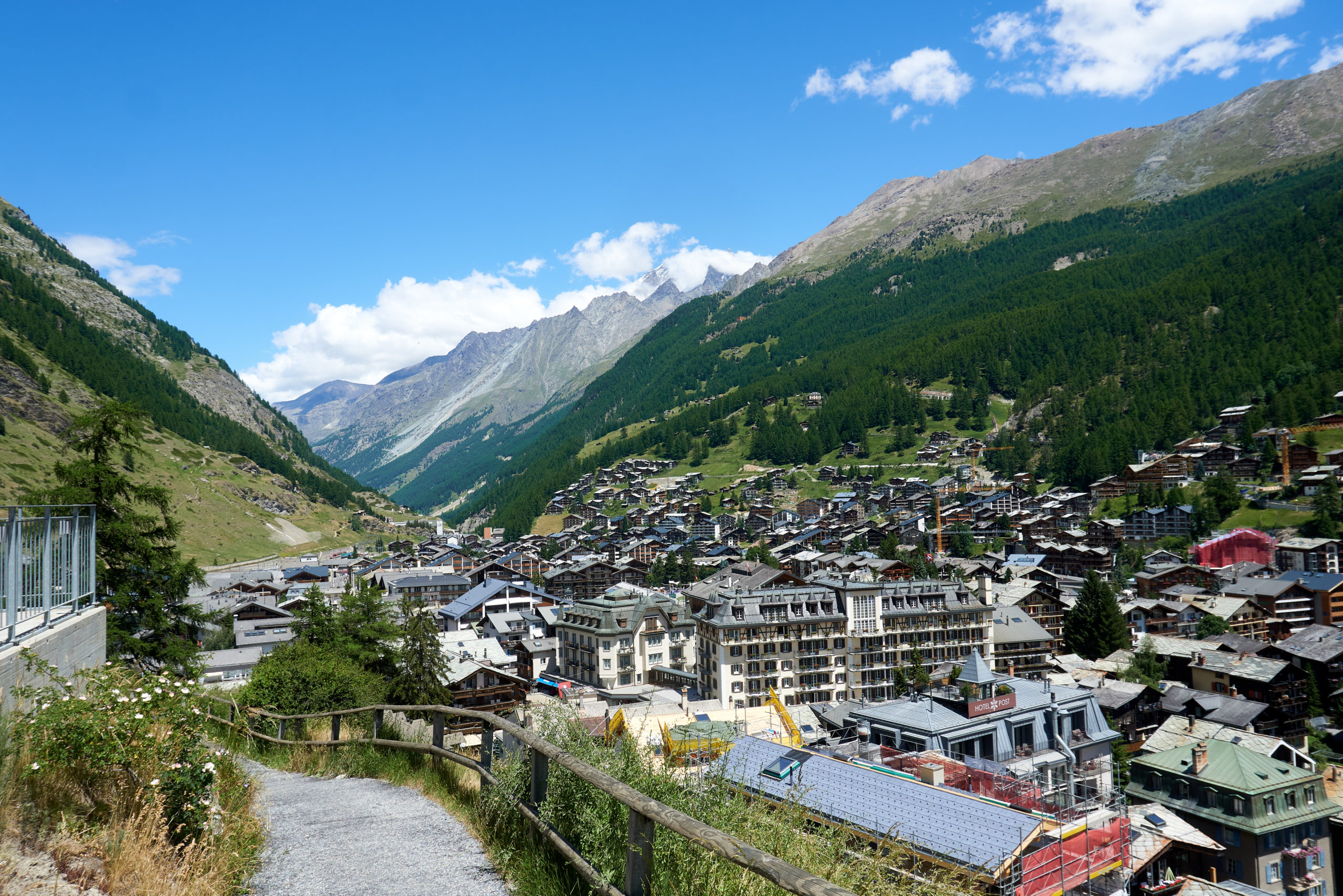
My previous post ends with us successfully pulling off a lightning trip to the Dolomites and catching a train from Bolzano to Sion where we were scheduled to start the Via Valais.
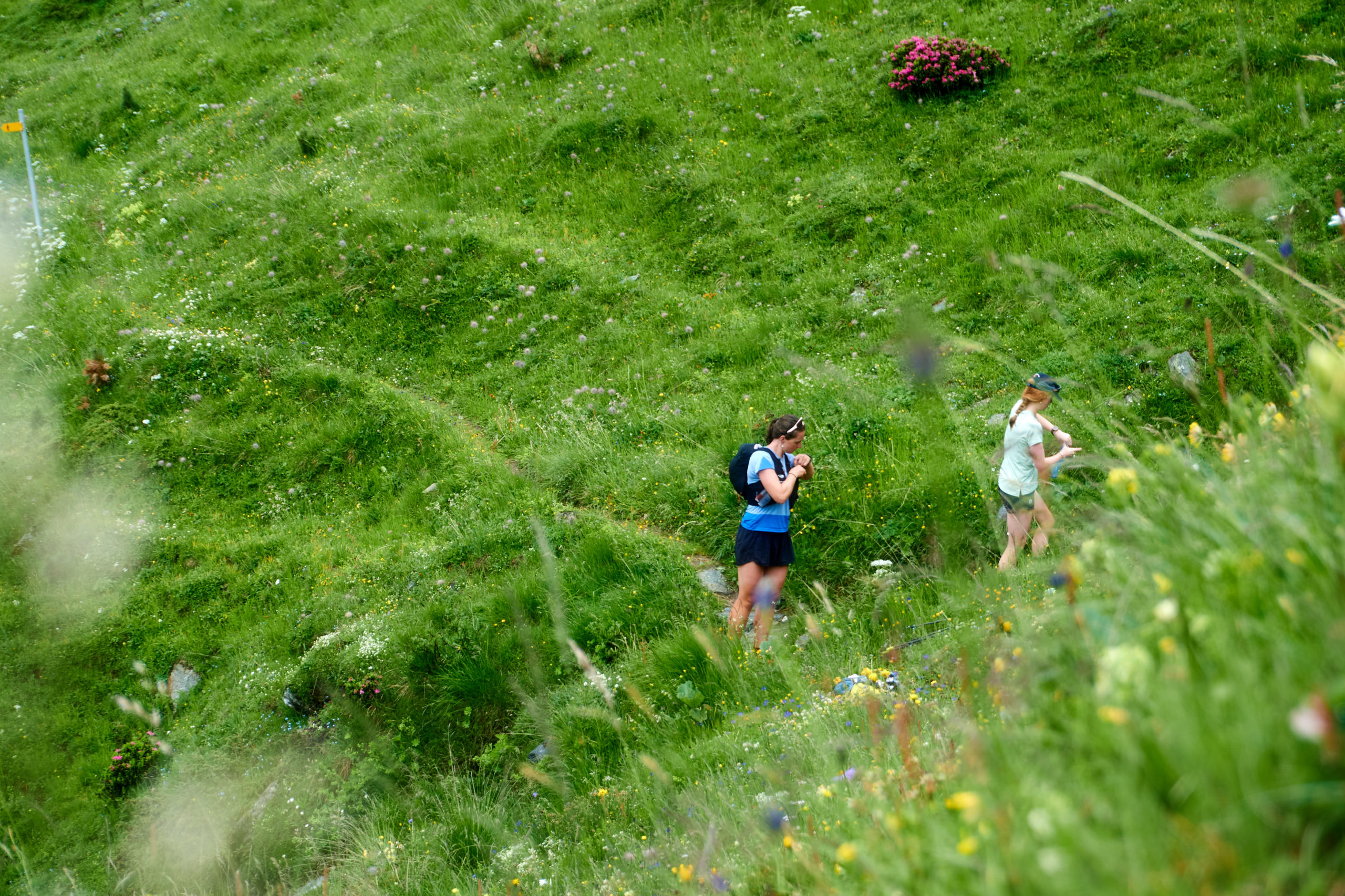
The Via Valais is a hut-to-hut trail run that navigates through the heart of the Swiss Alps. Thanks to nightly layovers in either mountain huts or small villages there is no need to carry more than a small running pack with supplies for the day, making it an ideal way to enjoy some big mountain running.
In its full form it can be done in 9 stages, starting in Verbier and finishing in Zermatt, but we had chosen to do the 6 stage version which starts by riding the Crêt du Midi cable car outside of Sion up into the mountains and then joining the route at the Cabane de Moiry mountain hut. We arrived in Sion the evening of the 19th and found a hotel. We were planning to take the Crêt du Midi cable car the next morning to start the 16 mile run to Cabane de Moiry mountain hut.
With the 18 hours or so we had in Sion we needed to work out one final logistical hurdle, what to do with our bikes. More specifically, how to set ourselves up for success traveling with bikes after the run was complete.
We were scheduled to finish up the run sometime on June 25th and we were scheduled to fly out of Geneva to Copenhagen early on the morning of June 27th. The logistics of getting ourselves back from Zermatt, stopping through Sion to grab bikes and other non-running gear we had stashed somewhere, and then onto Geneva in a little over 24 hours was daunting enough, but then we realized an added wrinkle: June 26th was a Sunday.
We needed bike boxes to be able to fly with our bikes. Our plan had been to just check with bike shops in Geneva on the 26th as we were pretty confident we could scrounge up a couple of discarded boxes. But this wouldn’t work if all the bike shops were closed on the one day we had in Geneva. We did some googling and confirmed our fears; every bike shop we checked was closed on Sundays.
We found some information online that claimed that the Geneva airport sold bike boxes which would have solved all of our problems, but then we found some contradictory information saying that that program had been halted due to covid. We shot some desperate emails out to a support email associated with the Geneva airport trying to get clarity but we didn’t have any real expectation that we would hear back.
As we sat in our hotel in Sion desperately brainstorming we started to concoct a crazing sounding plan. We had to find somewhere to stash our bikes and other gear anyways. What if we rented a storage unit in Sion for the week, got bike boxes from a bike shop in Sion, and had everything waiting for us when we came back through Sion. Seemed like it could work on paper. A notable feature of this plan, however, was that it relied on businesses being open in Sion, and, seeing as it was a Sunday, they were not. Not coming up with any better plans, we nervously set our alarms for early the next morning and then did our best to get some sleep and forget about the mess we had put ourselves in.
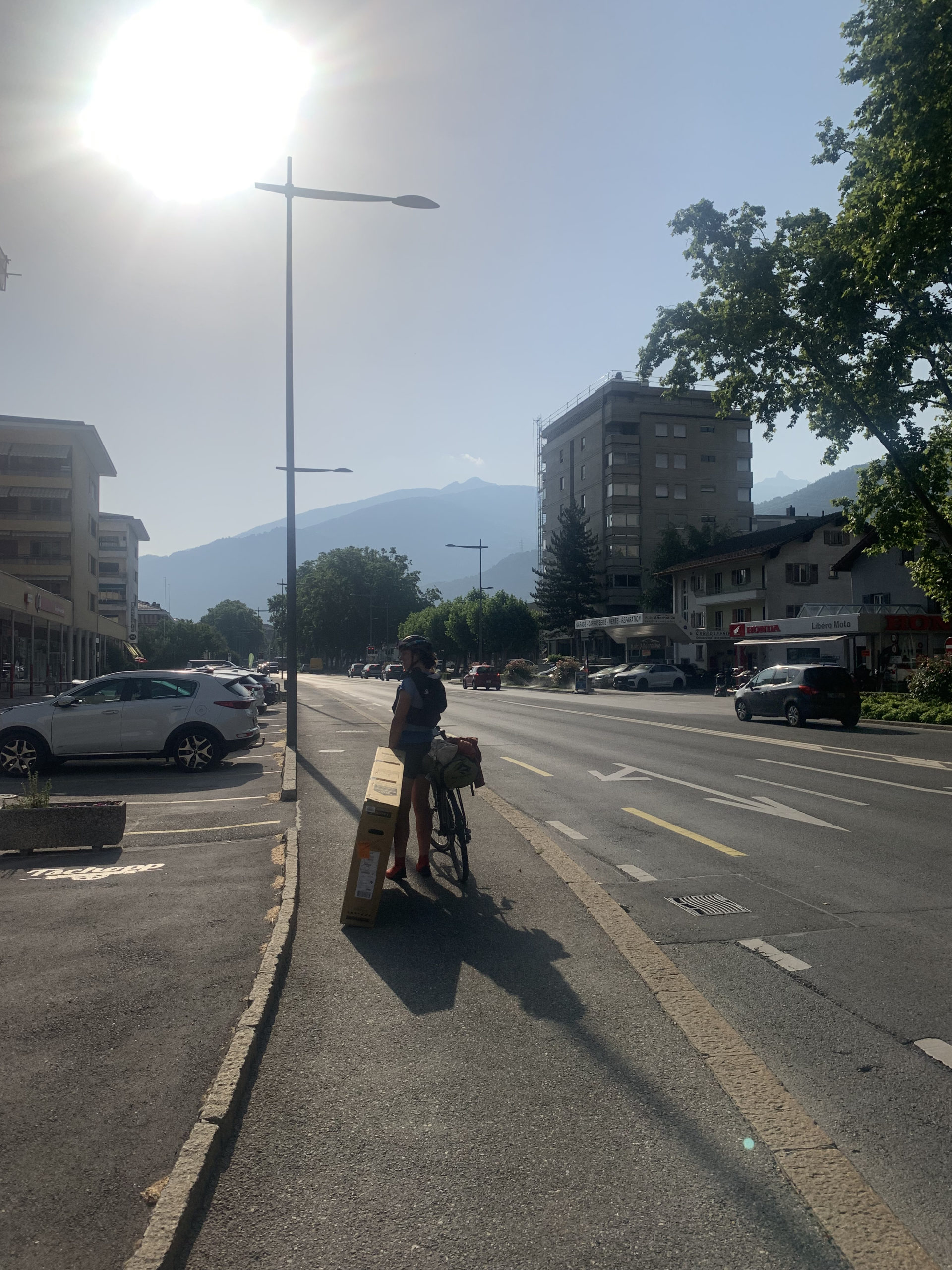
We woke up early and quickly threw on our running gear and loaded up our bikes with the remained of our stuff. We set off from the hotel and into the heart of Sion. We found a bike shop that opened at 8:30am and we were at their doors as soon as they unlocked them. They seemed a bit amused at our predicament but did in fact have two spare boxes for us. Feeling pleased at how smoothly the first step of our plan had gone we headed out onto the street with our boxes.
It was only once we started to try to move with both our boxes and loaded bikes that we realized how tricky it was just getting around with all of the stuff. The storage facility we had selected was almost two miles away on the outskirts of the city. After a few weeks of zipping around by bike the mileage hadn’t seemed too significant when we were scheming in the hotel. Now, dragging a giant box and pushing an unstable bike, it felt very significant. As they say, if you’re going to be dumb, you have to be tough, so we set off trudging across the city.
We eventually made it to the warehouse that google showed as the location of the storage company we had identified. To our alarm we saw no office or any sign of other humans. I continued looking around the building while Taryn worked on tracking down a number to call. Eventually Taryn managed to get in touch with a live human who informed her that the storage company had multiple facilities and the one we were at was self-service for existing customers only.
After Taryn hung up we stood in the hot morning sun feeling utterly defeated. By now it was 10am and we had no idea what to do next. We had to get started on our run before it got too late and we definitely didn’t feel like we had the time or energy to drag our boxes back to Sion to figure out other storage options.
We had just started to search around for a dumpster to ditch the boxes when we saw a small van roll up to the storage building and two friendly looking 20-somethings get out and start unloading some items. Hardly believing our luck we dragged ourselves (and our bikes (and our boxes)) up to them and explained our predicament. In what felt like divine intervention they were in fact very friendly and offered us a ride back into town with all of our stuff. We loaded up our bikes and boxes into the back and I climbed in after them while Taryn took the remaining seat up front. Taryn directed them to the hotel we had stayed at the previous night, figuring it would be the best place to regroup and figure out our next steps.
Arriving back at the hotel we thanked them profusely and clambered out. As they drove away we went into the hotel to see if they could help us. We figured they might at least have a dumpster we could use to dispose of the boxes so we could then go lock our bikes in the woods. To our amazement, the woman at the front desk said that the hotel had a storage room in the basement and we would be welcome to leave all of our stuff (boxes included) for the week! Our relief at finally having a solution overpowered any silliness we felt for having dragged two bike boxes all the way around Sion all morning just to end up back where we started.
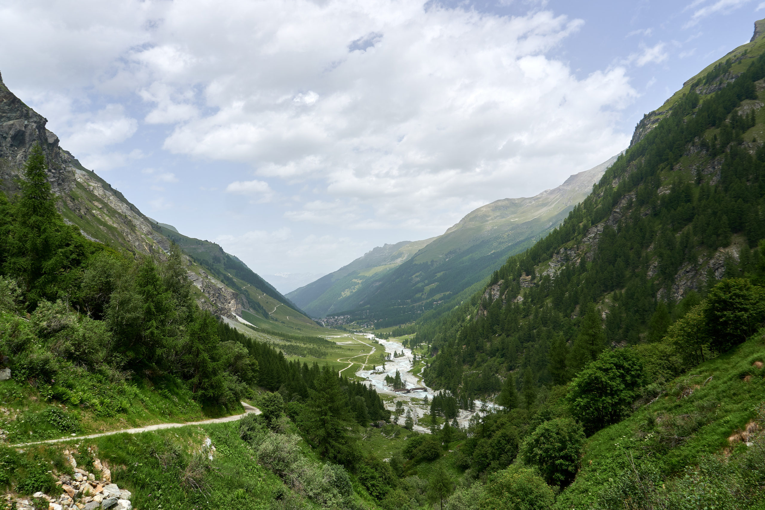
A few minutes later and we were walking out of the hotel with just our light running setups, feeling so excited to finally be starting our adventure. We jogged to a nearby bus stop and settled in to wait for the bus that would take us to the base of the Crêt du Midi cable car.
The day’s craziness was not completely over however. I decided to check the Crêt du Midi website while we were waiting for the bus just to see if we needed to buy tickets in advance or anything. When the site loaded I was horrified to see a banner announcing that due to the unprecedented heat wave (it had certainly felt hot walking around Sion all morning) they had temporarily closed the cable car because of cable stretch. This meant we would have to start at the mountain base, adding an additional 5 miles and 3,500 feet to an already big day. We emailed the hut to tell them we might be late for dinner and then did our best to savor the final bit of downtime before what we knew was going to be a very active afternoon.
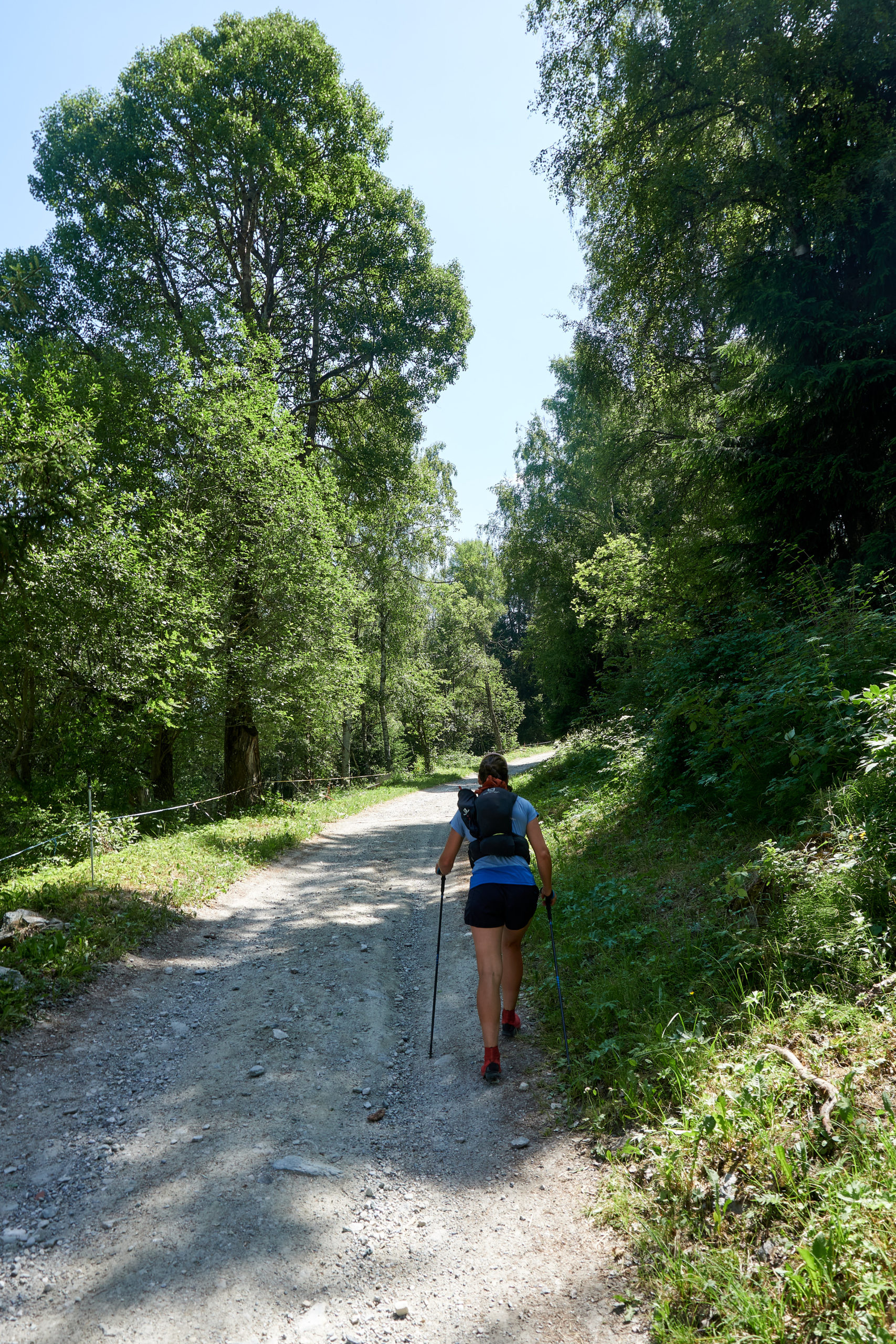
It was 12:30pm by the time we finally made it to the base of Crêt du Midi, not exactly an alpine start, and definitely not ideal timing for starting a big run in a heat wave. We started up some steep fire roads, sweating in the stifling air.
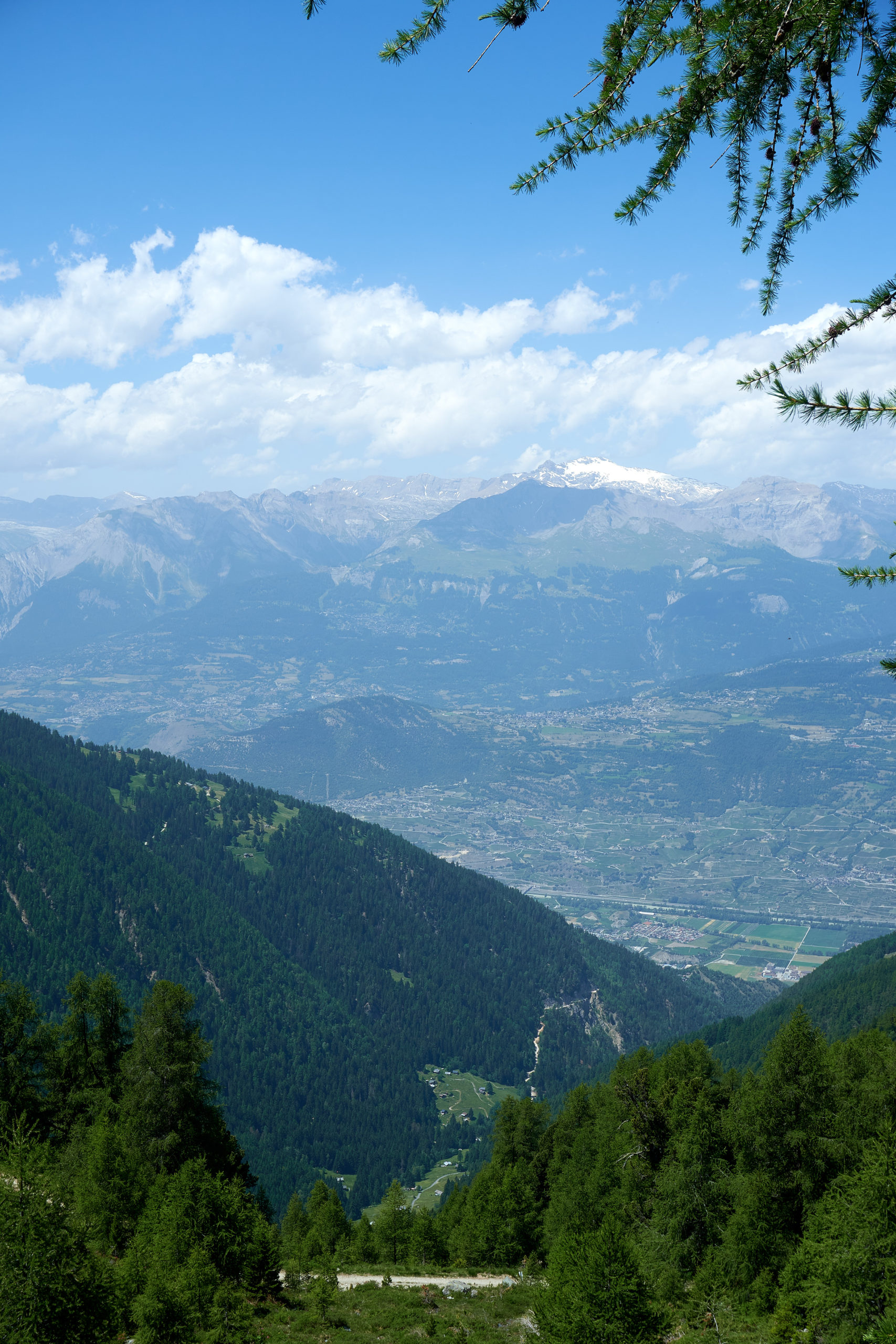
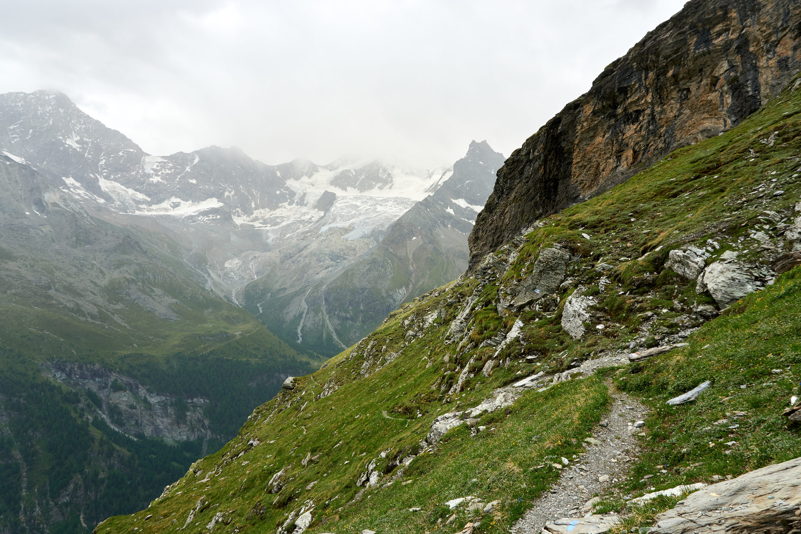
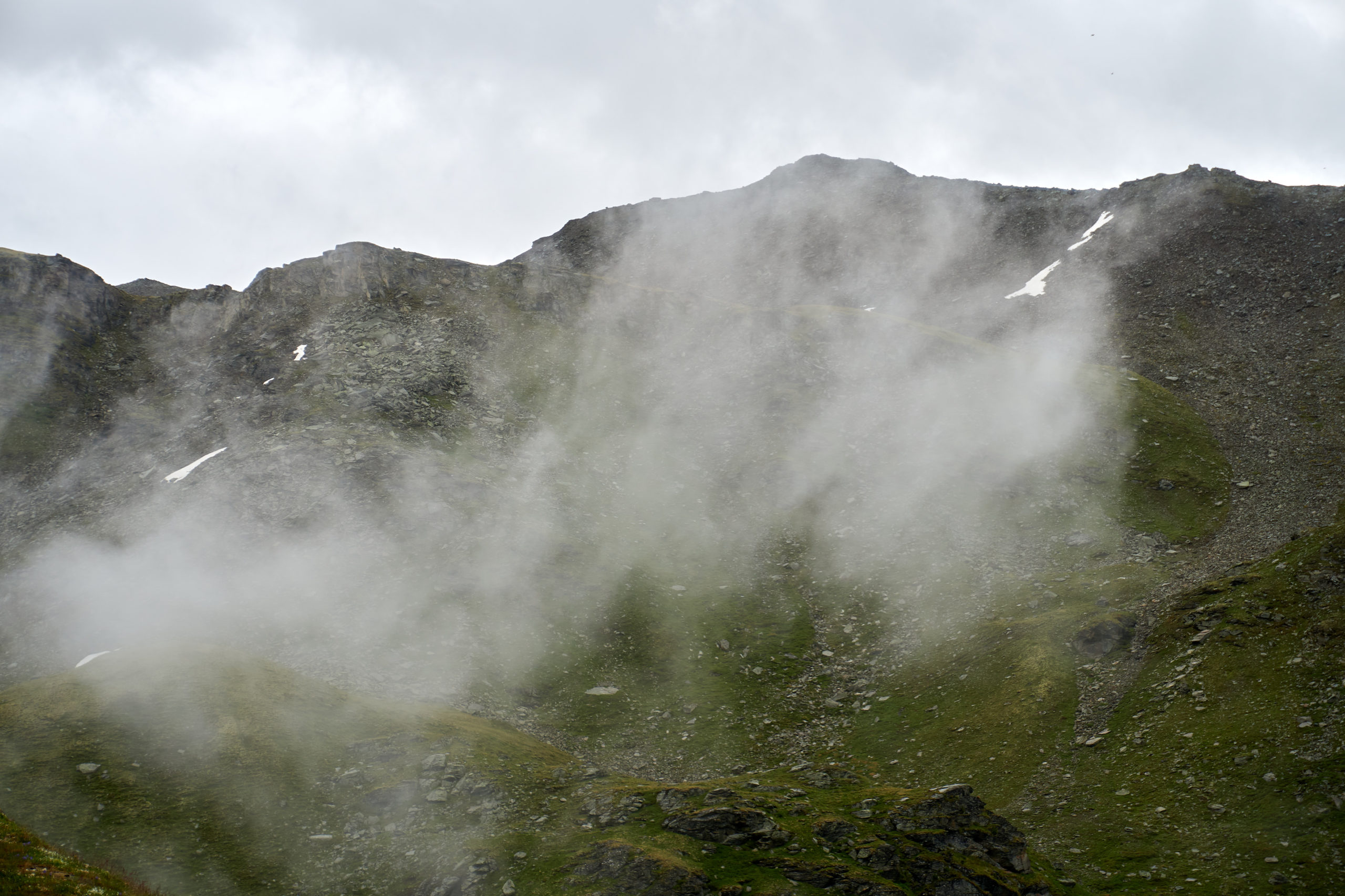
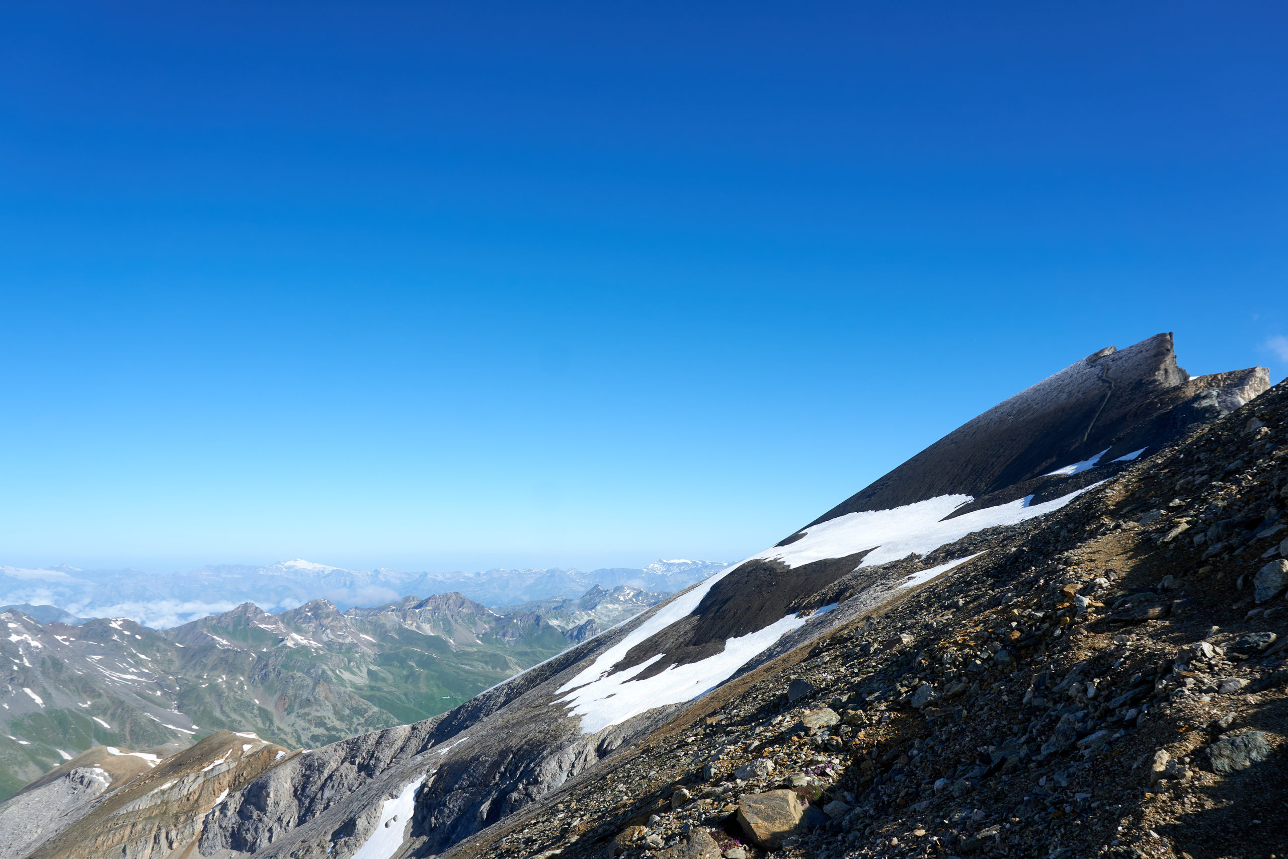
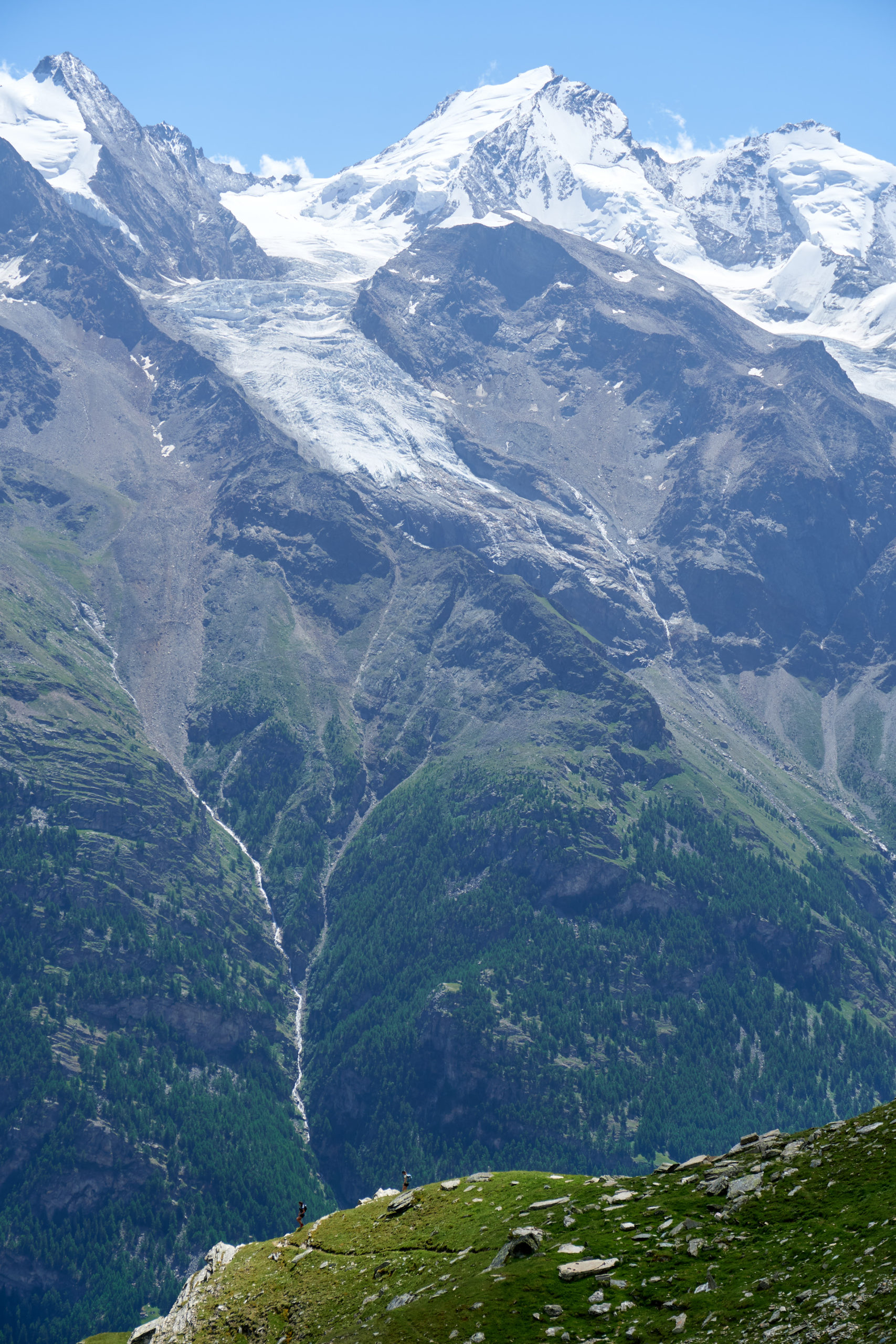
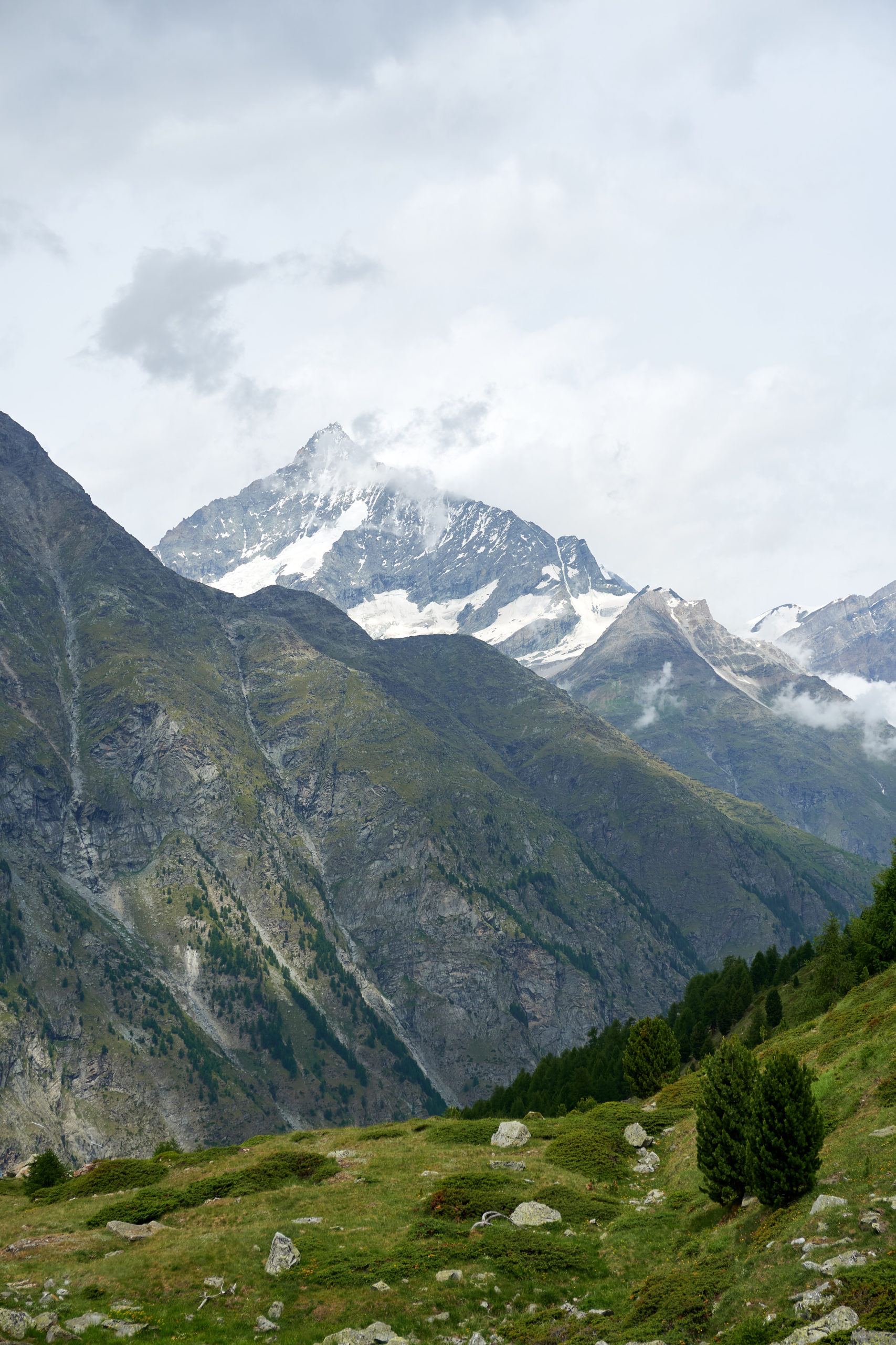
After an hour and a half of suffering we finally broke into the alpine and got our first real view of the massive peaks ahead.
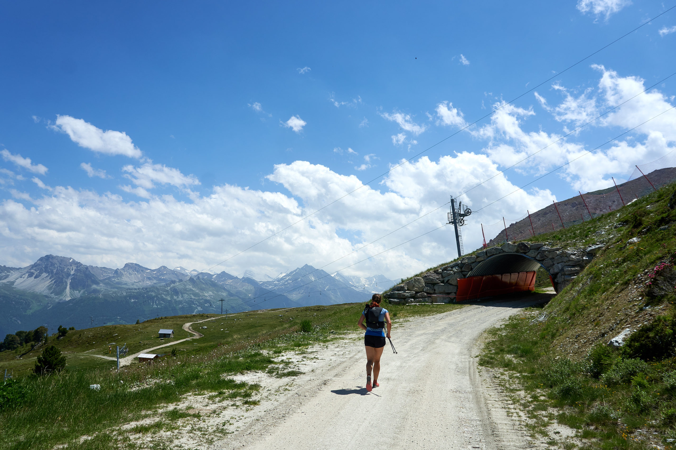
The steep climb up the Crêt du Midi was a brutal warmup, but it was satisfying to look back at Sion knowing we had covered much of the vert entirely under our own power.
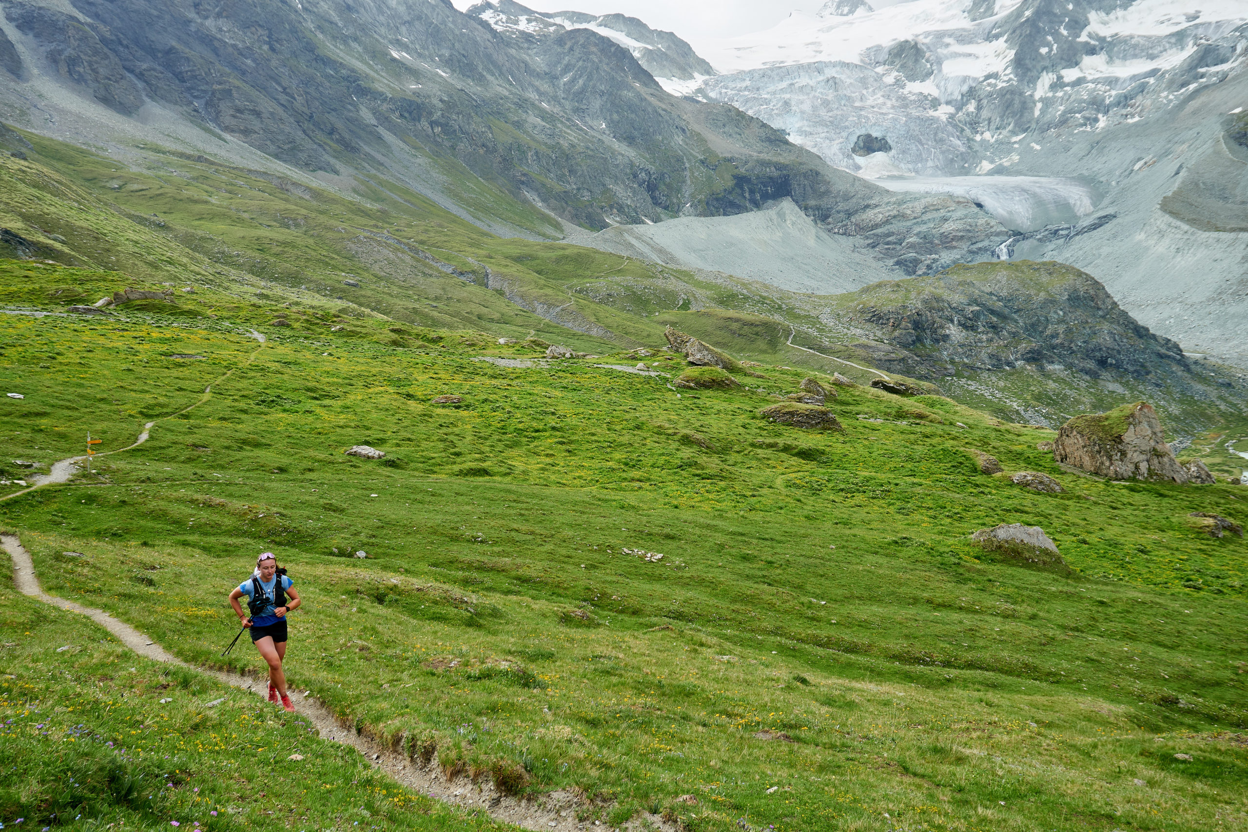
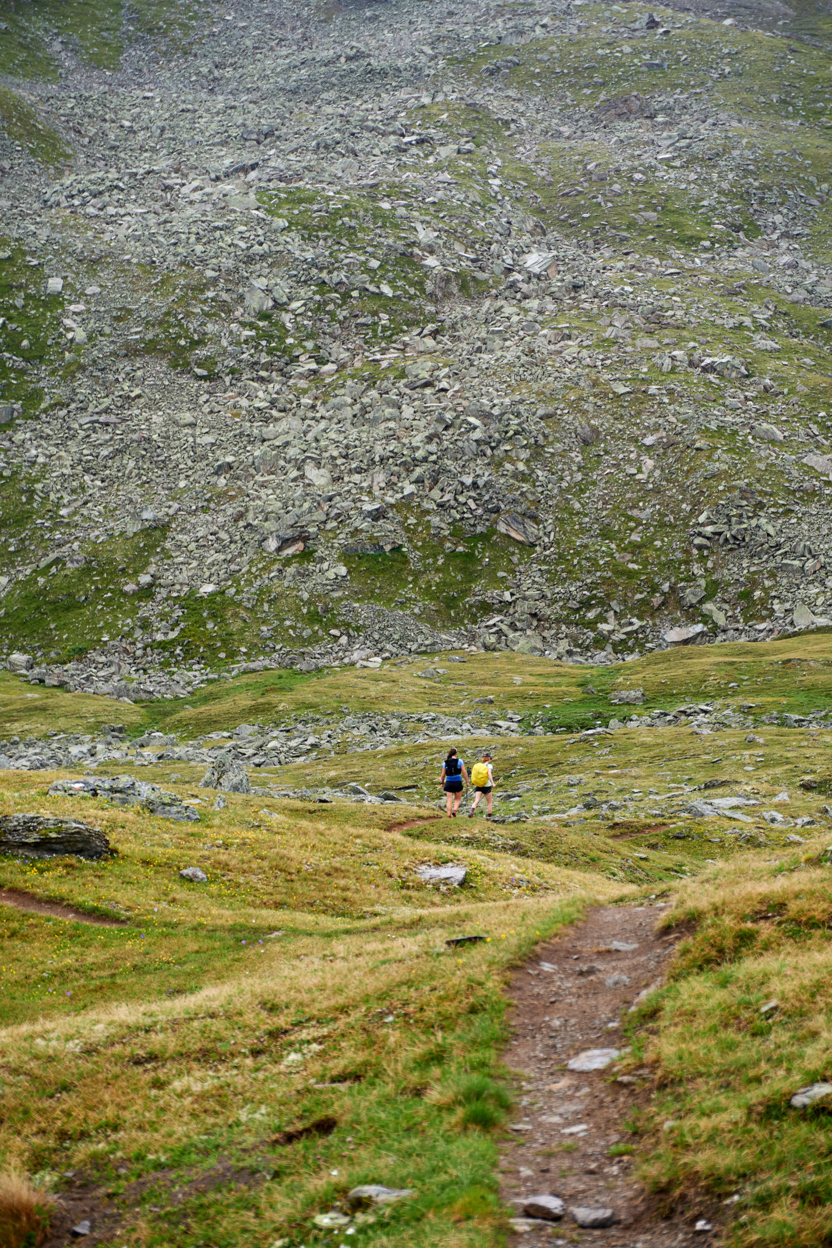
Reaching the top of the Crêt du Midi we said goodbye to dusty fire roads and started along some beautiful alpine single track. The oppressive valley heat was replaced with a nice mountain breeze and we even got to enjoy a brief descent as we dropped into the gorgeous Vallon de Réchy. Our packs felt wonderfully light and for the first time all day we were really able to appreciate the fact that for the next six days we had nothing we needed to do except run through some beautiful mountains.
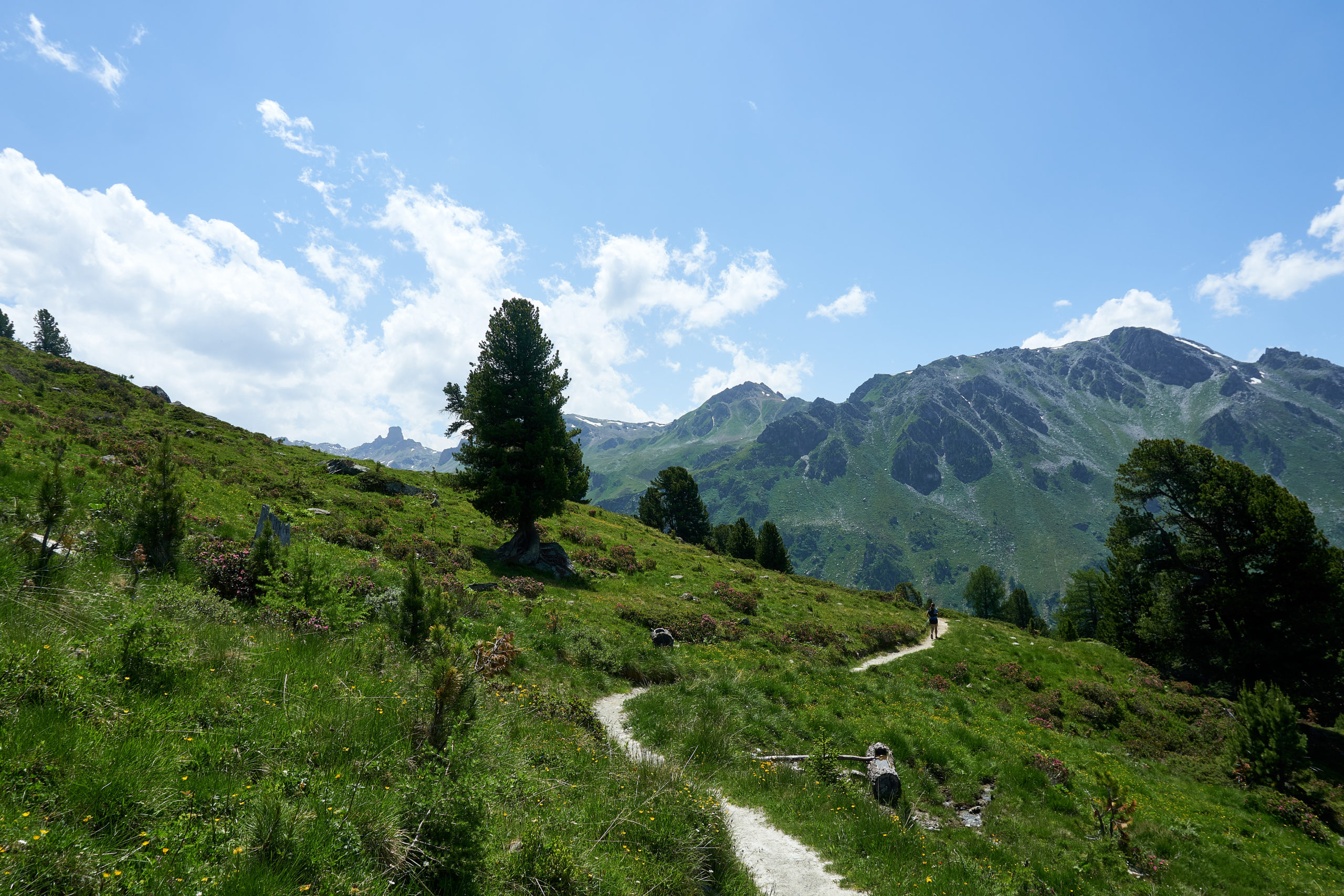
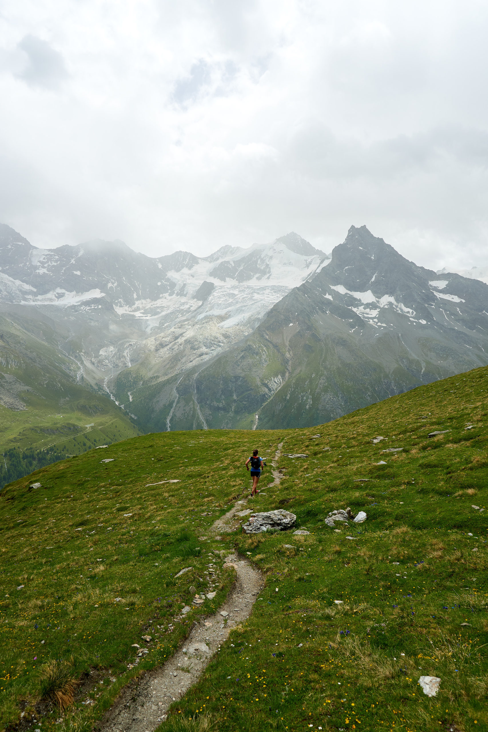
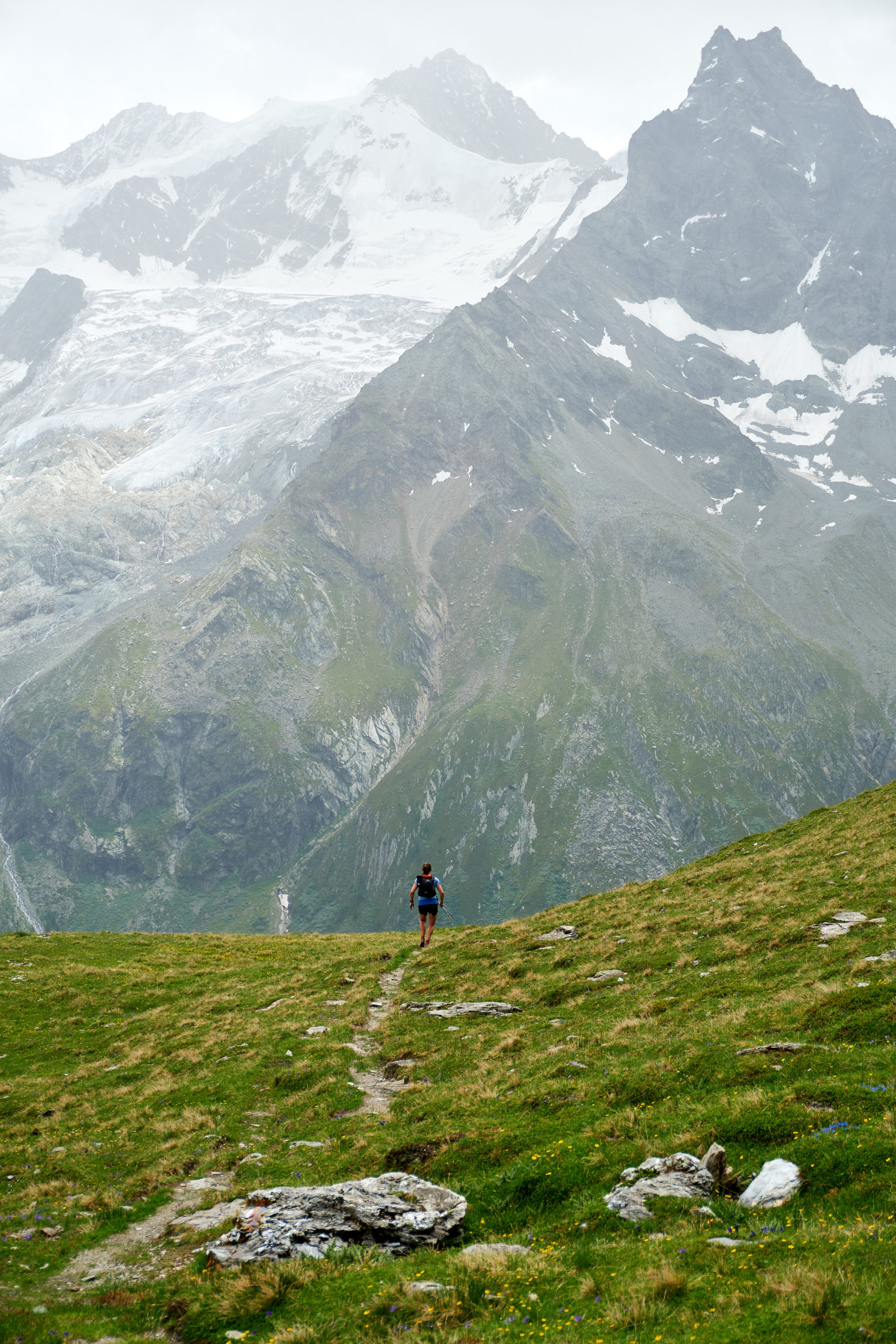
Another hour and a half of running (and 2,500 feet of climbing) brought us to the top of the Vallon de Réchy.
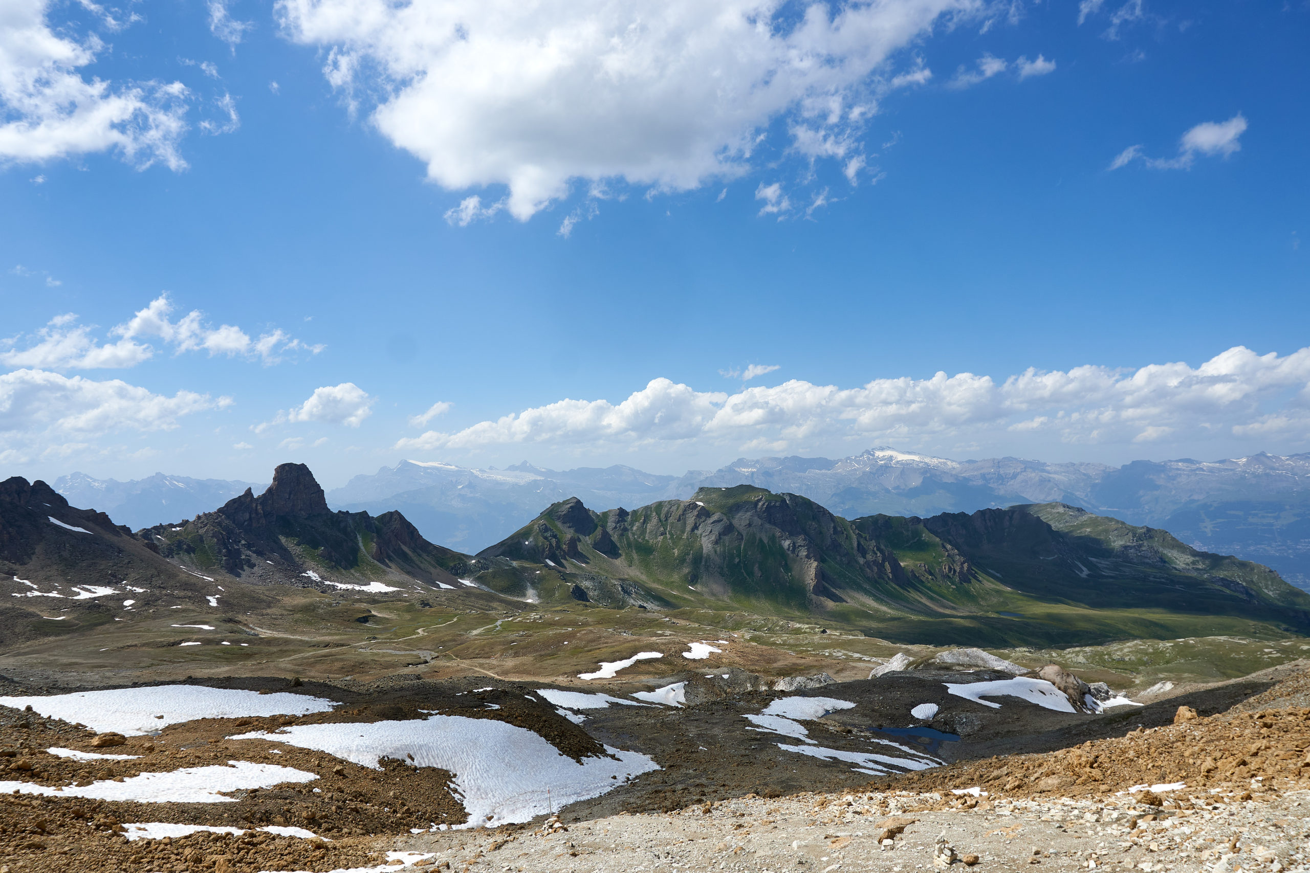
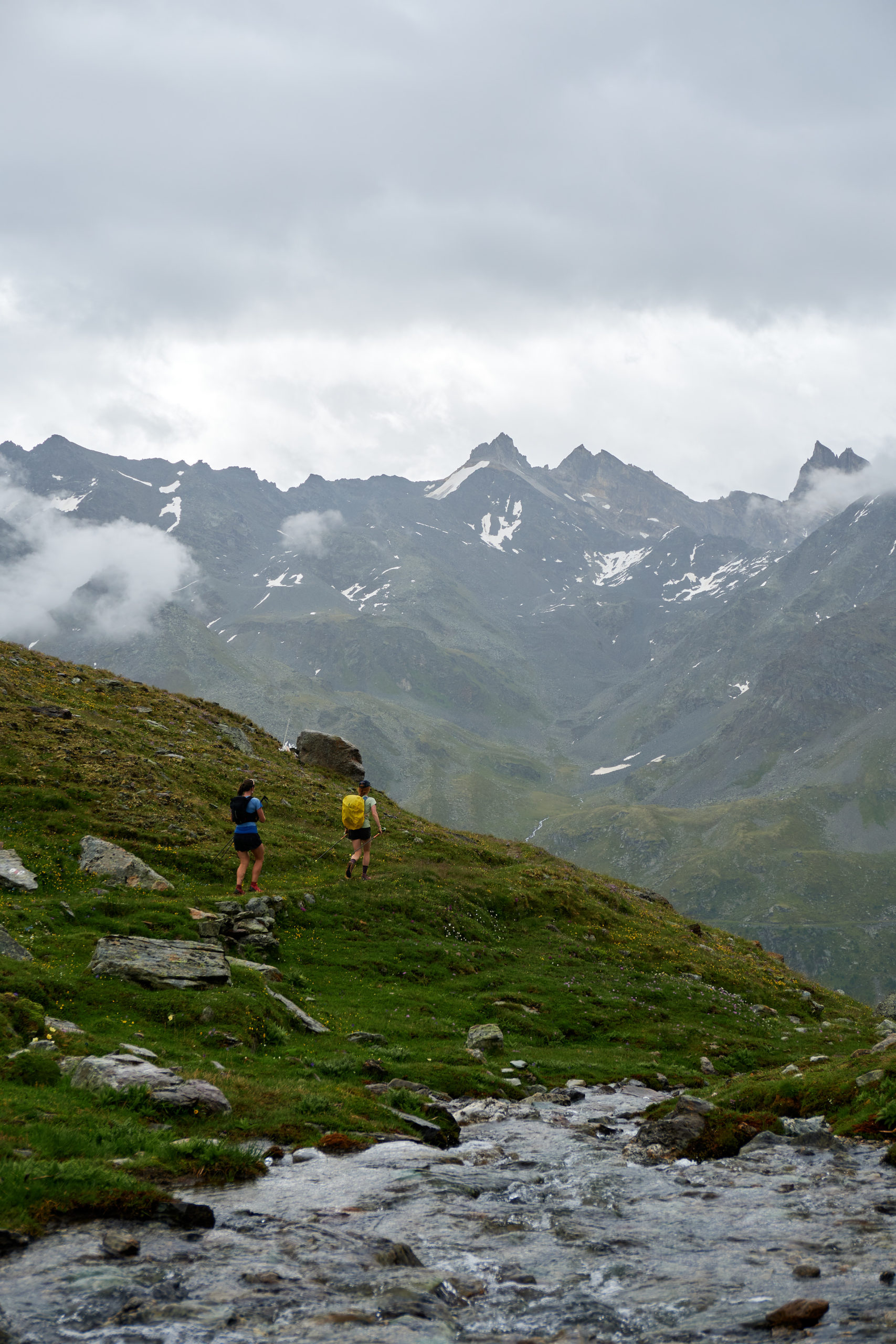
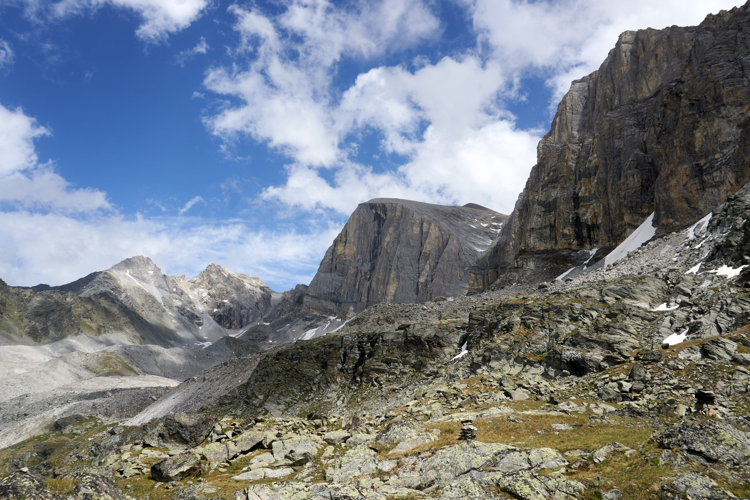
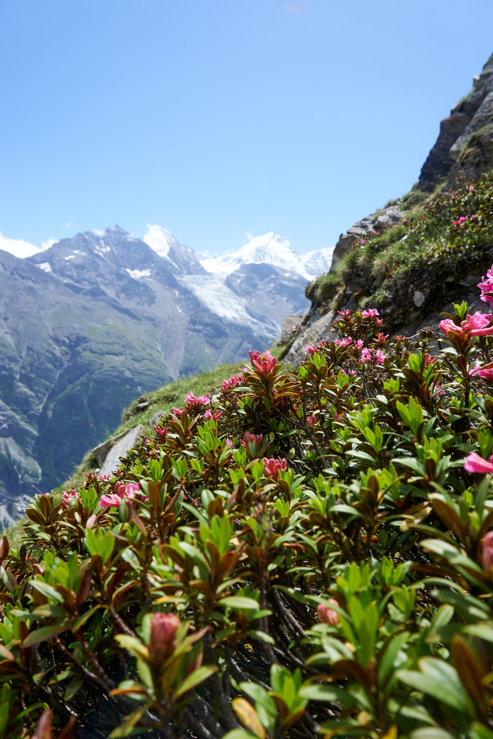
From the Col de la Tsevalire we got our first real view eastwards towards the rest of the route. Dropping over the col we passed the Cabane des Becs de Bosson, the hut at the end of stage 3 on the full 9 stage itinerary. After all of the uncertainty earlier in the day it felt like a nice symbolic victory to finally be on the main Via Valais route.
The views only continued to improve as we wrapped around some small alpine lakes before doing a small climb to a pass overlooking the beautiful Lac de Moiry.
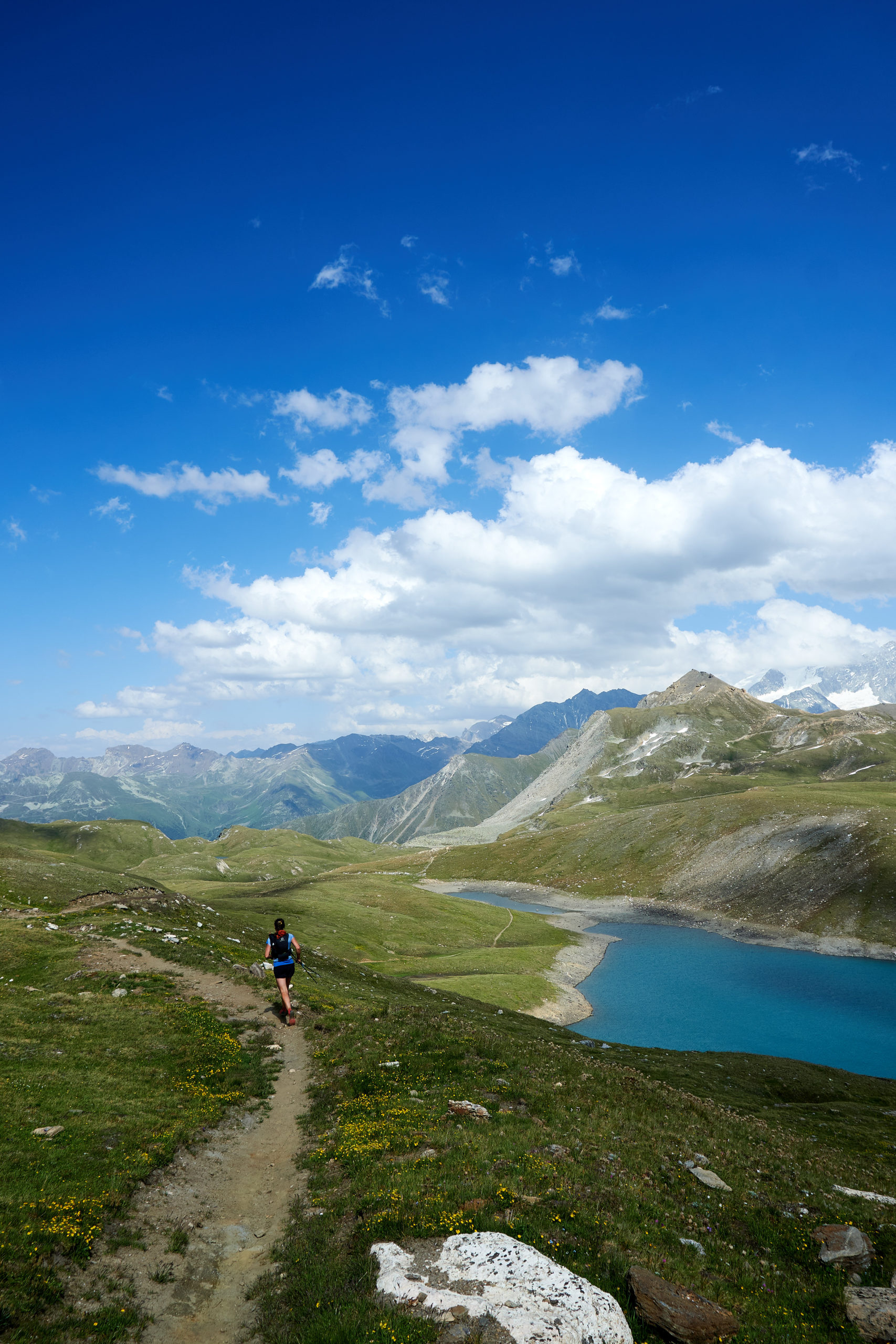
We took a brief break at the pass to soak up the views. We knew our destination for the night, Cabane de Moiry, was set up above Lac de Moiry at the end of the valley. Something about having a line-of-sight to our destination helped reassure us that we were going to make it to the hut at a reasonable time.
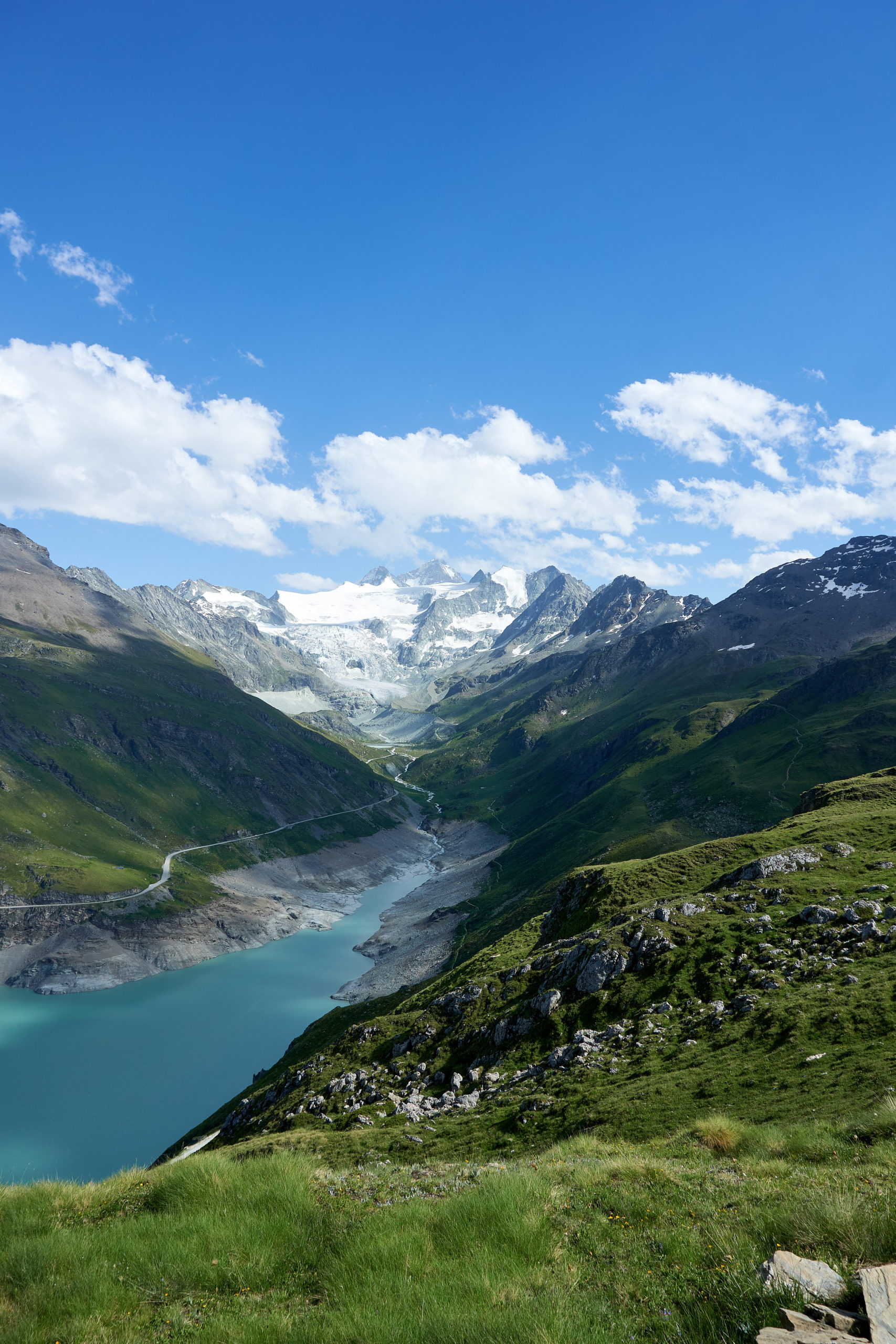
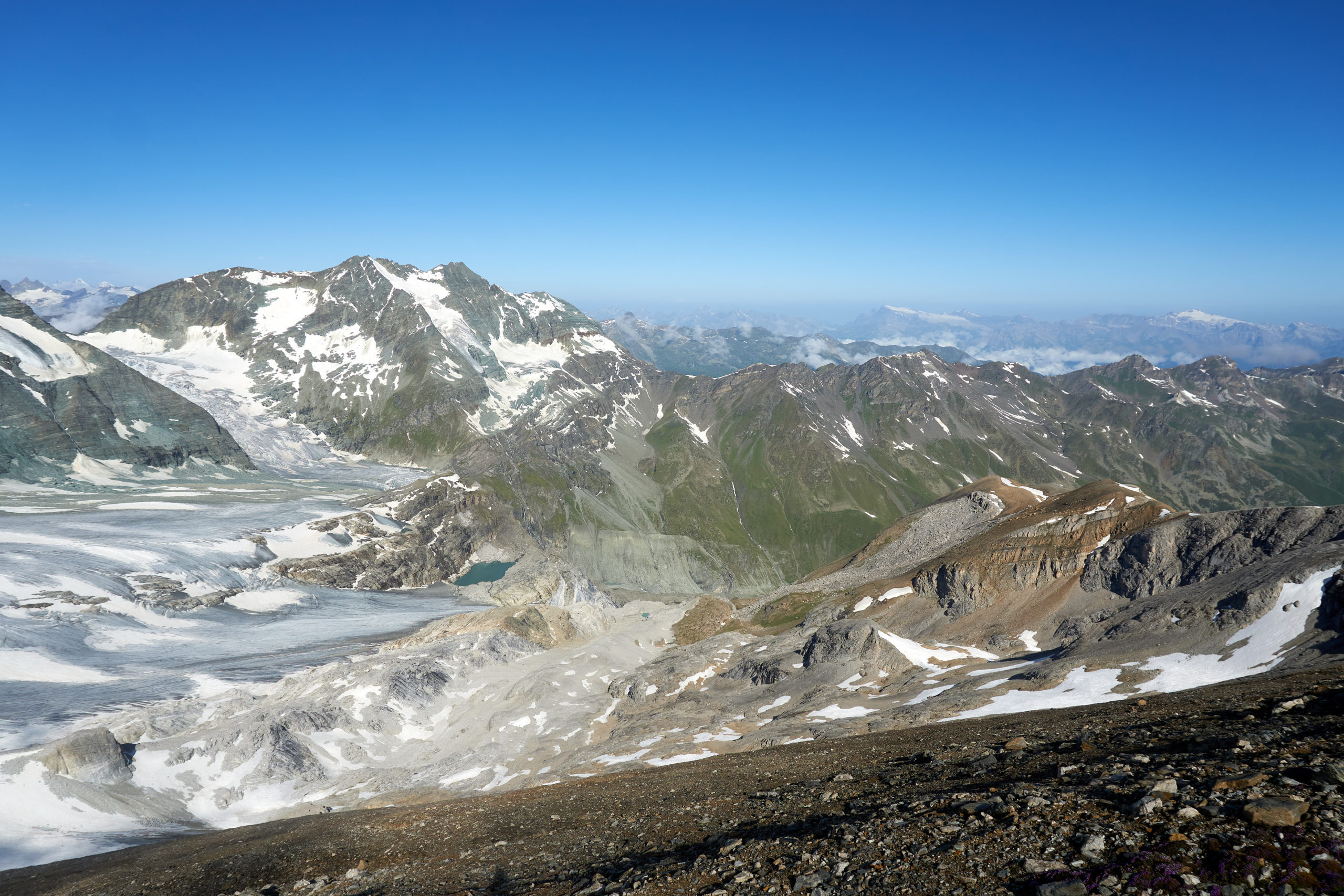
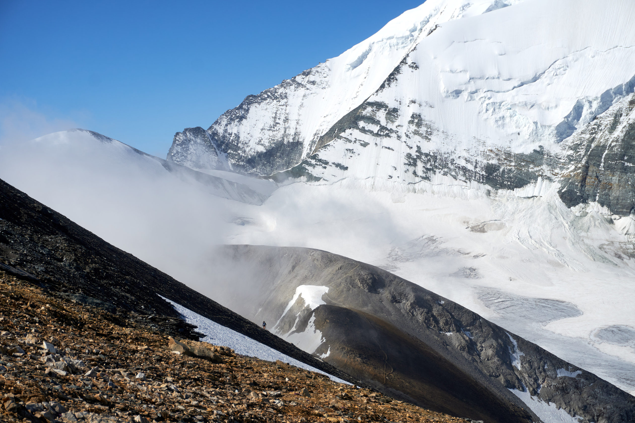
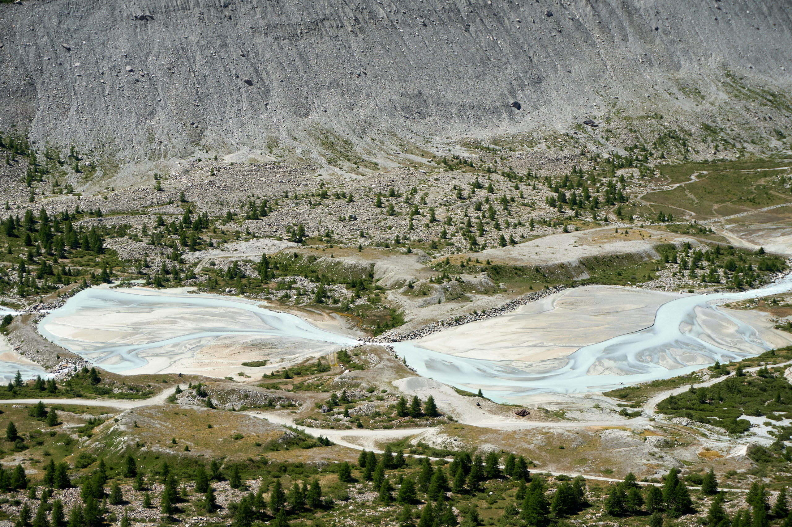
A nice gentle trail contoured down the hillside above the lake and after 1,500 feet of descending we reached the glacial blue stream that fed into the top of Lac de Moiry.
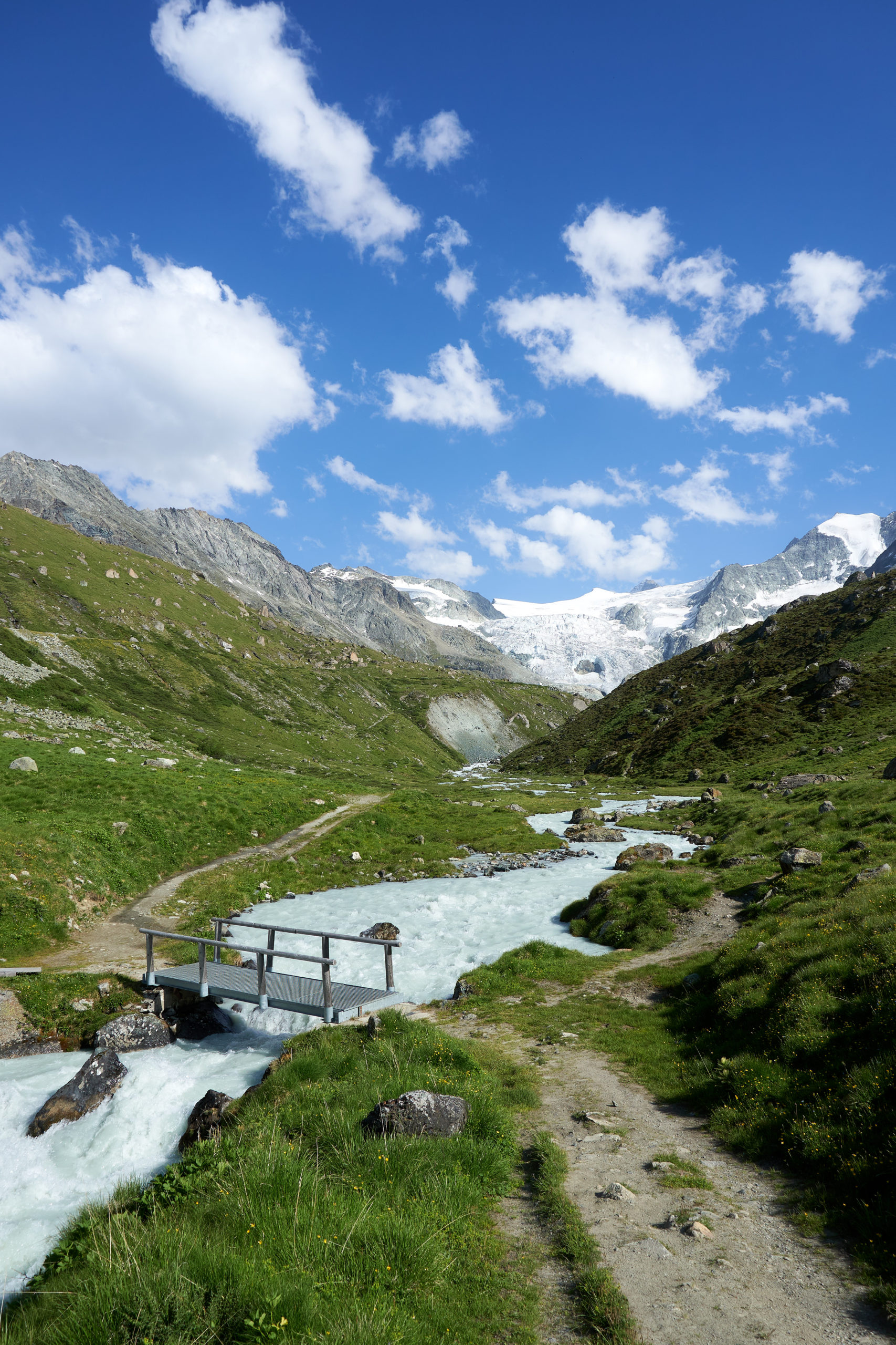
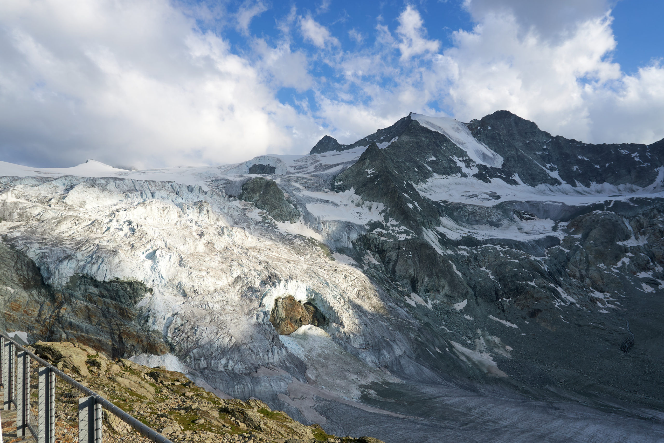
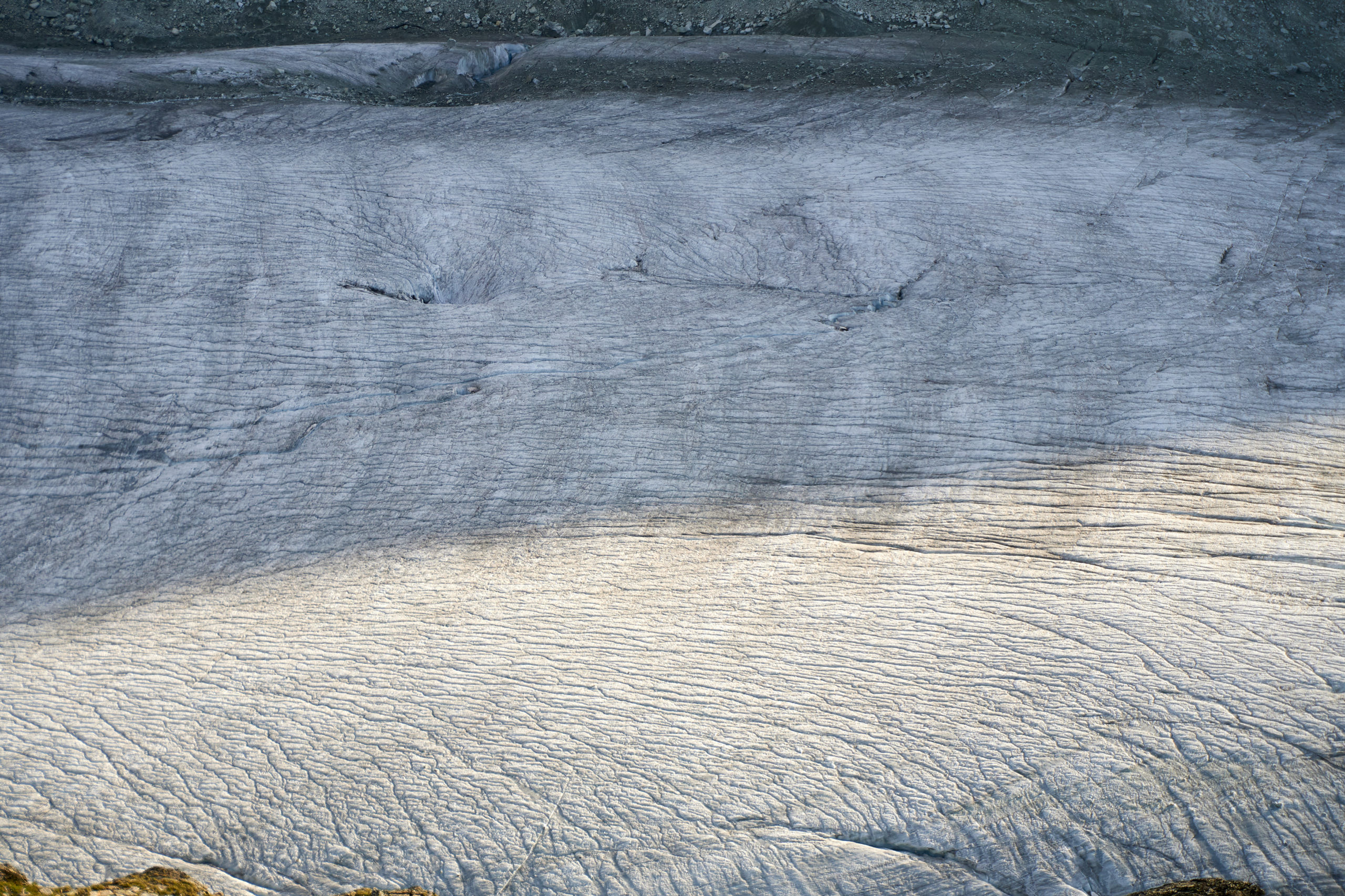
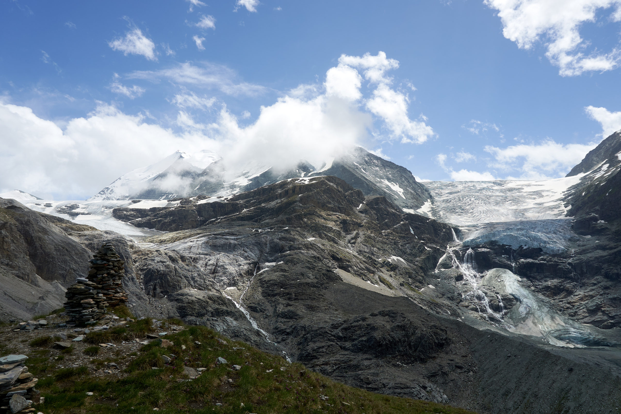
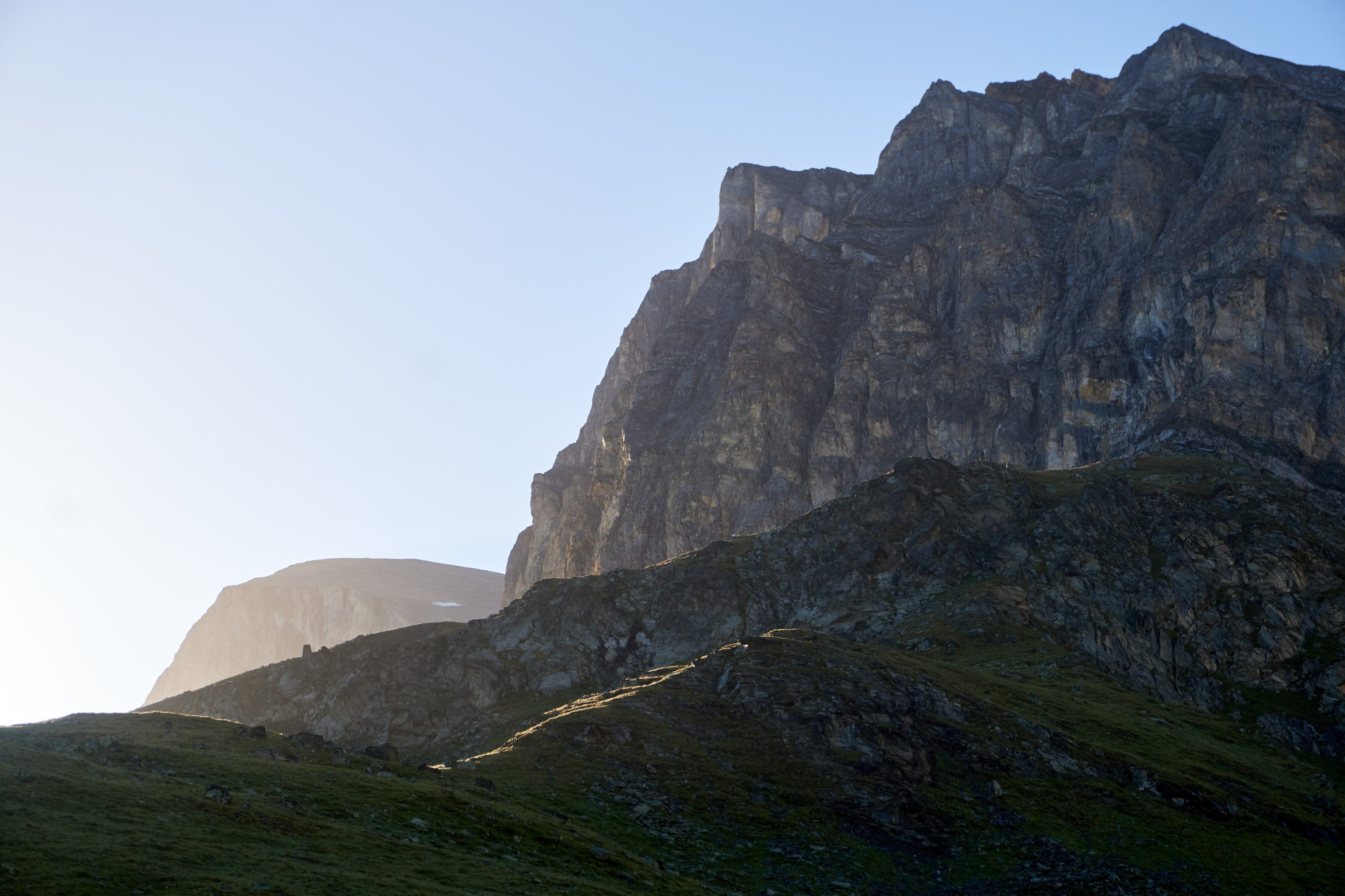
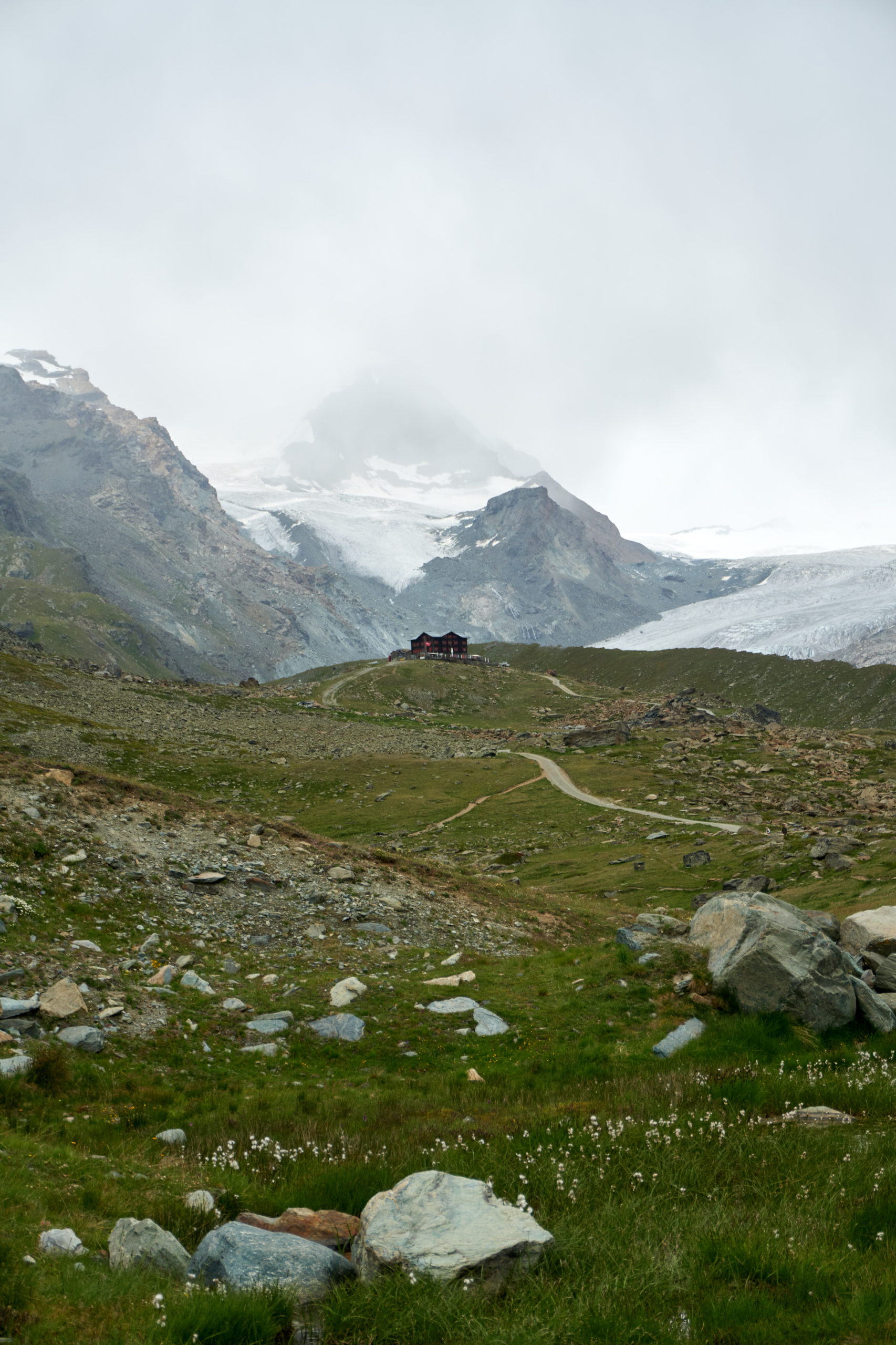
From the stream crossing we could just make out Cabane de Moiry perched on a rocky outcropping, set in front of a massive cascading glacier.
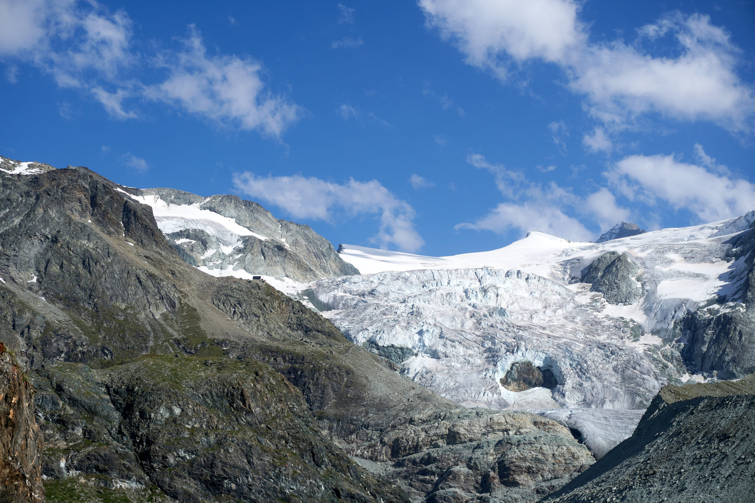
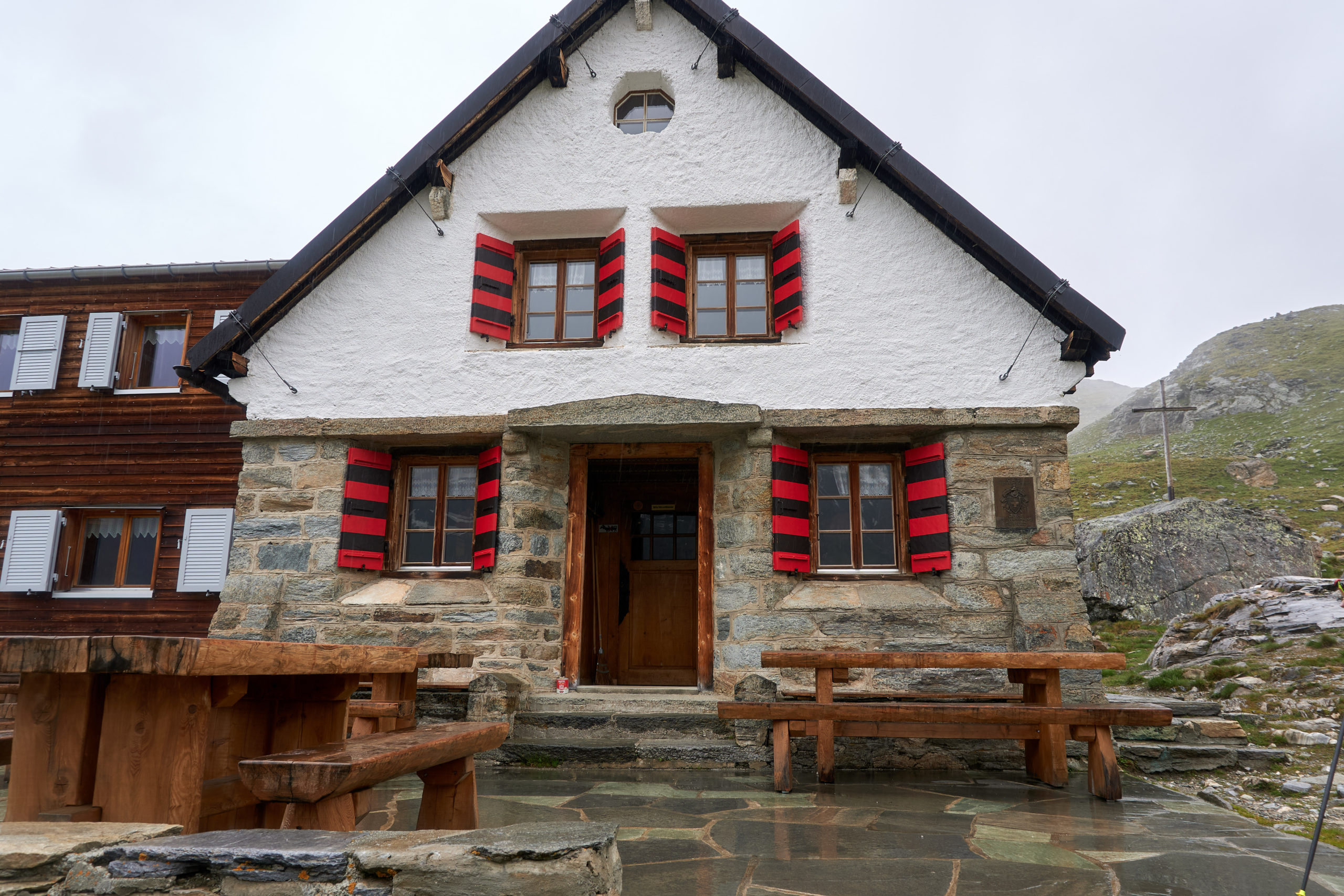
The final 1,800 foot climb was a grind but eventually we made our way up the last few switchbacks and laid eyes on the beautiful Cabane de Moiry; its solid stone walls perfectly matching the Swiss mountain hut aesthetic we had imagined.
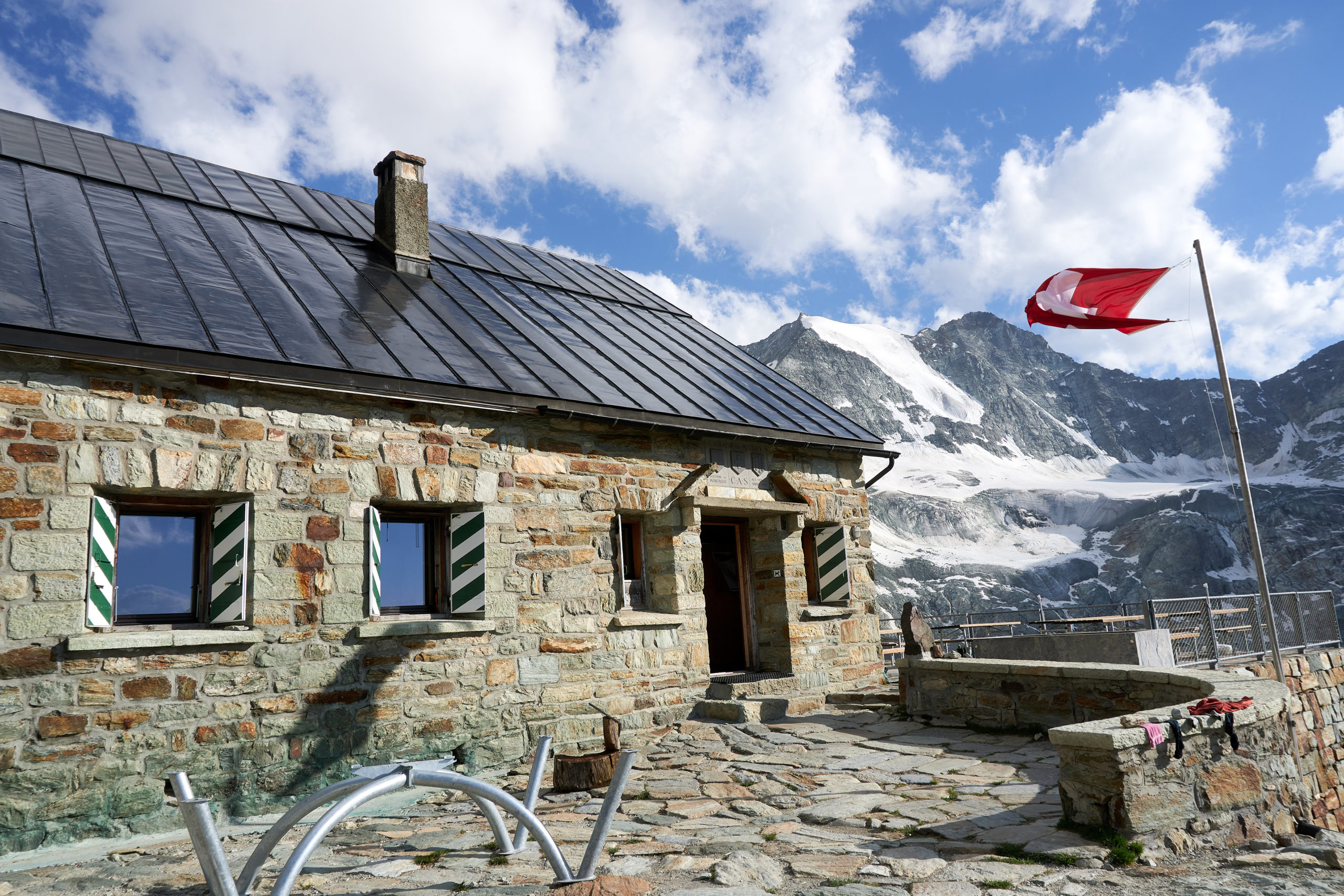
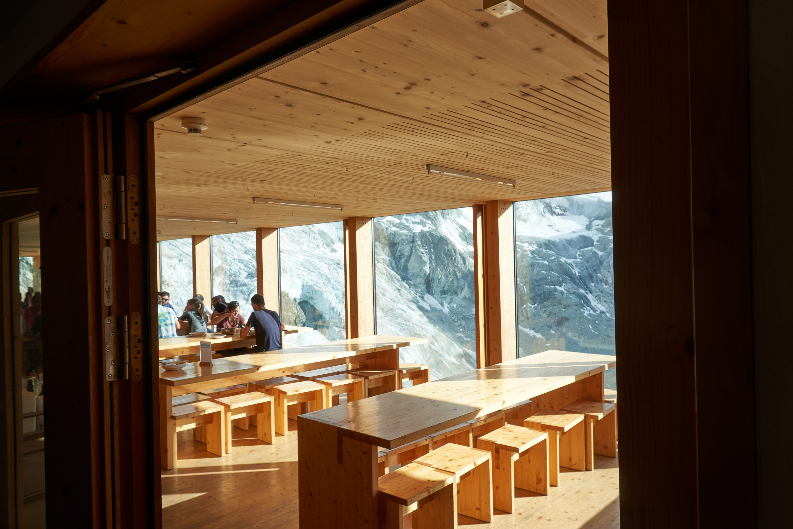
We were shocked then when we walked inside and saw the interior. Massive floor to ceiling windows overlooked the glacier below and the interior and furniture was entirely built out of light-colored, modern looking wood. It felt more like entering a set in a Bond movie than a mountain hut.
Our next surprise came when we went to check in. We found a hut employee and told her our information. After locating our reservation she gave us a quick rundown of the layout of the hut and how things worked. Absent from this orientation was any information on drinking water. Quite thirsty from the big final climb up to the hut we asked her where we could fill up our bottles. She looked at us confused and then pointed to some bottles on a shelf behind her, “you can buy water here, 9 euro for a liter”. Taryn and I glanced at each other. “No we don’t need bottled water”, we clarified. Again a confused look, “there is no other water”. Trying to pave over the awkward interaction I turned to Taryn and said “no big deal we can just fill up our bottles at the stream we passed on the way up close to the hut”. When the hut employee heard this she informed us that this wasn’t allowed.
At this point it was clear that the cultural gap between our expectations for a night out in the mountains and a Swiss hut’s expectations was not going to be bridgeable so we thanked her for her help and then escaped outside to “sneak” back down the trail for some water.
Fifteen minutes of hiking and some filtering later and we arrived back at the hut just in time for dinner. The food was absolutely delicious and the novelty of running all day through the mountains and then having a fresh-cooked meal brought out to us did wonders to pave over any doubts we had after the earlier water “incident”.
After dinner we went out onto the deck and spent the remaining daylight soaking in the grandeur of the mountains as the evening sun slid across the landscape.
We woke up early the next morning and enjoyed a warm breakfast before pulling together our light packs and heading out for the day.
The run to Zinal was significantly shorter than the previous day, only about 14 miles and 3,000 feet of elevation gain, so we decided to start the day with a bonus summit of the nearby Pigne de la Lé.
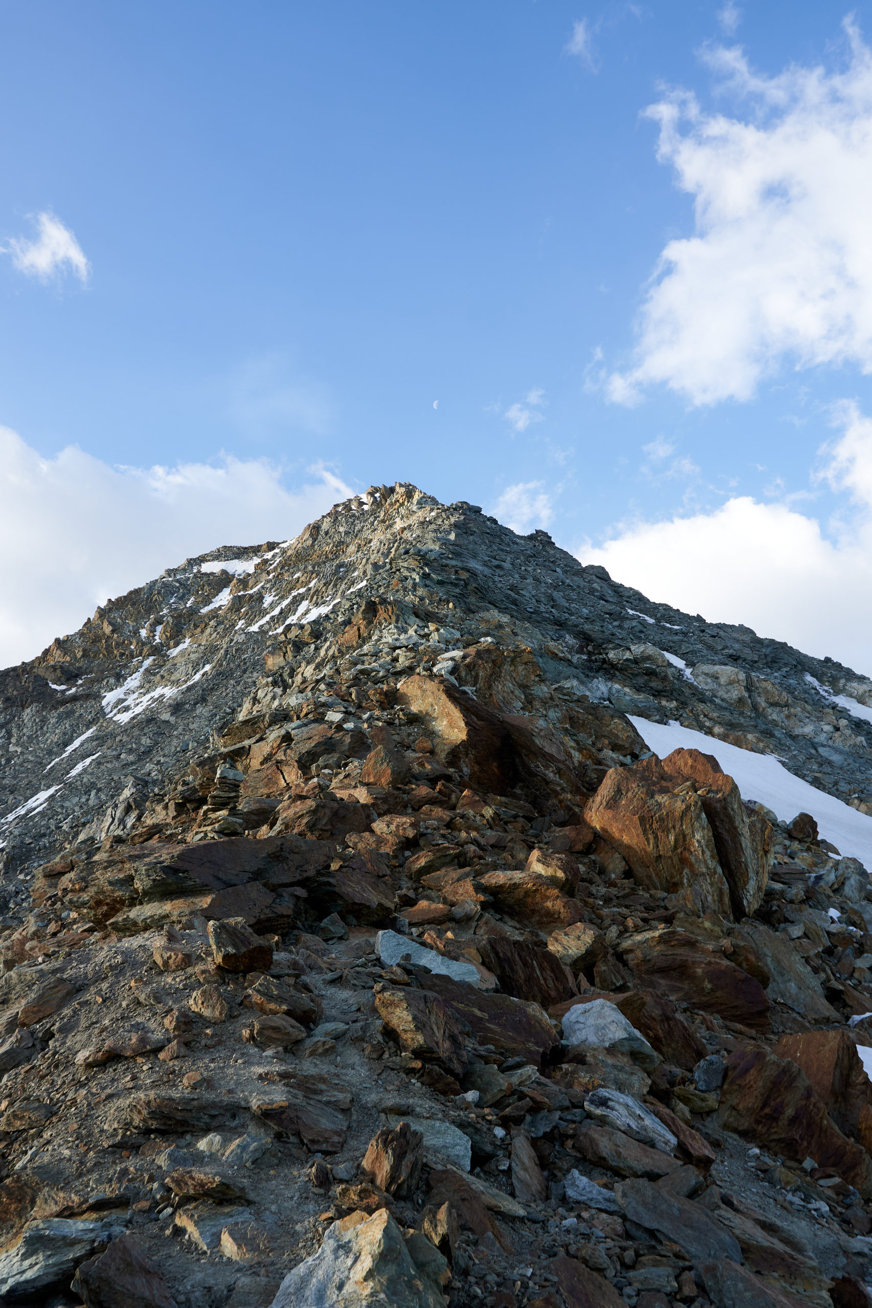
A quick 1,000 foot climb took us to the col below the north ridge. On the way up from the hut we had passed several parties with ropes, crampons, and heavy mountaineering boots so we weren’t really sure what we were getting ourselves into. But looking up the ridge we saw that it was free of snow and looked to be only loose class 2 or 3 so we started up.
As we got higher the exposure increased, but the terrain remained reasonable. The backdrop behind the ridge grew more and more epic as the heart of the Swiss Alps came into view.
Twenty minutes of ridge scrambling brought us to a perfect snow-capped summit. From the summit a long snowfield beckoned us deeper into the range but we had neither the time nor the equipment to continue to strike out into more glaciated terrain so we enjoyed the early-morning tranquility on the summit and then turned around to reverse down the ridge.
On the way back down we climbed past all the groups we had passed earlier, now picking their way up the ridge. It was funny to see European guiding techniques in practice; five or six climbers short-roped to each other, led by a guide up through the loose rocks, with no attachment to the actual mountain. I’m not sure the exact reasoning behind putting a bunch of novices with clunky boots and poor movement skills right on top of each other, and linking all of their fates together, but it made for good entertainment on the descent.
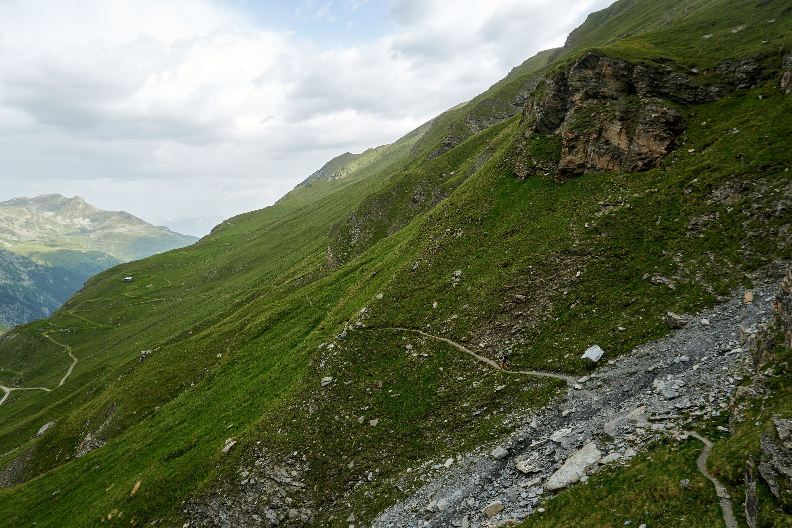
An hour after starting out we returned to the hut. From there we retraced our steps from the previous afternoon and descended back down to Lac de Moiry. Instead of crossing back to its western shores where we had come from the day before we contoured around to the east.
The trail was beautifully cut into the hillside, allowing for easy contouring and fun rolling terrain.
Reaching the end of the lake we started up some switchbacks that would take us over a col and into the next valley. After a few switchbacks, however, we came across a closed sign blocking the trail. On the hillside above us we could see some machinery and a group of men working on the trail.
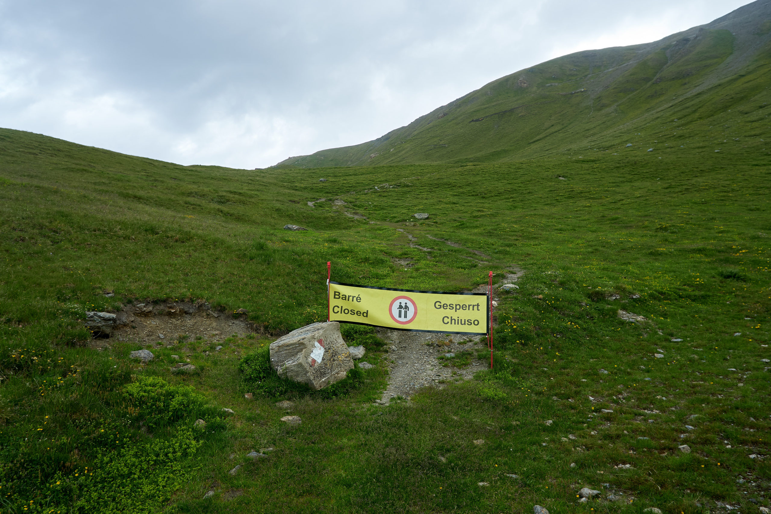
We didn’t really have any other options to get to Zinal so we started up the trail figuring we could explain our predicament to the men and they would let us pass through. After walking only a couple hundred feet we heard yelling and saw that the workers were very clearly not pleased with us. We yelled up and tried to explain the situation but the distance plus language barrier made it difficult.
Realizing that we were not going to be able to continue up the trail we pulled out our phones and looked at the topo. The slope angle looked reasonable to climber’s-left of the trail so we decided we would just walk up the hillside off to the side to avoid interfering with the trail work. We started contouring to the left but after only about 30 seconds heard more yelling, this time with a heavy dose of English expletives mixed in. We retreated back to the closure sign.
At this point we were really confused what we were supposed to do. We managed to find some construction plans on a Swiss website that claimed the trail work would be going on for at least a week but listed no alternatives. It was clear that the only way to Zinal would be to sneak over the ridge further up valley. The map made the terrain on the backside of the ridge look questionably steep, but we identified a steep gully 1/4 mile up-valley that seemed as if it would largely hide our climb from the workers but still put us on a place on the ridge where we could walk down the other side.
We backtracked along the hillside to the base of our gully and then started up. We again heard some yelling but forced ourselves to ignore it and just keep hiking up. We figured we were far enough away at this point that they would really have to care to come try to stop us. After climbing a couple hundred feet the gully walls grew more defined and we lost sight of the workers. From there it was about 700 feet of steep grass and easy class 4 scrambling before we finally made it to the ridge. We were thrilled to see a summer access road leading down into the valley below. Mission accomplished!
We didn’t dally because we still weren’t entirely convinced that a mob of angry workers wasn’t going to appear from around the corner to chastise us. It as only after dropping about 1,000 feet down the mountainside that we pulled off the trail and tucked into some rocks to enjoy some lunch.
After lunch we did a bit more descending and then intersected the traversing trail that offered the scenic route down to Zinal. This trail brought us back up valley and the combination of some moody weather and increasingly impressive peaks left us satisfied with our decision not to take the direct route straight down to Zinal.
Eventually we reached the head of the valley. The trail picked its way through some large cliff bands and then eventually mellowed out into a gentle dirt road that took us on a glide-path into Zinal.
It was only a little after 1pm when we arrived in Zinal, but with 40 miles and 13,000 feet already under our belt for the trip we were in need of a nap. We checked into the cute little bed and breakfast we had booked and conked out for a few hours. In the late afternoon we got a text from Taryn’s friend, Zoe, that she had made it to Zinal so we headed into the town to meet her. Pulling off her own heroic logistics, Zoe had traveled all the way from a family wedding in London to this quiet Swiss valley so she could join us for the remainder of the route. After so much time with just the two of us, Taryn and I were thrilled to have some fresh energy and we spent the remainder of the evening catching up and telling her about our travels.
The next day was scheduled to be shorter, with no bonus summits and only one smallish mountain pass to our next destination, Turtmanhutte. We had a more leisurely wake up time, gorged ourselves on the breakfast buffet, and started the day feeling relatively fresh and well rested.
The route headed pretty much straight up from Zinal, gaining about 1500 feet right away via some tight switchbacks. It started raining hard basically as soon as we left town, but luckily tree cover kept the weather from feeling too raw. The highlight of this first climb was passing a beautiful little stone house with an older woman standing outside tending to some sheep. We chatted with her briefly and she explained that she spent the rest of the year living in London but owned this land and came every summer to be a shepherd. Pretty cool lifestyle!
After we finished the switchbacks we crested a bench and followed that for a few miles until we reached the hanging valley that would lead us up over the pass and into Turtmanntal valley. The weather gods had our backs and the hard rain ended almost as soon as we got up to the bench. We were instead treated to some lovely low-hanging clouds that kept the temperatures nice and cool.
As we got higher the environment got more alpine but the trail continued to be incredibly well made and well maintained.
After crossing the pass the trail traversed back up valley, cutting its way through some incredibly lush hillside.
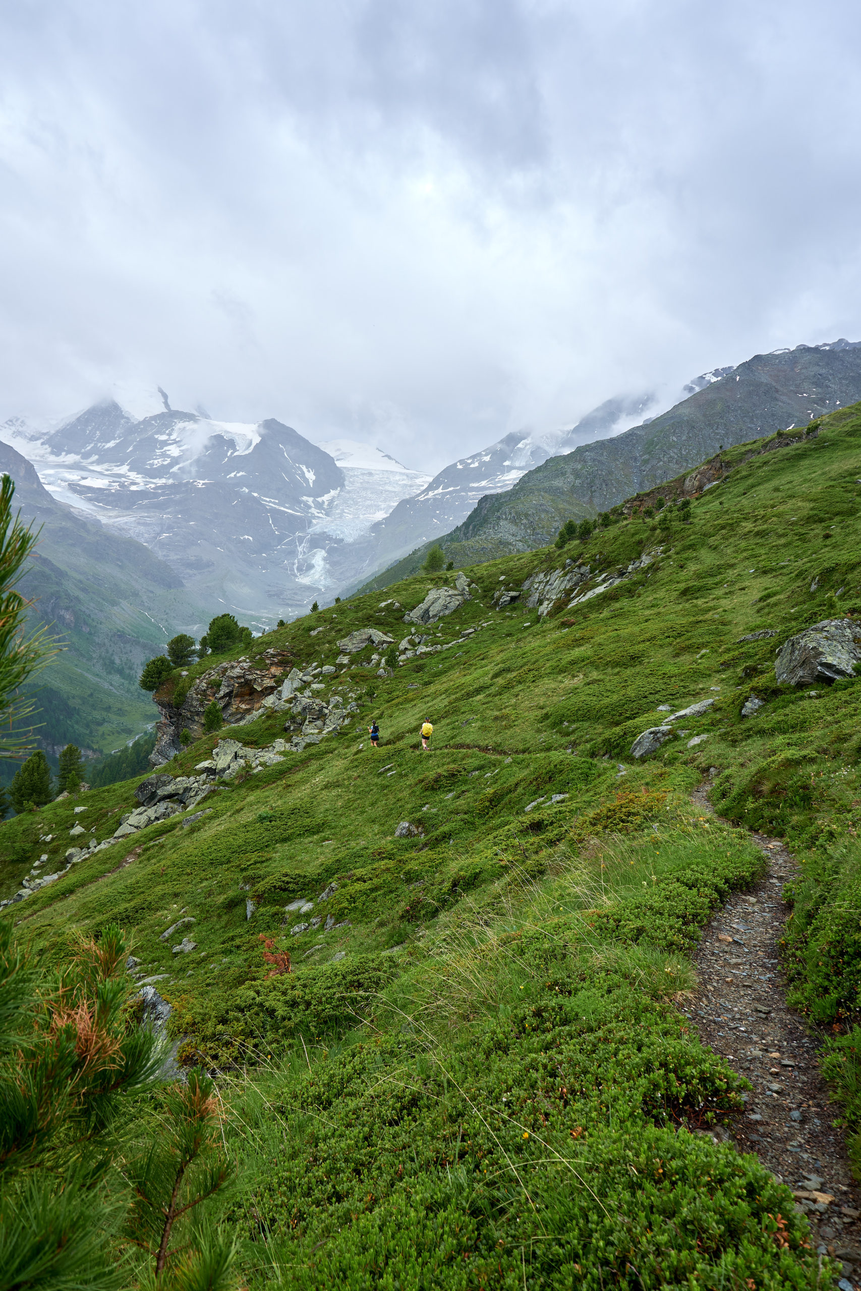
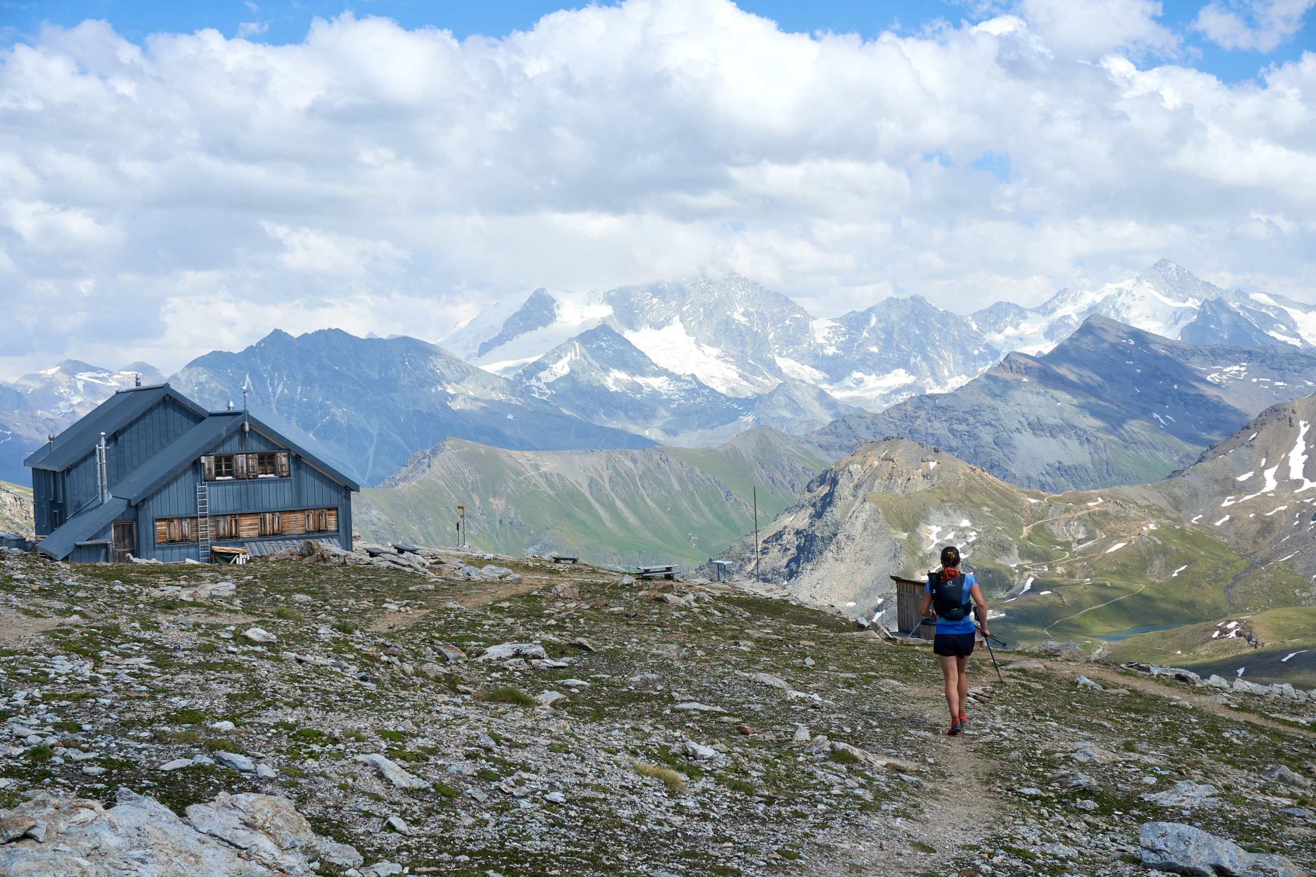
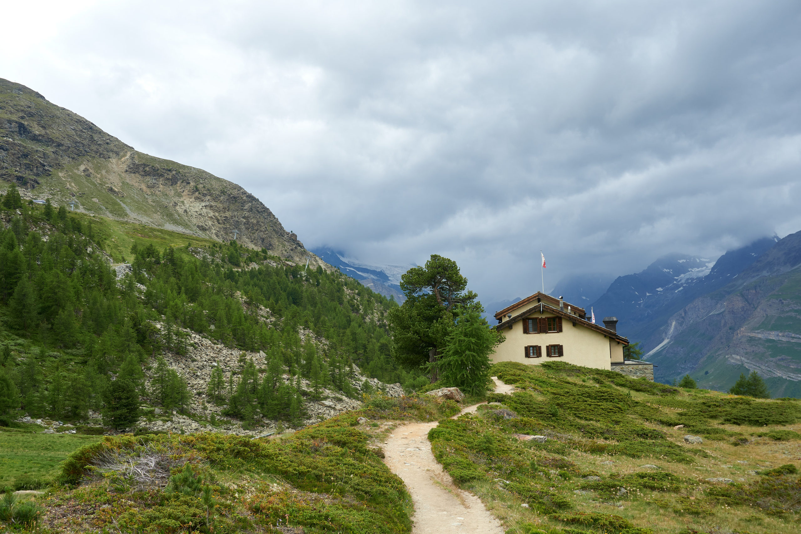
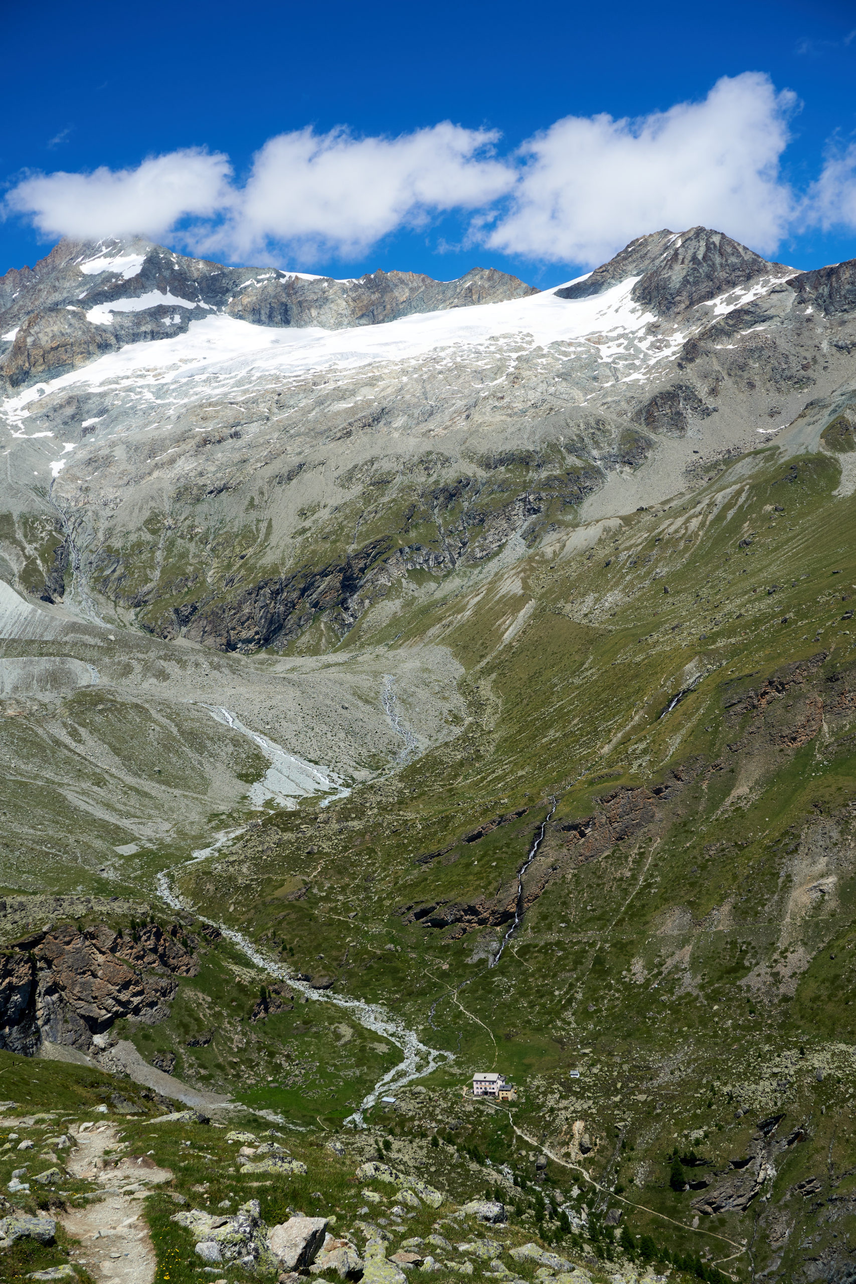
After two miles of gentle descending we reached the valley floor right at the mouth of two gorgeous mountain lakes filled by the glaciers above. A final 1,000 foot climb got us up to the beautiful Turtmanhutte. Unlike the Cabane de Moiry and its dual personalities Turtmanhutte felt like a traditional mountain hut through and through. The vibes were mellower (well apart from the 20 middle-school kids staying there for some school program) and they happily supplied us with tea and water at no extra cost!
It was rainy and foggy when we first showed up, but after only a few minutes of being there the skies began to clear and by early afternoon it was a bluebird day. As seems to be the theme for Swiss huts, the backdrop was out of this world. We cozied up at the picnic tables with our books and soaked in the glory of it all.
After an hour or two of patio hanging I found myself growing restless. The morning’s run had just been a quick four hour jaunt after all. So I left Taryn and Zoe and headed up the hillside above the hut to explore. My initiative paid off and I was rewarded with some views of massive rock faces the next valley over. I clambered up to the base of one imposing cliff and contemplated trying to scramble up a large chimney system but knew that Taryn would kill me (if the loose chimney didn’t first) so spent the remainder of the afternoon wandering around taking in the sights.
That evening we were treated to an amazing sunset and a hearty pasta dinner. After dinner we almost had our cake and ate it too. Literally. The school group had carried up a couple delicious-looking chocolate cakes for a kid’s birthday and we watched on with jealously as they doled out slice after perfect slice to the already hyperactive kids. After all the kids had received a piece there was still a bit left over and we did our best to make our expressions reflect the longing we very much felt, but the chaperones skillfully ignored our gaze and packed up the remaining cake for later.
We woke up the next morning excited and a bit nervous for the day ahead. The section from Turtmanhutte to the town of Randa was supposed to be the “queen” stage of the route. The trail once again headed into high into the alpine, offering a bonus summit of Barrhorn, the tallest peak in Switzerland accessible by official trail, before crossing over Schöllijoch, a technical mountain pass made passable to runners only by the use of fixed ropes and ladders. We had read that Schöllijoch was often not equipped until early July and we had been unable to get 100% confirmation that the crossing would be ready to go by the time we needed to cross over it. We suspected that with our climbing skills we would probably be able to make it work, but it still left a degree of uncertainty hanging over our heads as we left the hut for the day.
Leaving Turtmanhutte the trail quickly turned semi-technical as it wound up and over some broken cliff bands. Painted trail markers and steel cable hand-lines might have offended our backcountry sensibilities but it did keep the travel efficient and made it easy to enjoy the stunning scenery all around.
One above the cliff bands the terrain opened up into a beautiful alpine basin, the massive north face of the Bishorn looming above. Once again the trail was remarkably smooth given the surrounding terrain and it was a joy to be able to run in such a setting.
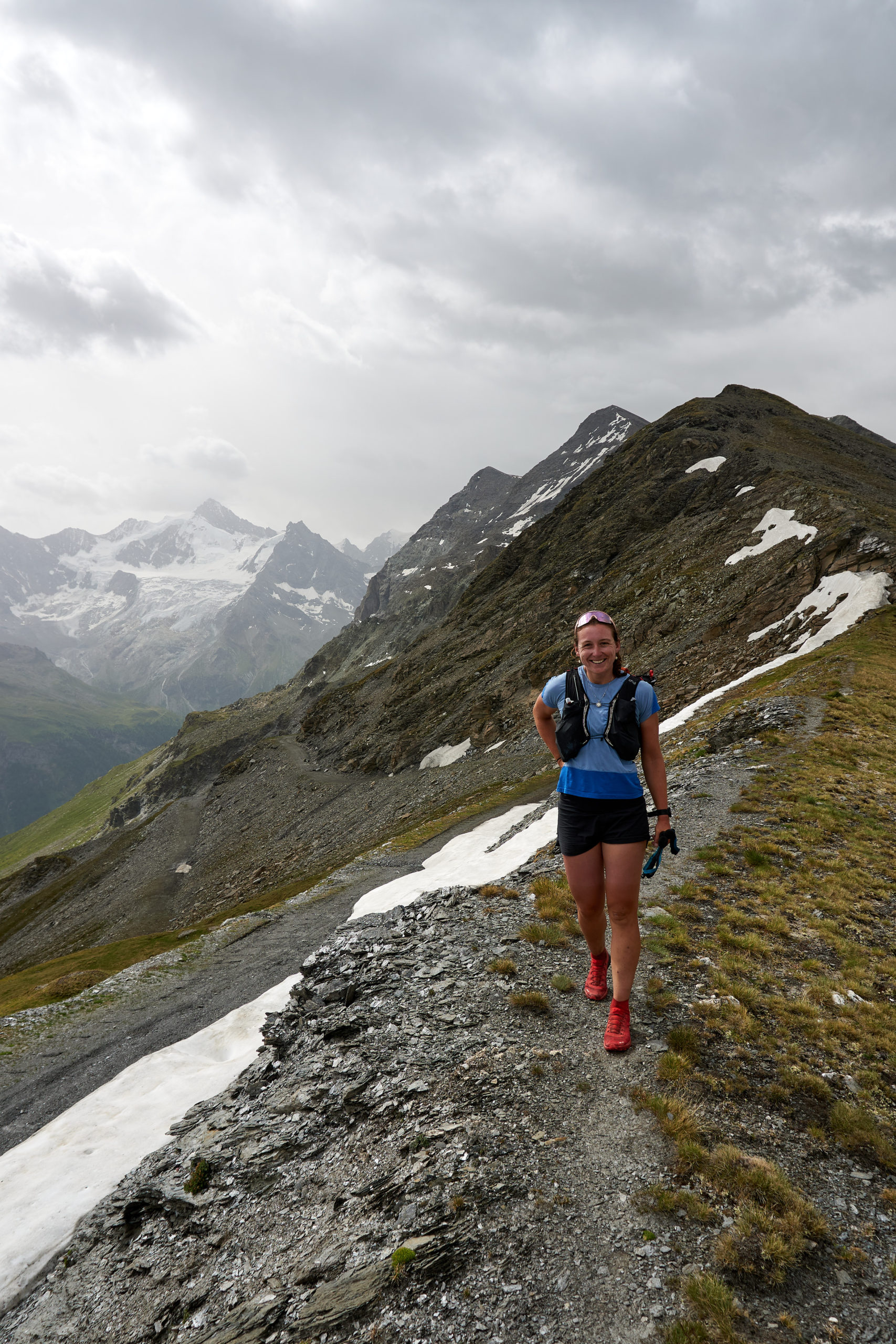
A steep climb at the end of the basin brought us up to the ridge line. The weather was still as perfect as one could hope for and it was only 8:30am so we decided to go tag the summit of Barrhorn.
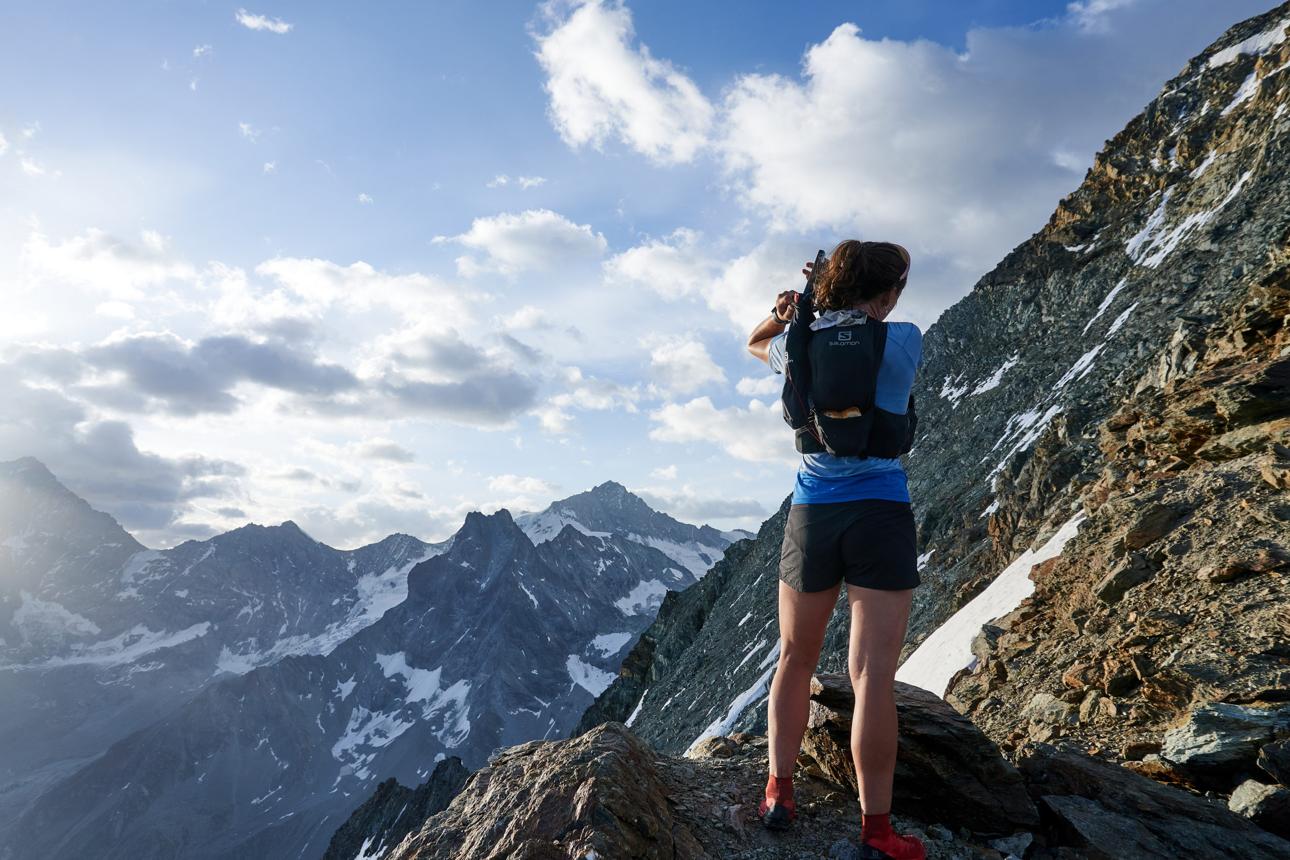
Traversing along the summit ridgeline gave us some amazing views of the terrain we had just covered.
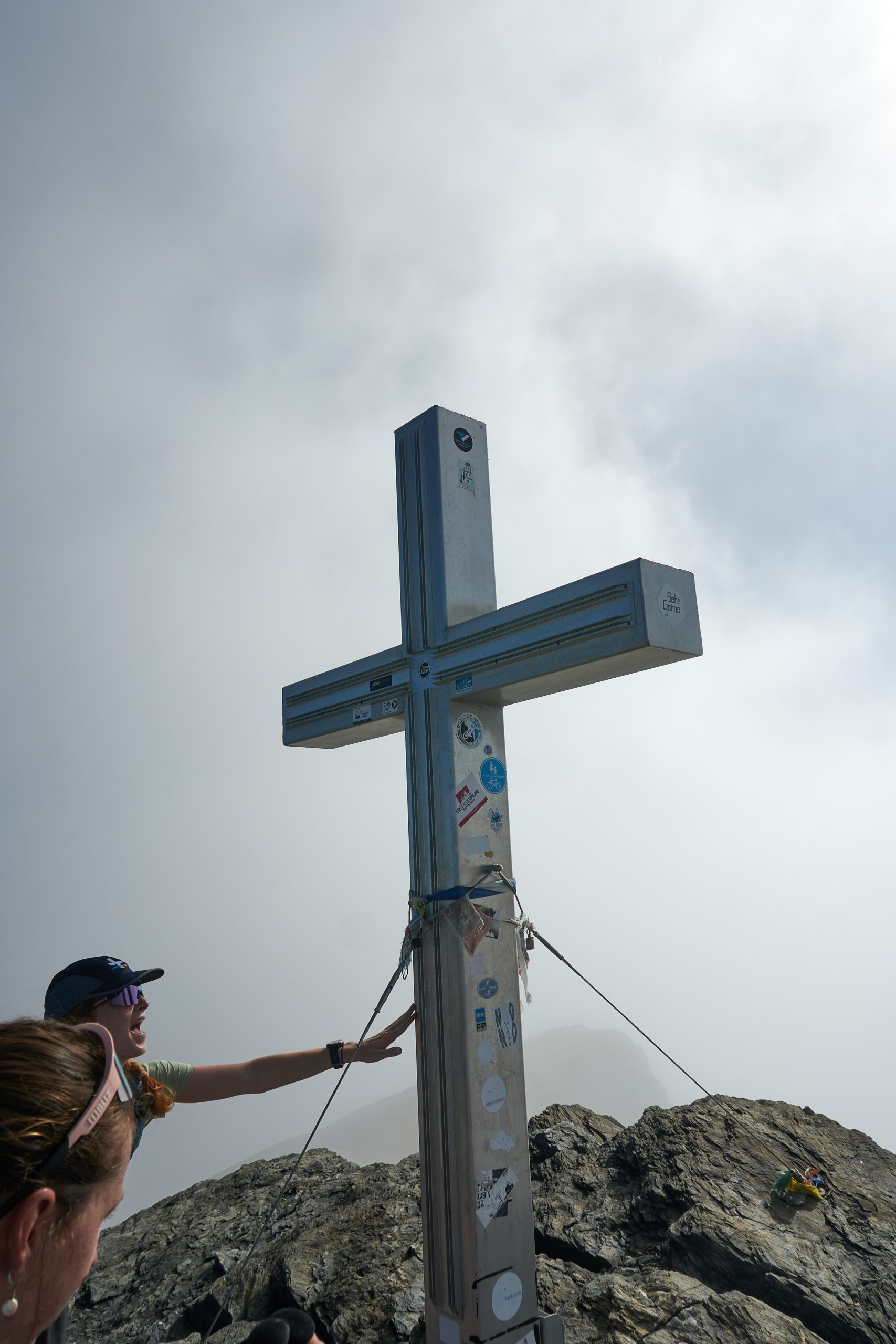
As we got closer to the summit the winds began to pick up and some clouds formed against the steep drop off on the other side of the ridge.
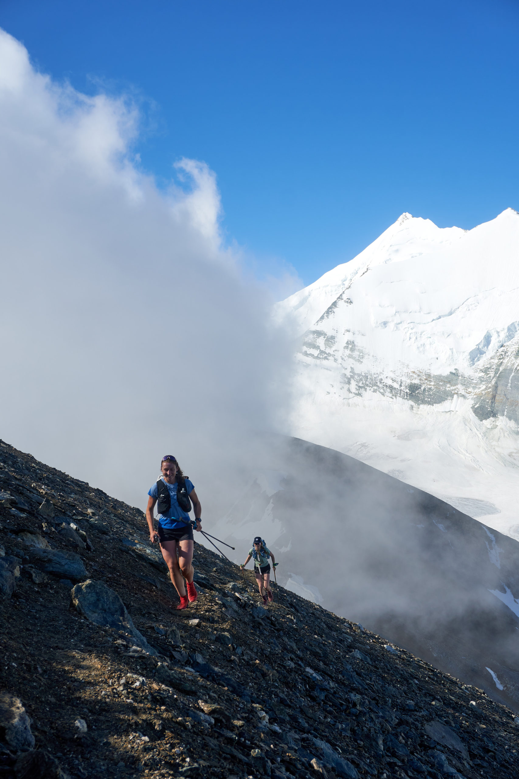
An hour and a half after leaving the hut we reached the summit of Barrhorn. Unfortunately the clouds hid most of the views, but we enjoyed the novelty of finding a giant cross atop the summit, a wonderfully European alternative to the ammo-box summit registers we were used to.
We reversed our route back down the ridge, our anticipation for Schöllijoch growing.
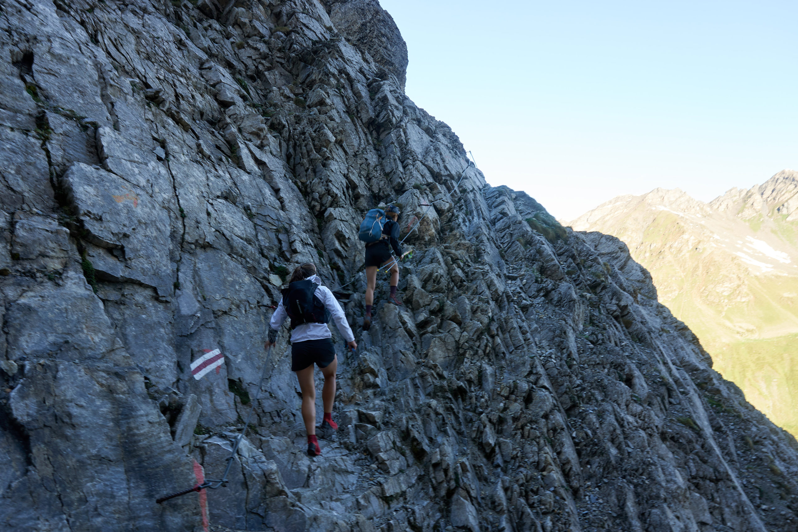
A well worn trail led us to the edge of a drop-off where we were able to peer over. To our relief we saw a smattering of ladders and ropes affixed to the cliff-side, evidence that the route ahead would be passable.
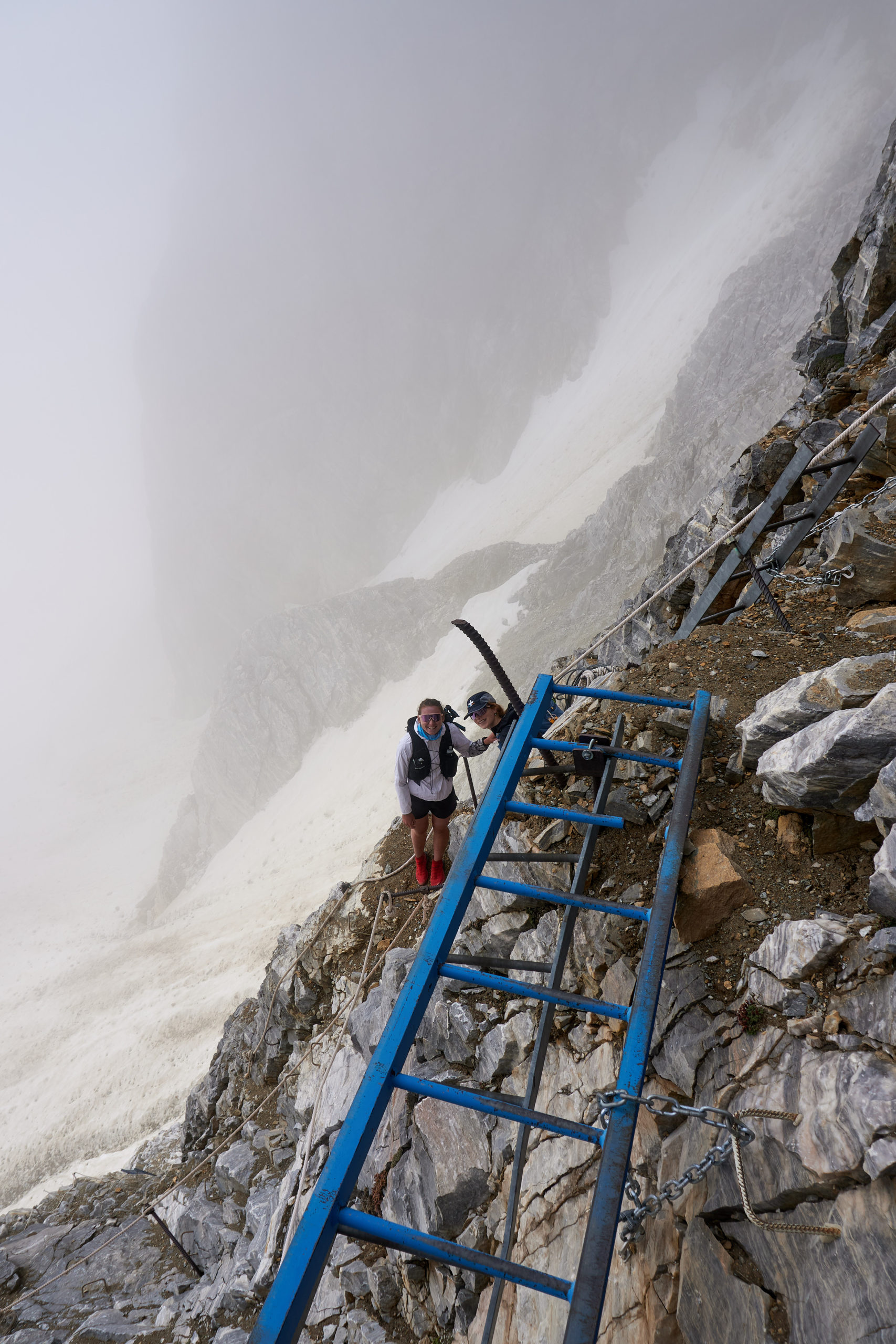
Even with the infrastructure it was still intimidating climbing down over the edge. We were still enveloped in the fog and the faint outline of the ground below looked precipitously far away. The down climbing was extremely secure, however, and once we started descending our nerves disappeared allowing us to savor the position.
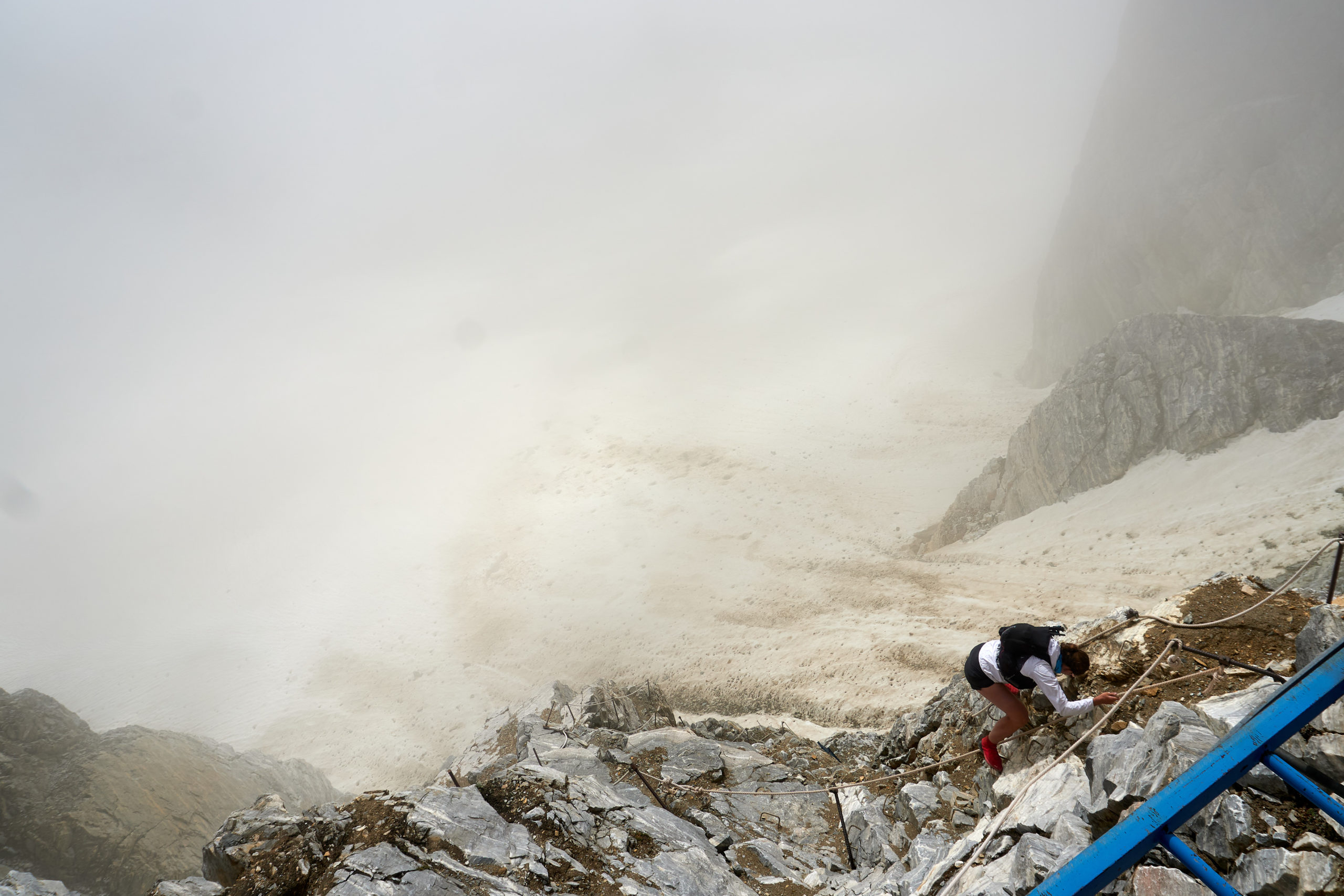
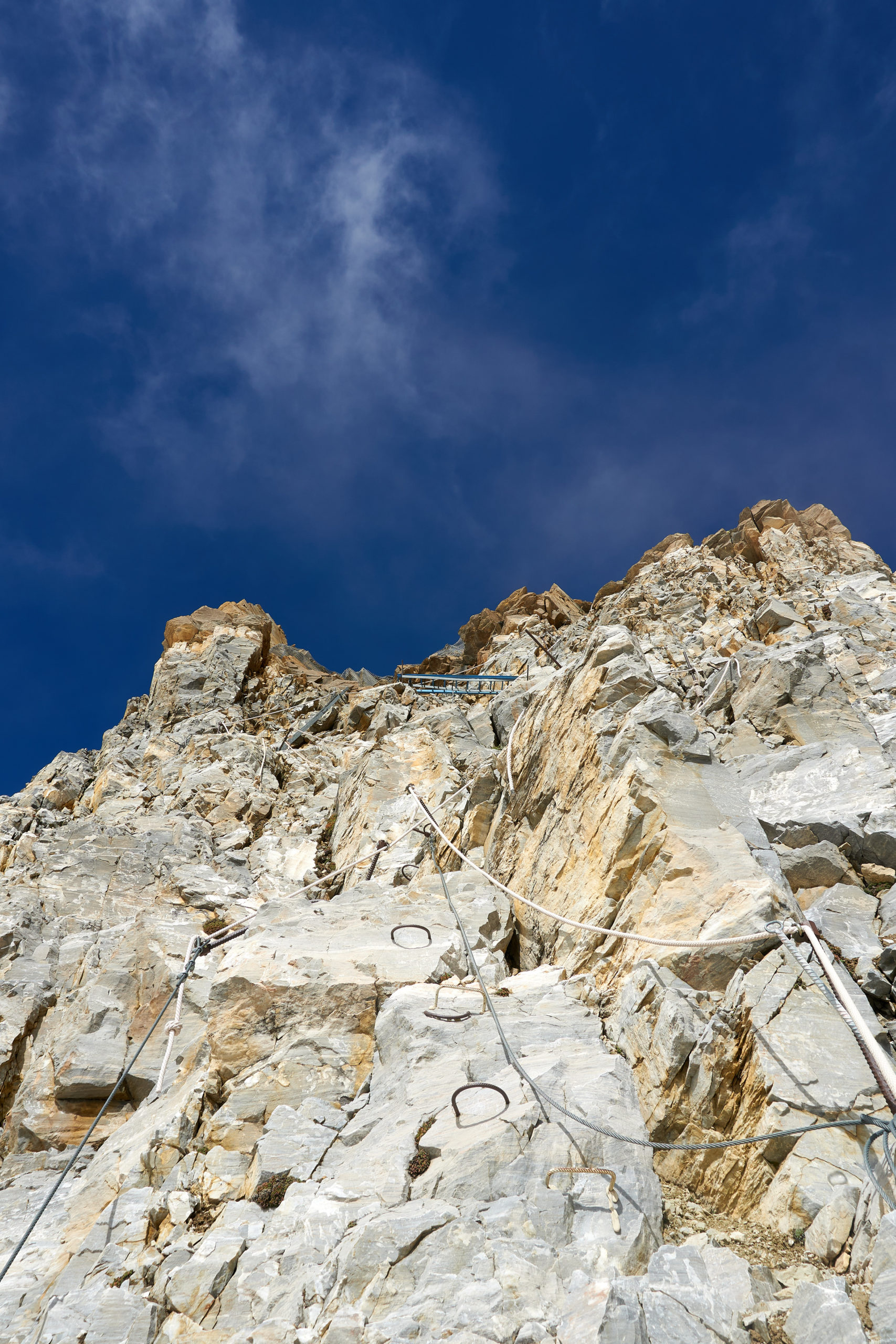
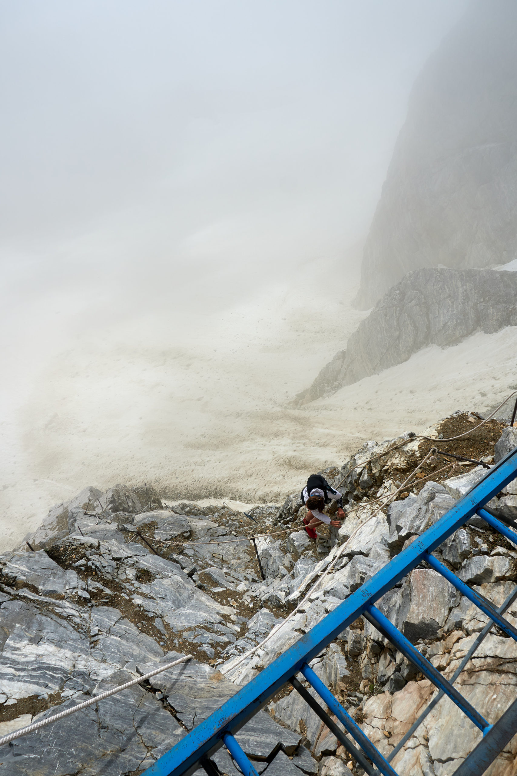
We spaced out to avoid kicking rocks onto each other, but soon enough we were all standing safely on the snow at the base. We all agreed it was less bad than we had feared. We also agreed that it would likely still be passable even if the ropes and other seasonal infrastructure wasn’t in place simply due to the large amount of fixed equipment. Good to know for next time!
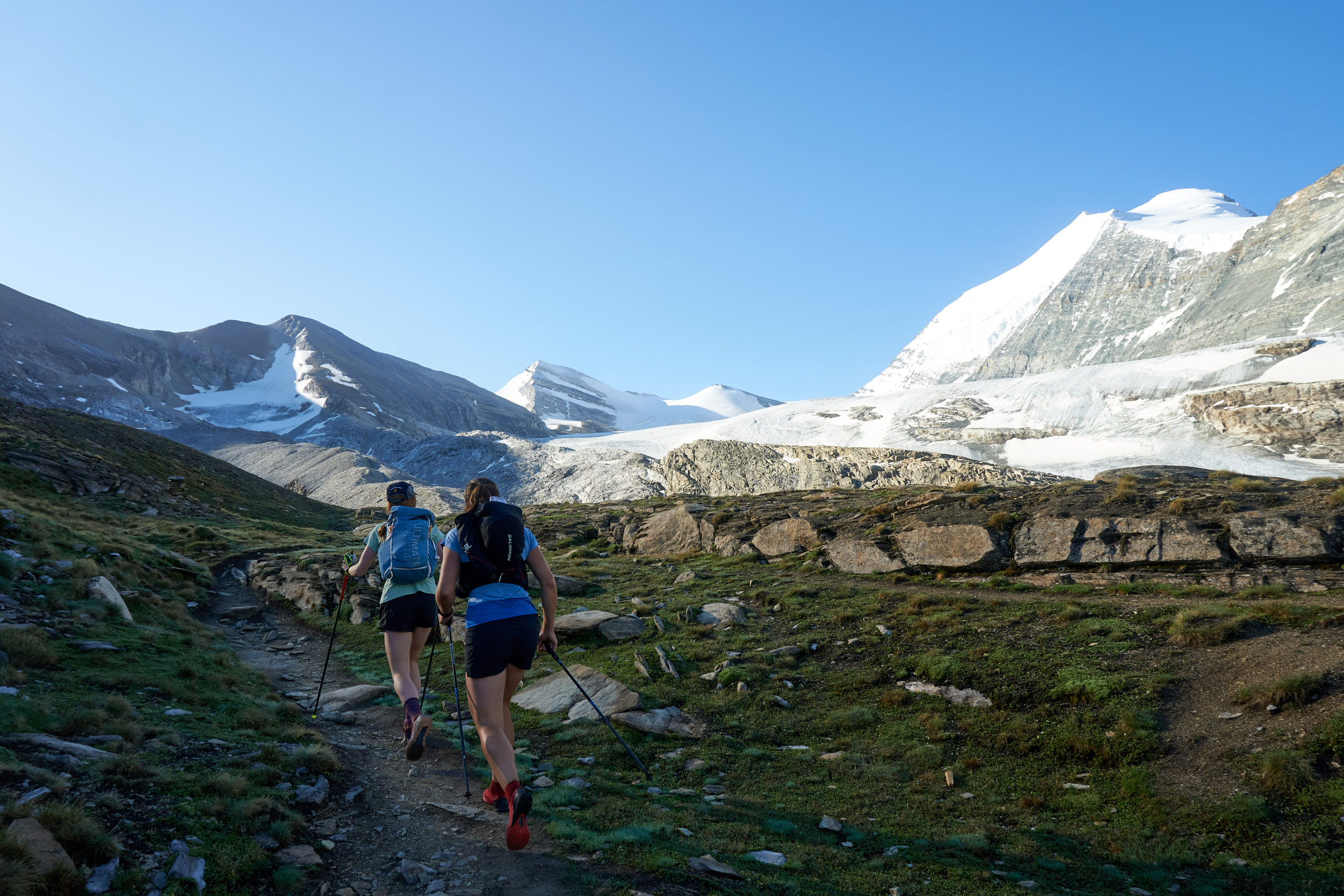
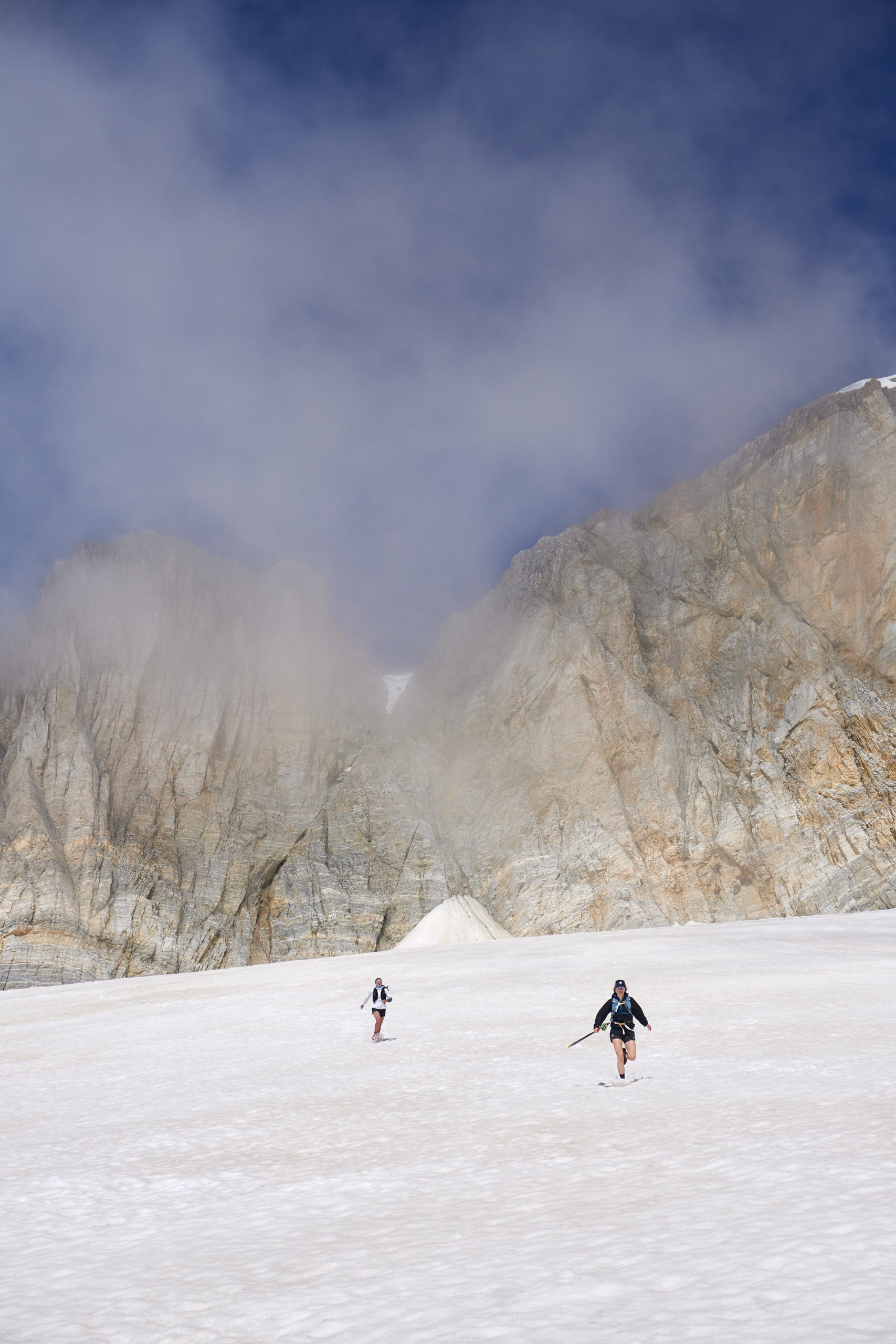
The large permanent snowfield beneath the pass was the cherry on top and we gleefully ran down it like little kids.
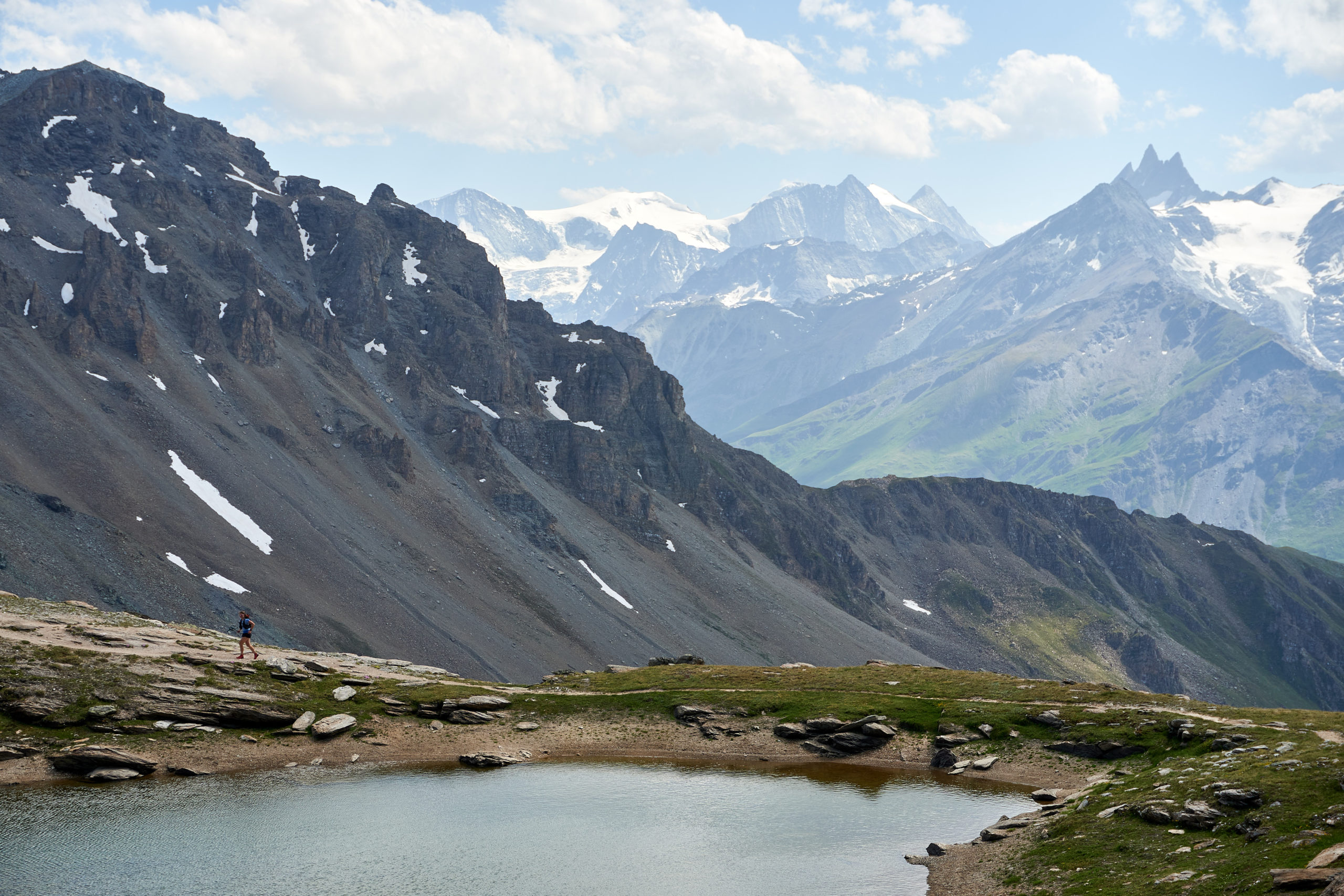
Reaching the end of the snowfield we encountered a short section of tedious talus hopping and then 1,000 feet of loose and steep descending which brought us back below the alpine and onto a grassy bench. We could see on our maps that the trail was supposed to contour up valley for another 3 or 4 miles before descending to the valley floor but looking ahead that seemed absolutely impossible. The mountainside was a mix of cliff-bands and near-vertical grass with no clear way through.
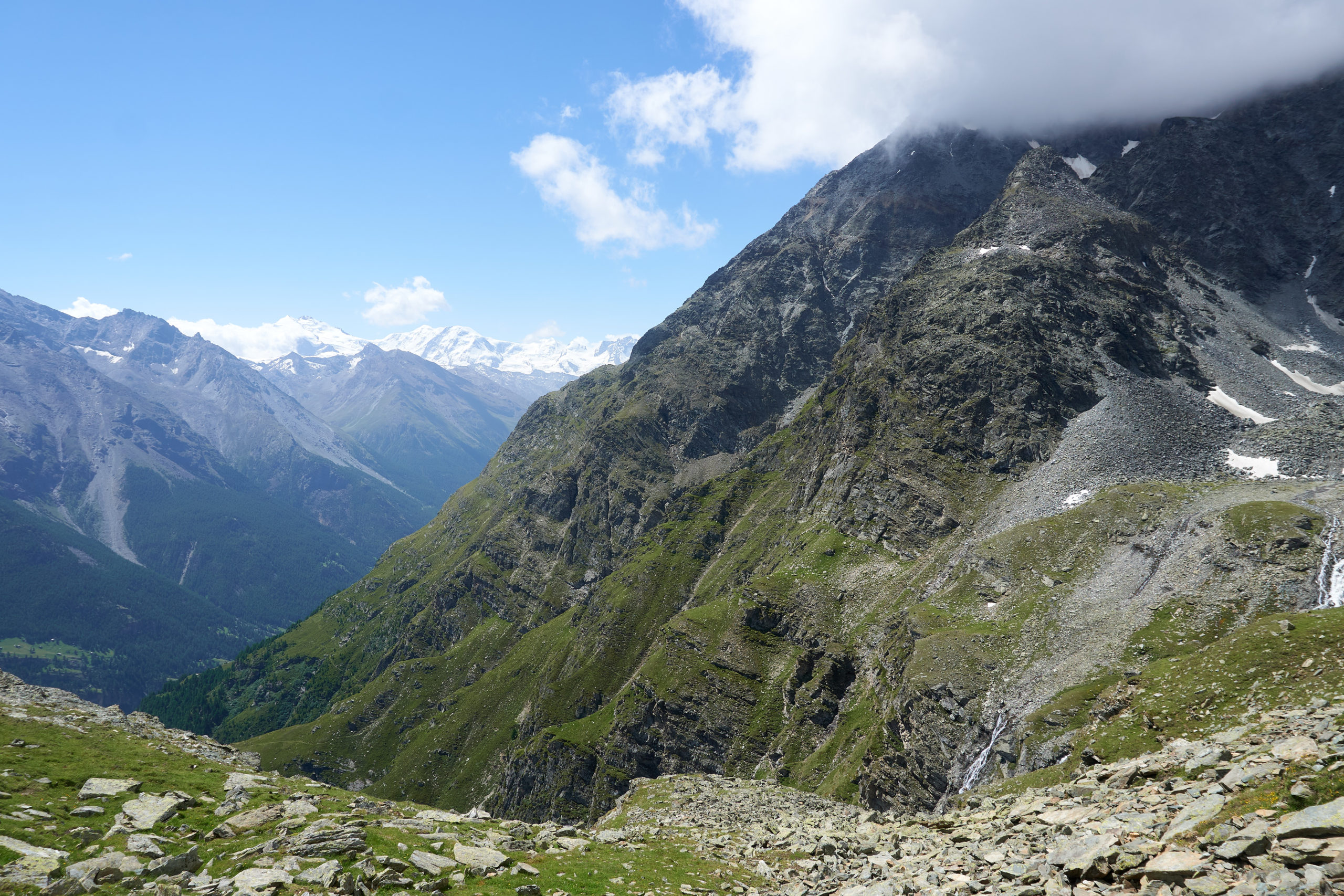
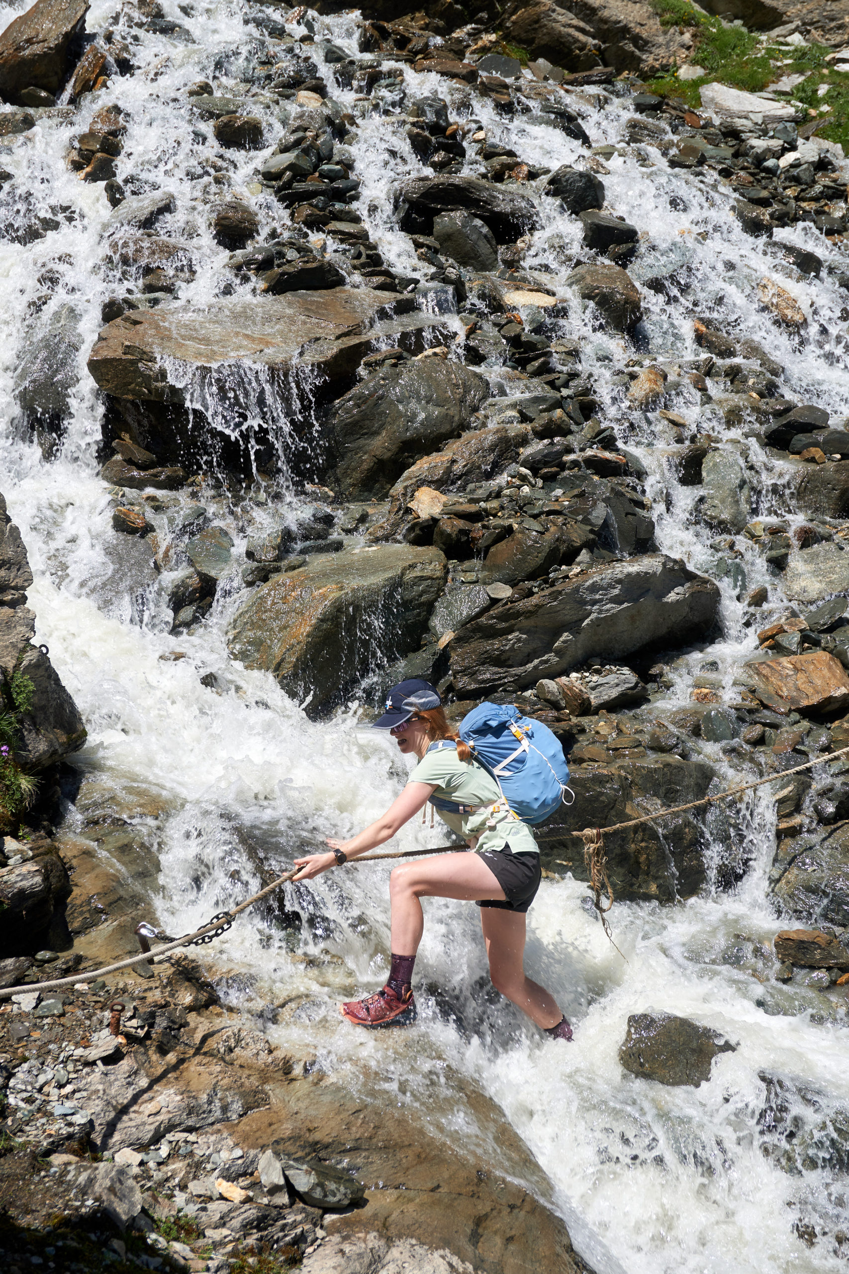
But the trail looked well traveled so we followed it out onto the steep slopes. The next few miles of trail were some of the most stunning and whimsical I have had an opportunity to run. Much of the trail was seriously exposed, with life-altering fall potential if you were to go careening off the side. Usually when traveling in this sort of terrain I’m used to rugged, trail-less hiking, but, as was the theme for this entire trip, the trail was immaculate. Level, perfect tacky dirt, well formed switchbacks. It had it all.
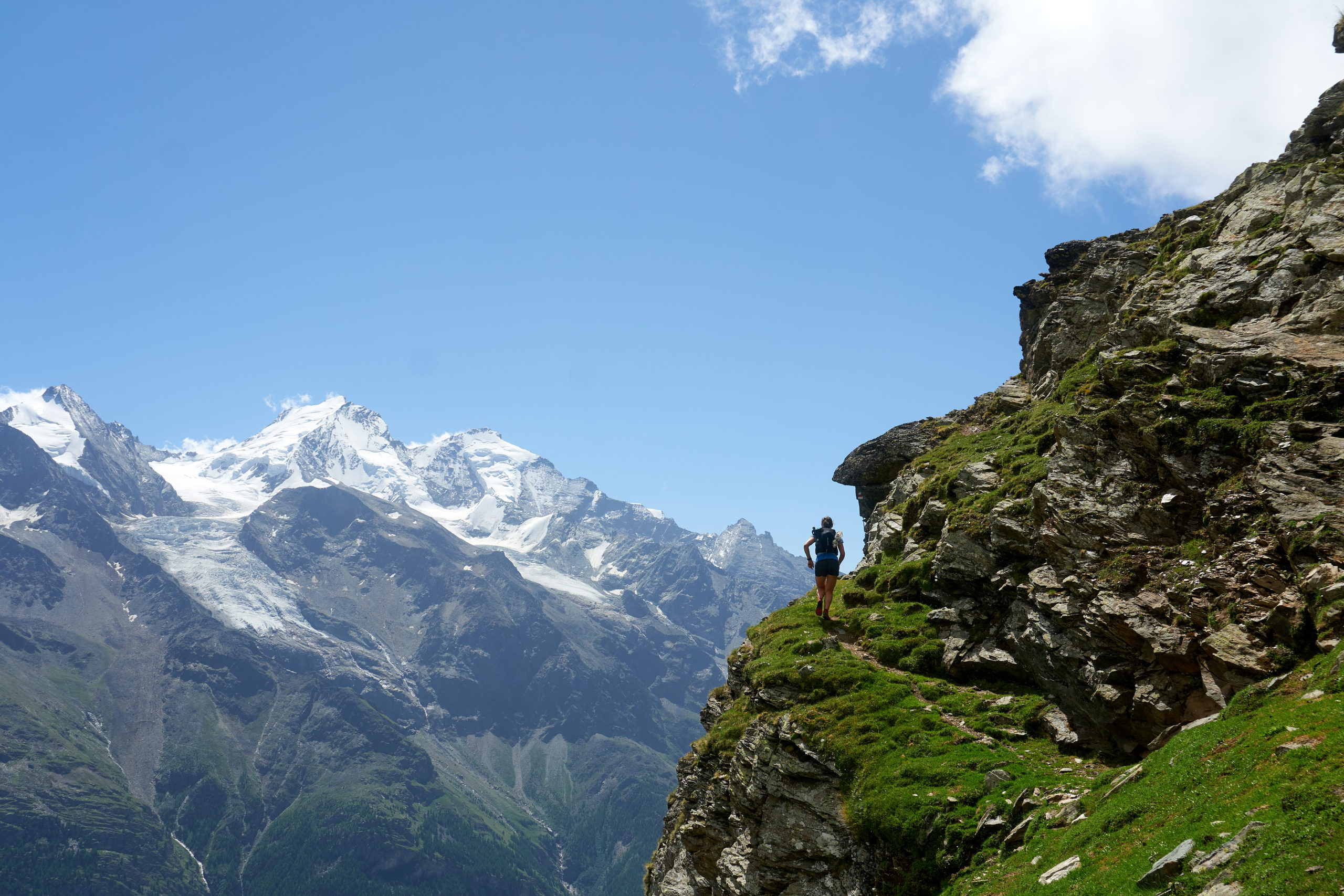
Beautiful wildflowers and a few exciting stream crossings further added to this amazing section of trail.
After an hour of traversing it was time to begin a grueling 3,000 foot descent to the down of Randa. Thirty-plus switchbacks later and we finally reached the valley floor, our knees aching. We stopped by a river to soak our legs for a bit and then hobbled up into town to check into the hotel.
Our short stay in Randa was defined by the quirky characters we encountered. We stayed at the Klein Matterhorn, and found the owner/manager to be eccentric but wonderfully sweet and helpful. On the other end of the spectrum was the chef/owner of a nearby restaurant. While a little outside of town, this restaurant was the only one open in Randa so we decided to go walk and check it out. When we arrived an older lady guided us to a table and we asked to see a menu. She brought back some menus and we flipped through them, quickly realizing that the food was outside of our price range. A bit abashed we decided to leave and did our best to explain it to our host. As we were standing up to walk out the chef/owner of the restaurant came over and angrily asked why we were leaving. We tried to explain but he cut us off and started an angry rant about how he was a world famous chef who had cooked for celebrities all around the world. We eventually just backed away and left as he continued his tirade. We retreated to our friendly hotel and got some delicious sausage from the attached restaurant.
The next day was our second to last day. The day’s itinerary was less alpine than the day before, with a long gradual climb up to the top of Matter Valley where we would finally get a view of our final destination, Zermatt, and the famed Matterhorn.
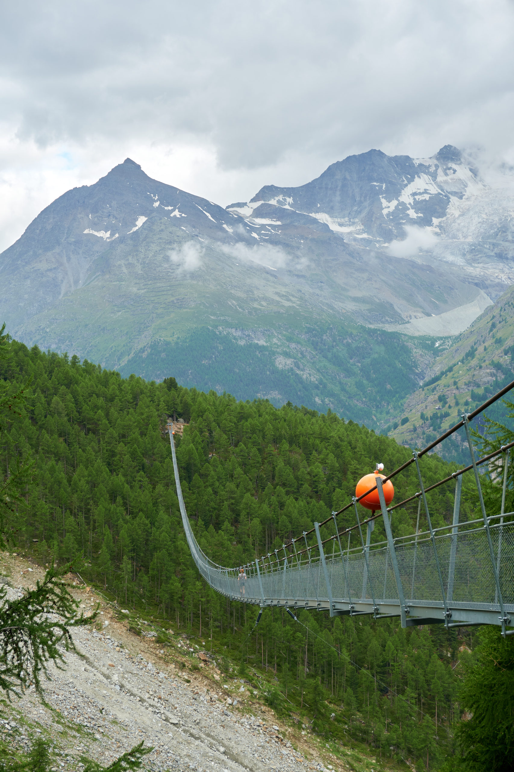
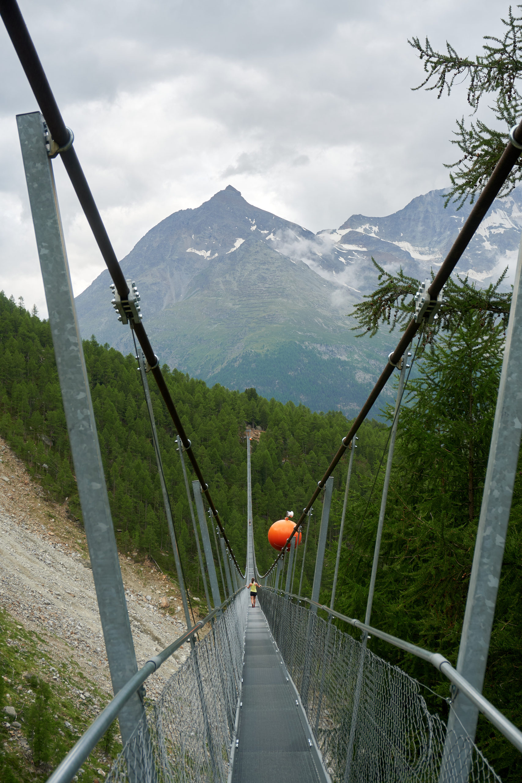
Following the pattern of previous days, we started out with a solid 2,000 foot climb out of the valley to where the trail started to head up valley. Before continuing towards our day’s objective we decided to quickly back track half a mile down valley to check out the Charles Kuonen Bridge, once the world’s longest pedestrian suspension bridge. This small detour proved very worthwhile and walking along a swaying 500m long bridge, 300 feet above the ground below was quite the experience.
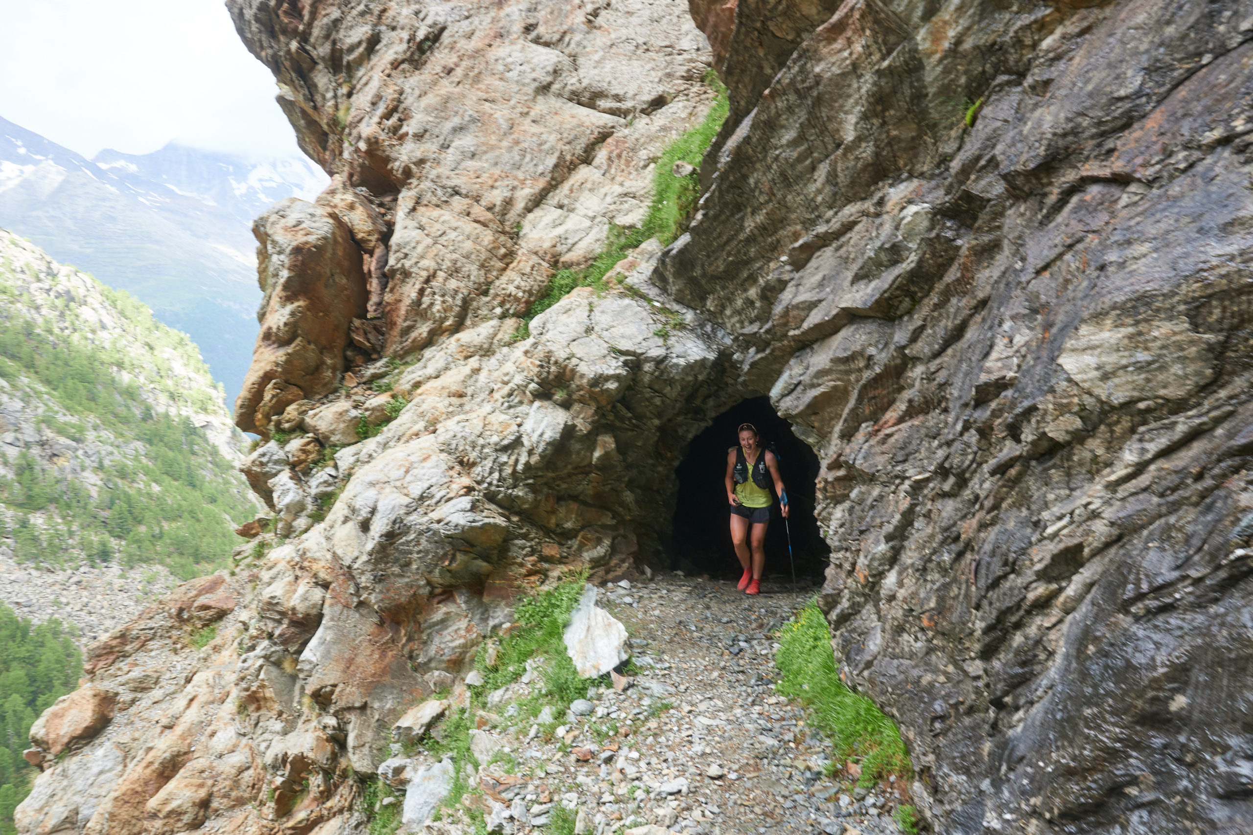
After our excursion to the bridge we backtracked and then started the run up valley. The trail wound up and down some side valleys, but largely did a good job of holding altitude, a welcome relief after the steep ascents and descents the last few days. A highlight on this section of trail was the trail cutting through some fairly long tunnels to avoid otherwise impassable cliffs.
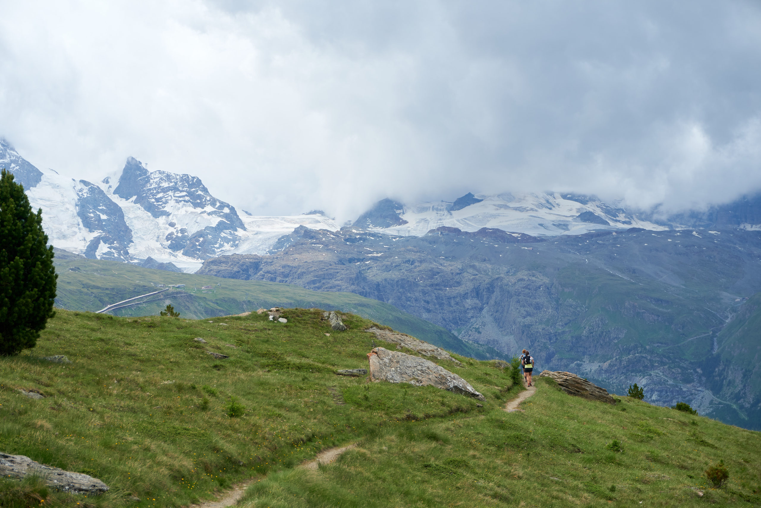
After about 12 miles of running we reached the edge of the Zermatt ski resort. Cloudy weather hid most of the tallest peaks, but we still got a good sense of why this area is world-famous.
A final steep climb brought us up to the outrageously scenic Stellisee lake and Fluhalp mountain hut.
We would have stayed longer to enjoy the views but right as we arrived at the hut the skies opened up and some thunder began rolling in so we continued to make our way around the valley and enjoyed a nice two mile descent down to our home for the night, Ze Seewjinu mountain lodge.
We were feeling pretty worked after more than 80 miles of mountain running in the last 5 days. Luckily the moody weather made it easy to stay inside and Ze Seewjinu was the perfect place to hang out. Reflective of its proximity to Zermatt, Ze Seewjinu is less of a true mountain hut and more of a lodge that has a bunk room. The downstairs had a cozy bar/lounge to hang out in, and we met some really interesting people including a biologist who ran a group in Madagascar and was in Switzerland for a conference.
A delicious dinner also very much lived up to the mountain lodge vibe and there was even cake for desert! The increased fanciness felt like a perfect way to celebrate the last night of the trip.
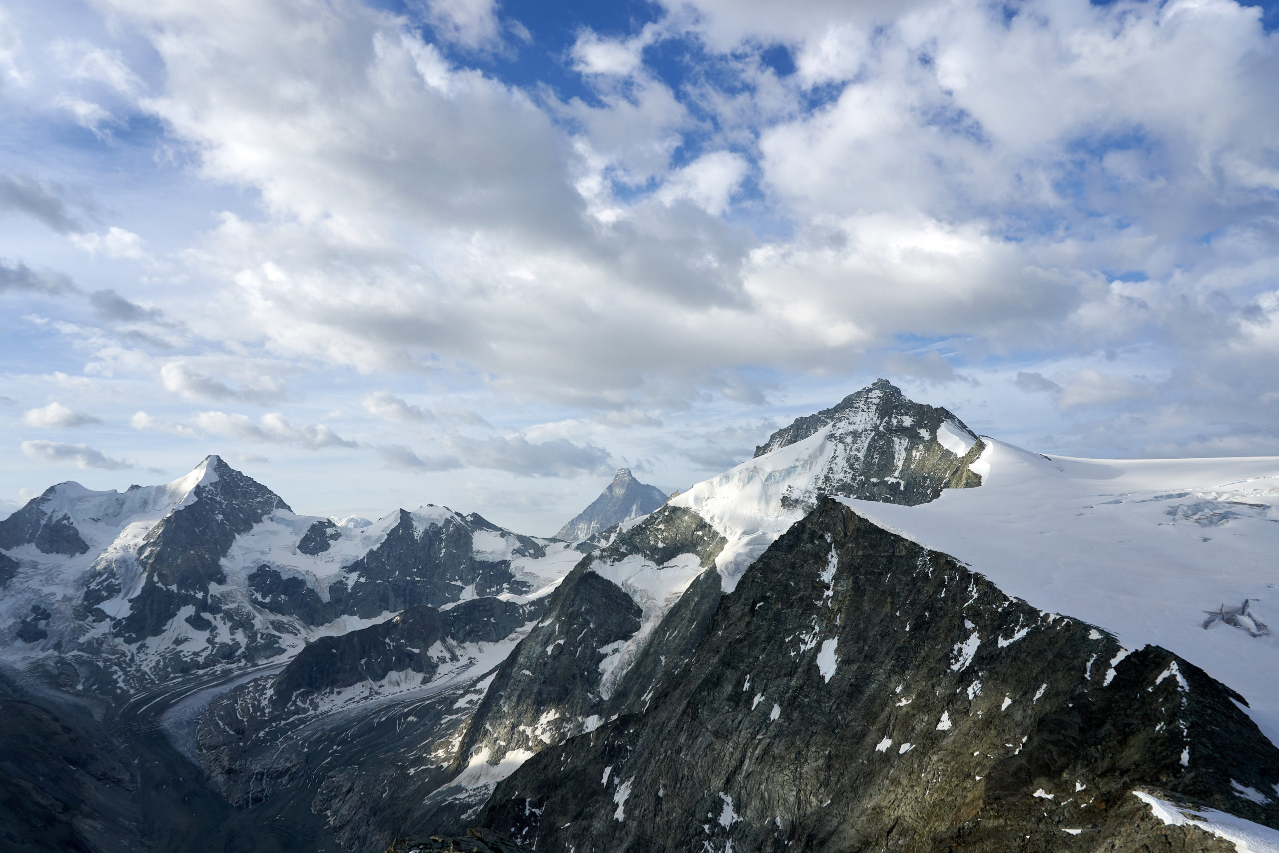
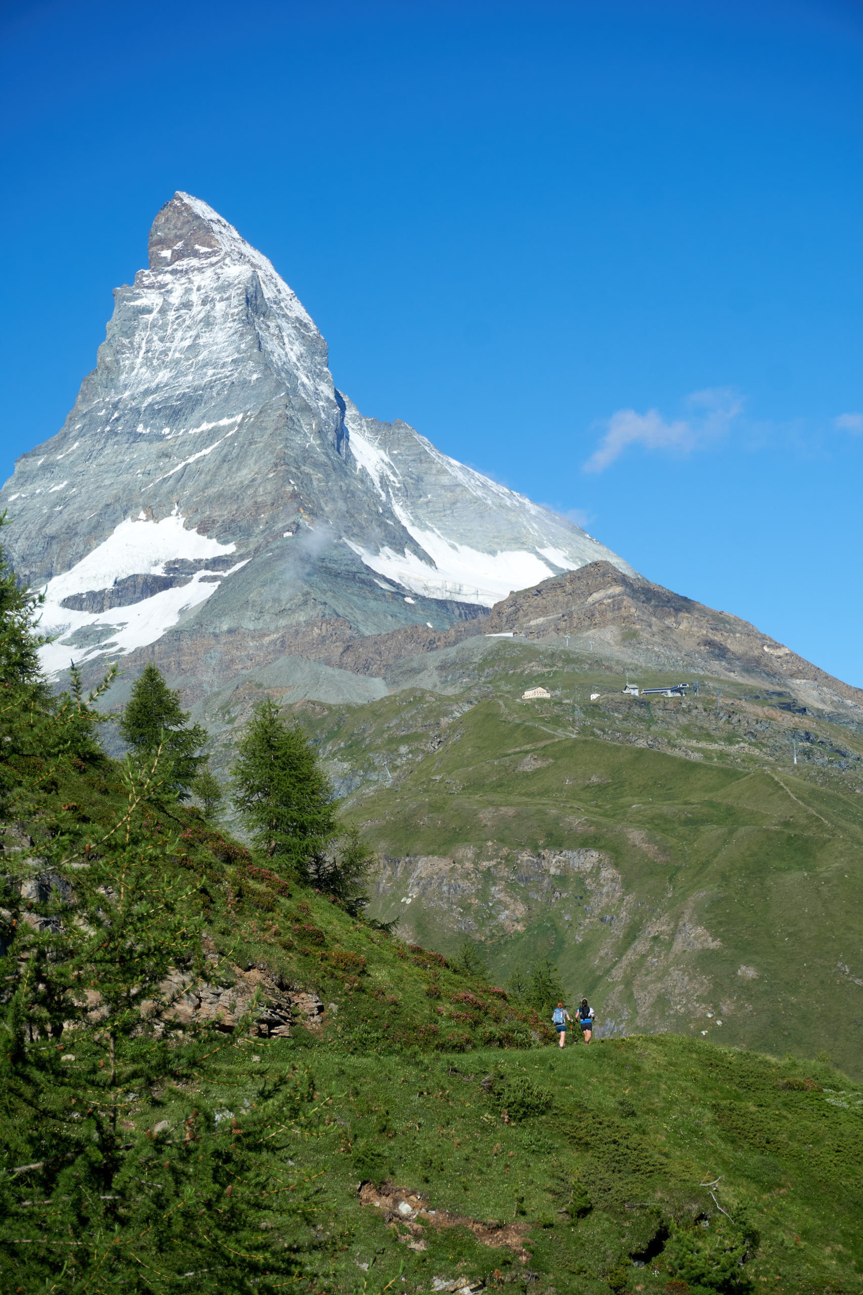
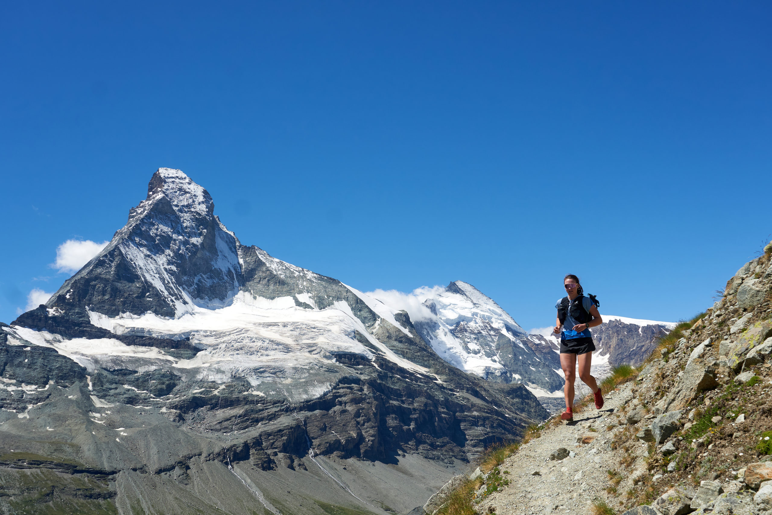
I slept like a rock that night and was delighted to wake up to see sunlight streaming in the window. Looking out the window I saw that the sky was cloudless and got my first view of the Matterhorn, truly as stunning as I had dreamed it might be.
The final stage of the tour is a bit of a victory lap. From Ze Seewjinu it would be possible to descend directly to Zermatt but what would be the fun in that. Instead the route loops around the top of the Matter Valley, passing under all the major peaks and offering a chance to soak up the views from every angle.
From the lodge we started the clockwise traverse, all the while the Matterhorn providing a movie-like backdrop.
After a bit of traversing the trail dropped us down to Furi, a tiny little collection of buildings above Zermatt. We stopped at a coffee shop to grab some lunch. From there Zoe decided to head straight down to Zermatt because she had a tight travel schedule back to London. It was sad saying goodbye to Zoe because she had been such an amazing companion and conversationalist the last few days, but it also felt fitting that Taryn and I would get to complete the final section of trail just the two of us.
Leaving Furi we headed up the valley underneath the north face of the Matterhorn. This valley was perhaps the most beautiful of our run, surrounded on all sides by iconic 4,000m peaks. It’s hard to remember you’re right outside a major ski resort as you cross over glacier-fed streams and look up at towering summits 6,000 feet overhead.
The views got even more ridiculous as the trail began to ascend the north side of the valley. We climbed almost 2,000 feet straight up and then enjoyed two miles of perhaps the most scenic trail in the world as we traversed back towards town.
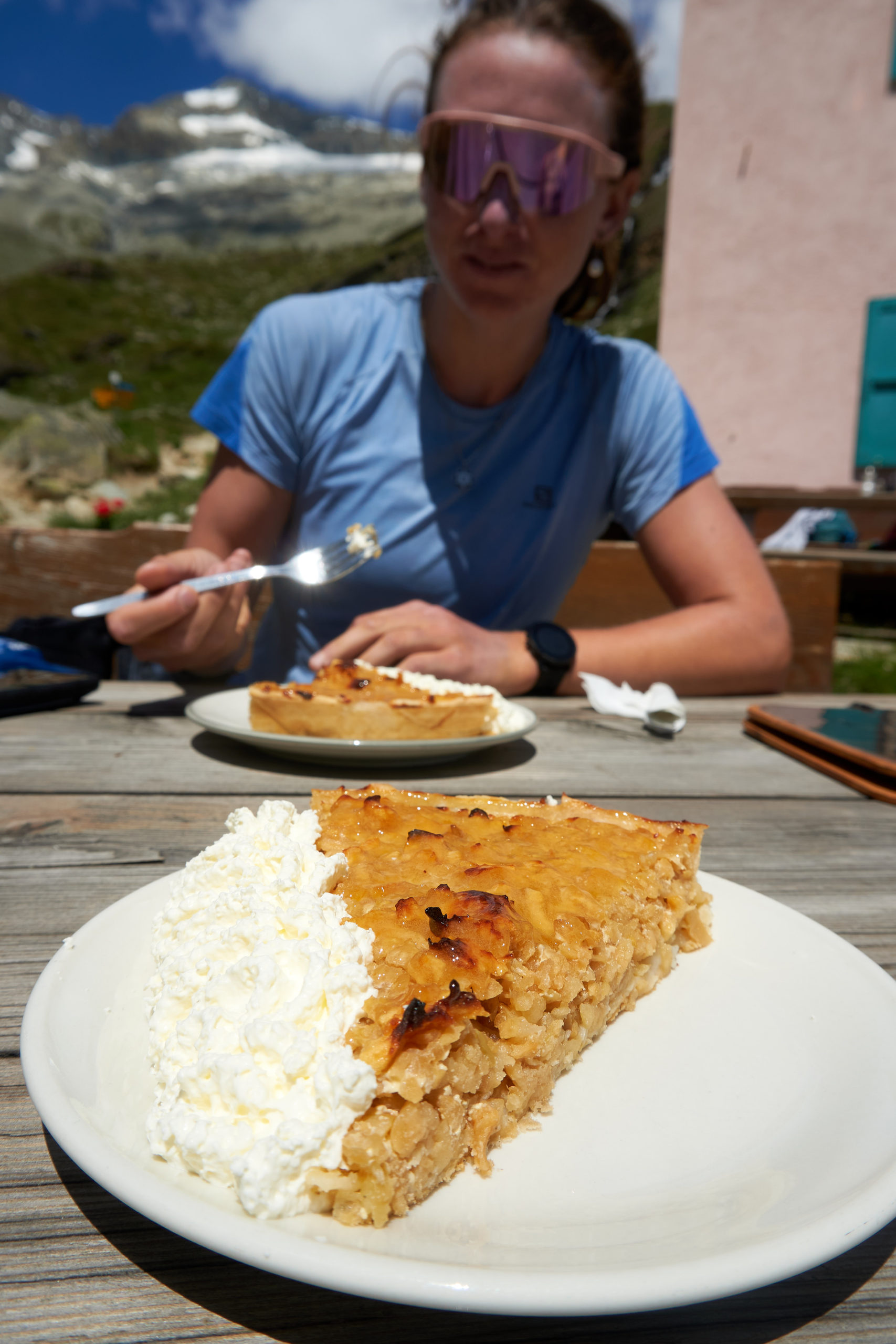
The culminating stage offered a final delight in the form of another picturesque mountain hut, Berggasthaus Trift. This pink hut looked straight out of a Wes Anderson film, tucked precariously at the base of a massive alpine cirque.
This hut is famous for its apple pie and it definitely did not disappoint. Taryn and I even convinced ourselves to splurge for sides of whipped cream, a sign we were definitely getting used to this cushy European style of mountain running.
With our bellies full it was time to face the inevitable and finish the loop down to Zermatt. The final 2,500 descent was brutal after the week’s volume, but by some miracle our bodies held it together until the final half mile into town when I suddenly developed some sharp knee pain. I couldn’t believe how lucky I was that it had held off all the way through six big days of running.
We limped our way into town, feeling a bit like we were coming out of a dream. Zermatt was buzzing with the nice weekend weather and we felt extremely out of place amongst the wealthy tourists with our salt-caked running vests and stinky clothes. Most of the shops were too bougie for us to even dare look at, but we found a bakery with pastries too delicious looking to resist and stopped in for one final treat. From there we headed to the train station so we could catch an afternoon train and start the long journey to Geneva.
Some closing thoughts about this experience, in no real coherent order.
This was an absolutely unique and stunning adventure and I’m so glad we did it. In many ways it felt less adventurous than our other adventures because the itinerary was set and food and housing was not a concern. But that did not at all detract away from the joy of getting to spend six days running through some of the most beautiful mountains on earth with only a light running vest. Our days consisted of eating, sleeping, and running and basically nothing else. With the eating and sleeping parts taken care of, I’ll never forget the wonderful simplicity of heading out each day fully present and relaxed.
That being said, I’m glad that we did the abbreviated tour rather than the full 9 days. For one thing I don’t know if my body would have been able to handle much more running. 100 miles and 35,000 feet of vert in a week felt like plenty and there is a good chance I would have needed a rest day or two if I had tried to do the full thing. Also, while each stage had it’s unique charm, I can imagine the days starting to blend together if we had done all 9 days.
Finally, this adventure was a lot cheaper than I would have imagined. Not necessarily cheap, but basically no more expensive than 6 days spent elsewhere in Switzerland. Perhaps my brain is just broken by AMC huts which can cost upwards of $200 a night, but spending ~$90 a night for room and board in a quaint mountain hut overlooking 4000m glaciated peaks seems like a very fair price. There were definitely sections of this Europe trip where we bummed it as hard as possible and it added to the experience, but I’m so glad we splurged for this unforgettable experience.
Leave a Reply